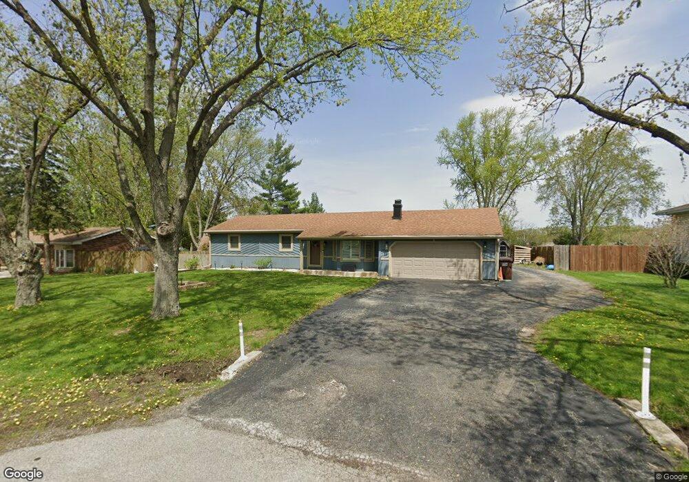
911 Somerset St New Lenox, IL 60451
Estimated Value: $362,000 - $385,000
3
Beds
2
Baths
--
Sq Ft
0.5
Acres
About This Home
This home is located at 911 Somerset St, New Lenox, IL 60451 and is currently estimated at $377,891. 911 Somerset St is a home located in Will County with nearby schools including Bentley Elementary School, Arnold J Tyler School, and Alex M Martino Jr High School.
Ownership History
Date
Name
Owned For
Owner Type
Purchase Details
Closed on
Jul 15, 2009
Sold by
Acosta Mario F and Acosta Susan B
Bought by
Dobis Eric
Current Estimated Value
Home Financials for this Owner
Home Financials are based on the most recent Mortgage that was taken out on this home.
Original Mortgage
$222,323
Outstanding Balance
$145,985
Interest Rate
5.43%
Mortgage Type
FHA
Estimated Equity
$231,906
Purchase Details
Closed on
Oct 10, 1996
Sold by
Verschave David A and Verschave Sandra J
Bought by
Acosta Mario F and Acosta Susan B
Home Financials for this Owner
Home Financials are based on the most recent Mortgage that was taken out on this home.
Original Mortgage
$143,100
Interest Rate
8.14%
Create a Home Valuation Report for This Property
The Home Valuation Report is an in-depth analysis detailing your home's value as well as a comparison with similar homes in the area
Home Values in the Area
Average Home Value in this Area
Purchase History
| Date | Buyer | Sale Price | Title Company |
|---|---|---|---|
| Dobis Eric | $230,000 | Atg | |
| Acosta Mario F | $159,000 | -- |
Source: Public Records
Mortgage History
| Date | Status | Borrower | Loan Amount |
|---|---|---|---|
| Open | Dobis Eric | $222,323 | |
| Previous Owner | Acosta Mario F | $143,100 |
Source: Public Records
Tax History Compared to Growth
Tax History
| Year | Tax Paid | Tax Assessment Tax Assessment Total Assessment is a certain percentage of the fair market value that is determined by local assessors to be the total taxable value of land and additions on the property. | Land | Improvement |
|---|---|---|---|---|
| 2024 | $8,097 | $111,483 | $33,966 | $77,517 |
| 2023 | $8,097 | $101,626 | $30,963 | $70,663 |
| 2022 | $7,769 | $93,621 | $28,524 | $65,097 |
| 2021 | $6,934 | $88,048 | $26,826 | $61,222 |
| 2020 | $6,731 | $84,907 | $25,869 | $59,038 |
| 2019 | $6,435 | $82,274 | $25,067 | $57,207 |
| 2018 | $6,282 | $79,438 | $24,203 | $55,235 |
| 2017 | $5,959 | $77,154 | $23,507 | $53,647 |
| 2016 | $5,781 | $75,089 | $22,878 | $52,211 |
| 2015 | $5,593 | $72,726 | $22,158 | $50,568 |
| 2014 | $5,593 | $71,828 | $21,884 | $49,944 |
| 2013 | $5,593 | $72,796 | $22,179 | $50,617 |
Source: Public Records
Map
Nearby Homes
- 214 Somerset Ct
- 125 N Anderson Rd
- 513 Somerset Ln
- 449 Somerset Ln Unit 1
- 1351 E Lincoln Hwy
- 1017 E Lincoln Hwy
- 1212 Georgias Way
- 1245 Georgias Way
- 1193 Georgias Way
- 1535 Glenbrooke Ln
- 1139 Georgias Way
- 1125 Georgias Way
- 641 Lisson Grove
- 701 Bishops Gate
- 117 Walona Ave
- 621 Chatfield Rd
- 203 Tonell Ave
- 1920 Tessington Ct
- 1931 Tessington Ct
- 920 Barnside Rd
- 915 Somerset St
- 907 Somerset St
- 146 S Anderson Rd
- 919 Somerset St
- 140 S Anderson Rd
- 1520 E Lincoln Hwy
- 908 Somerset St
- 912 Somerset St
- 916 Somerset St
- 925 Somerset St
- 920 Somerset St
- 208 S Anderson Rd
- 1530 E Lincoln Hwy
- 110 S Anderson Rd
- 929 Somerset St
- 924 Somerset St
- 147 S Anderson Rd
- 841 Somerset St
- 137 S Anderson Rd
- 913 Chelsea Ct