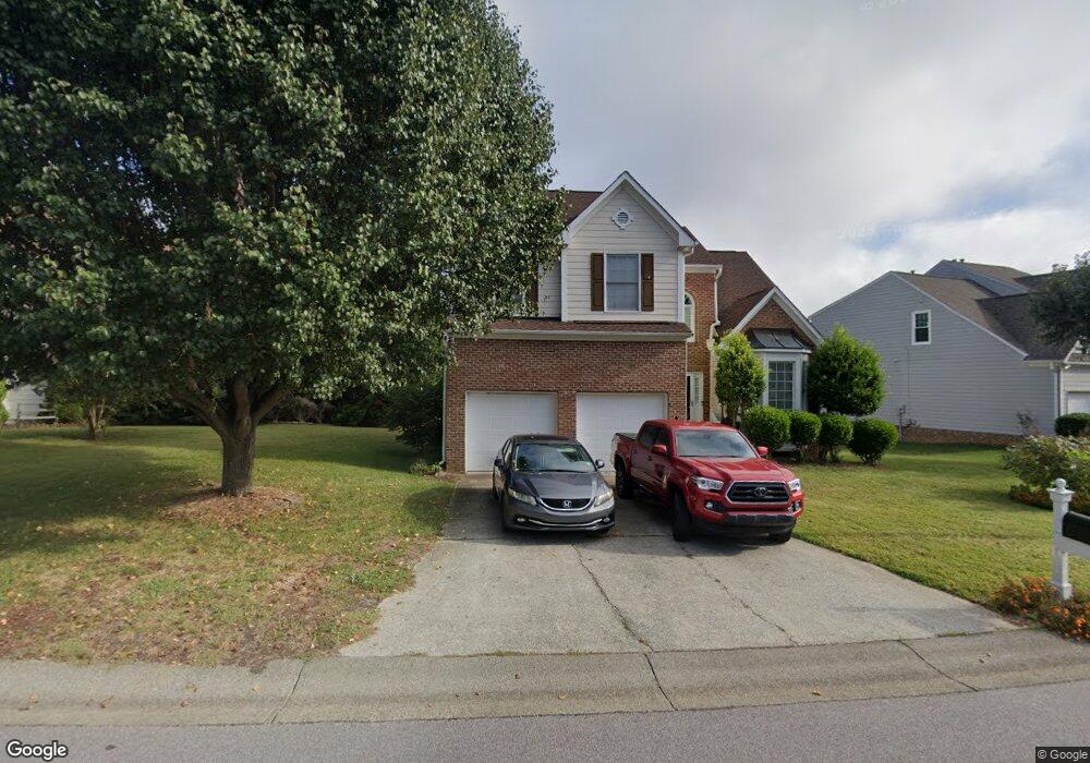
911 Southshore Pkwy Durham, NC 27703
Eastern Durham NeighborhoodEstimated Value: $446,630 - $479,000
4
Beds
3
Baths
2,433
Sq Ft
$190/Sq Ft
Est. Value
About This Home
This home is located at 911 Southshore Pkwy, Durham, NC 27703 and is currently estimated at $462,908, approximately $190 per square foot. 911 Southshore Pkwy is a home located in Durham County with nearby schools including Oak Grove Elementary, John W Neal Middle School, and Southern School of Energy & Sustainability.
Ownership History
Date
Name
Owned For
Owner Type
Purchase Details
Closed on
Aug 5, 2002
Sold by
D R Horton Inc Torrey
Bought by
Cherry Phillip and Cherry Janet B
Current Estimated Value
Home Financials for this Owner
Home Financials are based on the most recent Mortgage that was taken out on this home.
Original Mortgage
$185,155
Outstanding Balance
$68,890
Interest Rate
4.87%
Estimated Equity
$394,018
Create a Home Valuation Report for This Property
The Home Valuation Report is an in-depth analysis detailing your home's value as well as a comparison with similar homes in the area
Home Values in the Area
Average Home Value in this Area
Purchase History
| Date | Buyer | Sale Price | Title Company |
|---|---|---|---|
| Cherry Phillip | $195,000 | -- |
Source: Public Records
Mortgage History
| Date | Status | Borrower | Loan Amount |
|---|---|---|---|
| Open | Cherry Phillip | $185,155 |
Source: Public Records
Tax History Compared to Growth
Tax History
| Year | Tax Paid | Tax Assessment Tax Assessment Total Assessment is a certain percentage of the fair market value that is determined by local assessors to be the total taxable value of land and additions on the property. | Land | Improvement |
|---|---|---|---|---|
| 2025 | $4,555 | $459,500 | $65,326 | $394,174 |
| 2024 | $3,537 | $253,591 | $42,042 | $211,549 |
| 2023 | $3,322 | $253,591 | $42,042 | $211,549 |
| 2022 | $3,246 | $253,591 | $42,042 | $211,549 |
| 2021 | $3,230 | $253,591 | $42,042 | $211,549 |
| 2020 | $3,154 | $253,591 | $42,042 | $211,549 |
| 2019 | $3,154 | $253,591 | $42,042 | $211,549 |
| 2018 | $3,235 | $238,464 | $41,405 | $197,059 |
| 2017 | $3,211 | $238,464 | $41,405 | $197,059 |
| 2016 | $3,103 | $238,464 | $41,405 | $197,059 |
| 2015 | $3,360 | $242,702 | $44,786 | $197,916 |
| 2014 | $3,360 | $242,702 | $44,786 | $197,916 |
Source: Public Records
Map
Nearby Homes
- 615 Southshore Pkwy
- 715 Southshore Pkwy
- 503 Bellmeade Bay Dr
- 128 Leacroft Way
- 537 Crossview Ln
- 16 Vestrial Ln
- 1 Kings Grant Ct
- 301 Sylvias Ct
- 2117 Fletchers Ridge Dr
- 208 Lick Creek Ln
- 110 Kindlewood Dr
- 519 Keith St
- 506 Currin St
- 106 Newberry Ln
- 406 Robbins Rd
- 402 Robbins Rd
- 30 Plumleaf Ln
- 1013 Blackthorn Ln
- 622 Sherron Rd
- 610 Sherron Rd
- 905 Southshore Pkwy
- 1001 Southshore Pkwy
- 903 Southshore Pkwy
- 1000 Southshore Pkwy
- 2 Venetia Cove
- 1007 Southshore Pkwy
- 1002 Southshore Pkwy
- 901 Southshore Pkwy
- 904 Southshore Pkwy
- 902 Southshore Pkwy
- 4 Venetia Cove
- 1006 Southshore Pkwy
- 3 Venetia Cove
- 1009 Southshore Pkwy
- 813 Southshore Pkwy
- 5 Venetia Cove
- 813 Southshore Pkwy
- 610 Southshore Pkwy
- 808 Southshore Pkwy
- 808 SOUTHS To Be Added