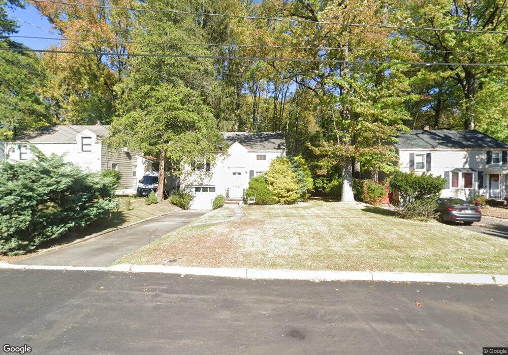
911 Sterling St Unit 13 Plainfield, NJ 07062
Estimated Value: $430,000 - $537,000
--
Bed
--
Bath
1,080
Sq Ft
$444/Sq Ft
Est. Value
About This Home
This home is located at 911 Sterling St Unit 13, Plainfield, NJ 07062 and is currently estimated at $479,391, approximately $443 per square foot. 911 Sterling St Unit 13 is a home located in Union County with nearby schools including Frederic W. Cook School, Emerson Community School, and Maxson Middle School.
Ownership History
Date
Name
Owned For
Owner Type
Purchase Details
Closed on
Jun 17, 2005
Sold by
Gayle Carlar A
Bought by
Adams Michael J
Current Estimated Value
Home Financials for this Owner
Home Financials are based on the most recent Mortgage that was taken out on this home.
Original Mortgage
$192,000
Outstanding Balance
$100,365
Interest Rate
5.78%
Estimated Equity
$379,026
Purchase Details
Closed on
Dec 7, 2001
Sold by
Erath George A and Erath Gertrude M
Bought by
Gayle Carlar A
Home Financials for this Owner
Home Financials are based on the most recent Mortgage that was taken out on this home.
Original Mortgage
$152,605
Interest Rate
6.6%
Mortgage Type
FHA
Create a Home Valuation Report for This Property
The Home Valuation Report is an in-depth analysis detailing your home's value as well as a comparison with similar homes in the area
Home Values in the Area
Average Home Value in this Area
Purchase History
| Date | Buyer | Sale Price | Title Company |
|---|---|---|---|
| Adams Michael J | $240,000 | -- | |
| Gayle Carlar A | $155,000 | -- |
Source: Public Records
Mortgage History
| Date | Status | Borrower | Loan Amount |
|---|---|---|---|
| Open | Adams Michael J | $192,000 | |
| Previous Owner | Gayle Carlar A | $152,605 |
Source: Public Records
Tax History Compared to Growth
Tax History
| Year | Tax Paid | Tax Assessment Tax Assessment Total Assessment is a certain percentage of the fair market value that is determined by local assessors to be the total taxable value of land and additions on the property. | Land | Improvement |
|---|---|---|---|---|
| 2025 | $8,374 | $95,900 | $49,500 | $46,400 |
| 2024 | $8,292 | $95,900 | $49,500 | $46,400 |
| 2023 | $8,292 | $95,900 | $49,500 | $46,400 |
| 2022 | $8,112 | $95,900 | $49,500 | $46,400 |
| 2021 | $8,041 | $95,900 | $49,500 | $46,400 |
| 2020 | $8,018 | $95,900 | $49,500 | $46,400 |
| 2019 | $8,018 | $95,900 | $49,500 | $46,400 |
| 2018 | $7,850 | $95,900 | $49,500 | $46,400 |
| 2017 | $7,659 | $95,900 | $49,500 | $46,400 |
| 2016 | $7,502 | $95,900 | $49,500 | $46,400 |
| 2015 | $7,281 | $95,900 | $49,500 | $46,400 |
| 2014 | $7,083 | $95,900 | $49,500 | $46,400 |
Source: Public Records
Map
Nearby Homes
- 939-45 Post Dr
- 848 Adam Cir
- 1158 Woodmere Place
- 810 Leland Ave Unit 14
- 481 Terrill Rd
- 842 Berkeley Ave
- 32 Gere Place
- 15 La Grande Ave
- 1224 Sunnyfield Ln
- 1138-40 Gresham Rd
- 1232 Sunnyfield Ln
- 714 Dixie Ln
- 351 Terrill Rd
- 1365 Columbia Ave Unit 69
- 771 Ravine Rd
- 767 Ravine Rd Unit 73
- 1364 George St
- 633 Woodland Ave Unit 37
- 5 Robin Rd
- 1255 Columbia Ave Unit 57
- 907 Sterling St Unit 9
- 915 Sterling St Unit 17
- 903 Sterling St Unit 5
- 919 Sterling St Unit 23
- 899 Sterling St Unit 901
- 925 Sterling St Unit 27
- 910 Sterling St Unit 14
- 916 Sterling St Unit 20
- 916-20 Sterling St
- 895 Sterling St Unit 97
- 900 Sterling St Unit 4
- 929 Sterling St Unit 31
- 922 Sterling St Unit 26
- 889 Sterling St Unit 93
- 1280 Oxford Ave Unit 84
- 1282 Oxford Ave
- 894 Sterling St Unit 98
- 928 Sterling St Unit 32
- 890 Sterling St Unit 92
- 885 Sterling St Unit 87