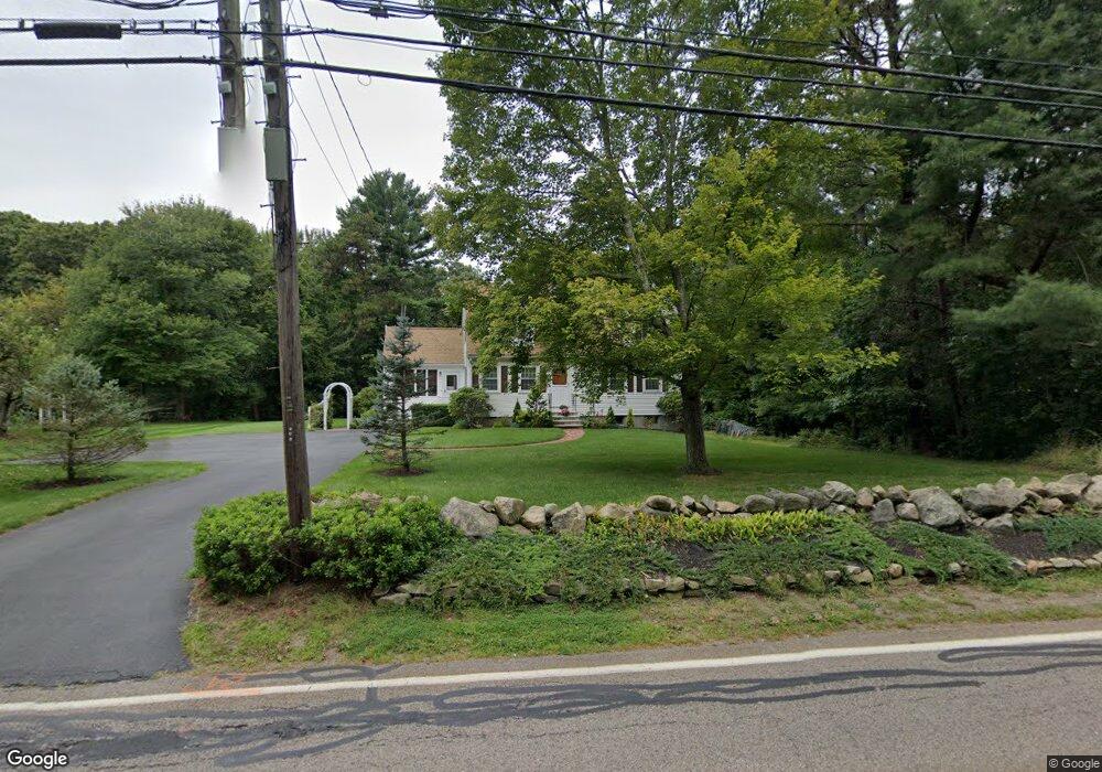
911 West St Walpole, MA 02081
Estimated Value: $813,326 - $891,000
3
Beds
3
Baths
2,103
Sq Ft
$407/Sq Ft
Est. Value
About This Home
This home is located at 911 West St, Walpole, MA 02081 and is currently estimated at $855,582, approximately $406 per square foot. 911 West St is a home located in Norfolk County with nearby schools including Elm Street School, Eleanor N. Johnson Middle School, and Walpole High School.
Ownership History
Date
Name
Owned For
Owner Type
Purchase Details
Closed on
Oct 29, 2018
Sold by
2015 Scimone Ft
Bought by
Scimone Joseph F and Scimone Mary L
Current Estimated Value
Purchase Details
Closed on
Aug 14, 2015
Sold by
Scimone Joseph F and Scimone Mary L
Bought by
Scimone Ft
Purchase Details
Closed on
Jan 31, 1996
Sold by
Stokinger William M and Stokinger Janice R
Bought by
Scimone Joseph F and Scimone Mary L
Home Financials for this Owner
Home Financials are based on the most recent Mortgage that was taken out on this home.
Original Mortgage
$150,000
Interest Rate
7.25%
Mortgage Type
Purchase Money Mortgage
Create a Home Valuation Report for This Property
The Home Valuation Report is an in-depth analysis detailing your home's value as well as a comparison with similar homes in the area
Home Values in the Area
Average Home Value in this Area
Purchase History
| Date | Buyer | Sale Price | Title Company |
|---|---|---|---|
| Scimone Joseph F | -- | -- | |
| Scimone Ft | -- | -- | |
| Scimone Joseph F | $193,333 | -- |
Source: Public Records
Mortgage History
| Date | Status | Borrower | Loan Amount |
|---|---|---|---|
| Previous Owner | Scimone Joseph F | $150,000 |
Source: Public Records
Tax History Compared to Growth
Tax History
| Year | Tax Paid | Tax Assessment Tax Assessment Total Assessment is a certain percentage of the fair market value that is determined by local assessors to be the total taxable value of land and additions on the property. | Land | Improvement |
|---|---|---|---|---|
| 2025 | $9,173 | $715,000 | $358,700 | $356,300 |
| 2024 | $8,914 | $674,300 | $345,800 | $328,500 |
| 2023 | $8,513 | $612,900 | $301,600 | $311,300 |
| 2022 | $8,035 | $555,700 | $278,400 | $277,300 |
| 2021 | $7,788 | $524,800 | $262,100 | $262,700 |
| 2020 | $7,535 | $502,700 | $248,200 | $254,500 |
| 2019 | $7,373 | $488,300 | $240,000 | $248,300 |
| 2018 | $7,102 | $465,100 | $229,500 | $235,600 |
| 2017 | $6,876 | $448,500 | $221,300 | $227,200 |
| 2016 | $6,761 | $434,500 | $215,600 | $218,900 |
| 2015 | $6,556 | $417,600 | $206,900 | $210,700 |
| 2014 | $6,291 | $399,200 | $206,900 | $192,300 |
Source: Public Records
Map
Nearby Homes
- 43 Chandler Ave
- 533 Lincoln Rd
- 25 Sandtrap Cir Unit 8
- 27 Sandtrip Cir Unit 7
- 13 Sandtrap Cir Unit 14
- 11 Sandtrap Cir Unit 15
- 20 Sandtrap Cir Unit 4
- 19 Sandtrap Cir Unit 11
- 18 Sandtrap Cir Unit 3
- 17 Sandtrap Cir Unit 12
- 15 Sandtrap Cir Unit 13
- 10 Sandtrap Cir Unit 2
- 31 Sandtrap Cir Unit 500
- 12 Brookside Ln
- 27 Thomas Mann Cir Unit 18
- 28 Thomas Mann Cir Unit Lot 38
- 26 Thomas Mann Cir Unit 37
- 37 Thomas Mann Cir Unit 23
- The Georgetown L Plan at Lakeland Hills
- The Georgetown Grand L Plan at Lakeland Hills