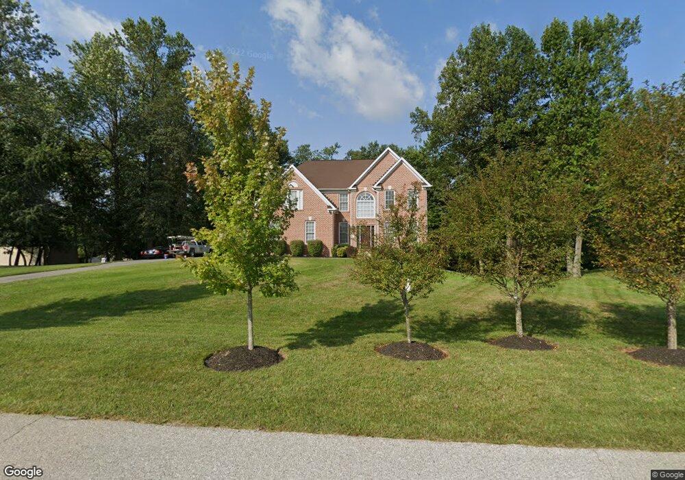
9110 Sylvan Dell Rd Randallstown, MD 21133
Estimated Value: $544,393 - $649,000
--
Bed
4
Baths
3,306
Sq Ft
$185/Sq Ft
Est. Value
About This Home
This home is located at 9110 Sylvan Dell Rd, Randallstown, MD 21133 and is currently estimated at $611,848, approximately $185 per square foot. 9110 Sylvan Dell Rd is a home located in Baltimore County with nearby schools including Randallstown Elementary School, Windsor Mill Middle School, and Randallstown High School.
Ownership History
Date
Name
Owned For
Owner Type
Purchase Details
Closed on
Mar 15, 2006
Sold by
Patapsco Valley Preserve Llc
Bought by
Cox Leroy and Cox Kathryn S
Current Estimated Value
Home Financials for this Owner
Home Financials are based on the most recent Mortgage that was taken out on this home.
Original Mortgage
$684,500
Outstanding Balance
$437,925
Interest Rate
7.5%
Mortgage Type
Purchase Money Mortgage
Estimated Equity
$173,923
Purchase Details
Closed on
Mar 1, 2006
Sold by
Patapsco Valley Preserve Llc
Bought by
Cox Leroy and Cox Kathryn S
Home Financials for this Owner
Home Financials are based on the most recent Mortgage that was taken out on this home.
Original Mortgage
$684,500
Outstanding Balance
$437,925
Interest Rate
7.5%
Mortgage Type
Purchase Money Mortgage
Estimated Equity
$173,923
Create a Home Valuation Report for This Property
The Home Valuation Report is an in-depth analysis detailing your home's value as well as a comparison with similar homes in the area
Home Values in the Area
Average Home Value in this Area
Purchase History
| Date | Buyer | Sale Price | Title Company |
|---|---|---|---|
| Cox Leroy | $200,000 | -- | |
| Cox Leroy | $200,000 | -- |
Source: Public Records
Mortgage History
| Date | Status | Borrower | Loan Amount |
|---|---|---|---|
| Open | Cox Leroy | $684,500 | |
| Closed | Cox Leroy | $684,500 |
Source: Public Records
Tax History Compared to Growth
Tax History
| Year | Tax Paid | Tax Assessment Tax Assessment Total Assessment is a certain percentage of the fair market value that is determined by local assessors to be the total taxable value of land and additions on the property. | Land | Improvement |
|---|---|---|---|---|
| 2025 | $5,786 | $491,733 | -- | -- |
| 2024 | $5,786 | $474,600 | $136,200 | $338,400 |
| 2023 | $2,872 | $469,000 | $0 | $0 |
| 2022 | $5,625 | $463,400 | $0 | $0 |
| 2021 | $5,572 | $457,800 | $136,200 | $321,600 |
| 2020 | $5,572 | $455,867 | $0 | $0 |
| 2019 | $5,377 | $453,933 | $0 | $0 |
| 2018 | $5,190 | $452,000 | $136,200 | $315,800 |
| 2017 | $4,939 | $425,900 | $0 | $0 |
| 2016 | $6,160 | $399,800 | $0 | $0 |
| 2015 | $6,160 | $373,700 | $0 | $0 |
| 2014 | $6,160 | $373,700 | $0 | $0 |
Source: Public Records
Map
Nearby Homes
- 3320 Offutt Rd
- 3332 Offutt Rd
- 8948 Harkate Way
- 3418 Carroll Ave
- 9311 Colorado Ave
- 5713 Old Court Rd
- 3506 Bayer Ave
- 0 Old Court Rd Parcel 631
- 9210 Liberty Rd
- 9208A Liberty Rd
- 3705 Allenswood Ct
- 9202 Samoset Rd
- 9302 Silver Charm Dr
- 9012 Allenswood Rd
- 3518 Orchard Shade Rd
- 9401 Summer Squal Dr
- 8305 Windsor Mill Rd
- 9406 Painted Tree Dr
- 3538 Corn Stream Rd
- 9044 Allenswood Rd
- 9112 Sylvan Dell Rd
- 4 Phoebe Ct
- 9107 Sylvan Dell Rd
- 9103 Sylvan Dell Rd
- 1 Towhee Ct
- 9109 Sylvan Dell Rd
- 9101 Sylvan Dell Rd
- 6 Phoebe Ct
- 9111 Sylvan Dell Rd
- 1 Phoebe Ct
- 3 Phoebe Ct
- 2 Towhee Ct
- 9099 Sylvan Dell Rd
- 6 Towhee Ct
- 8 Towhee Ct
- 8706 Julia Flowers Ct
- 9113 Sylvan Dell Rd
- 8705 Julia Flowers Ct
- 8702 Julia Flowers Ct
- 9202 Sylvan Dell Rd