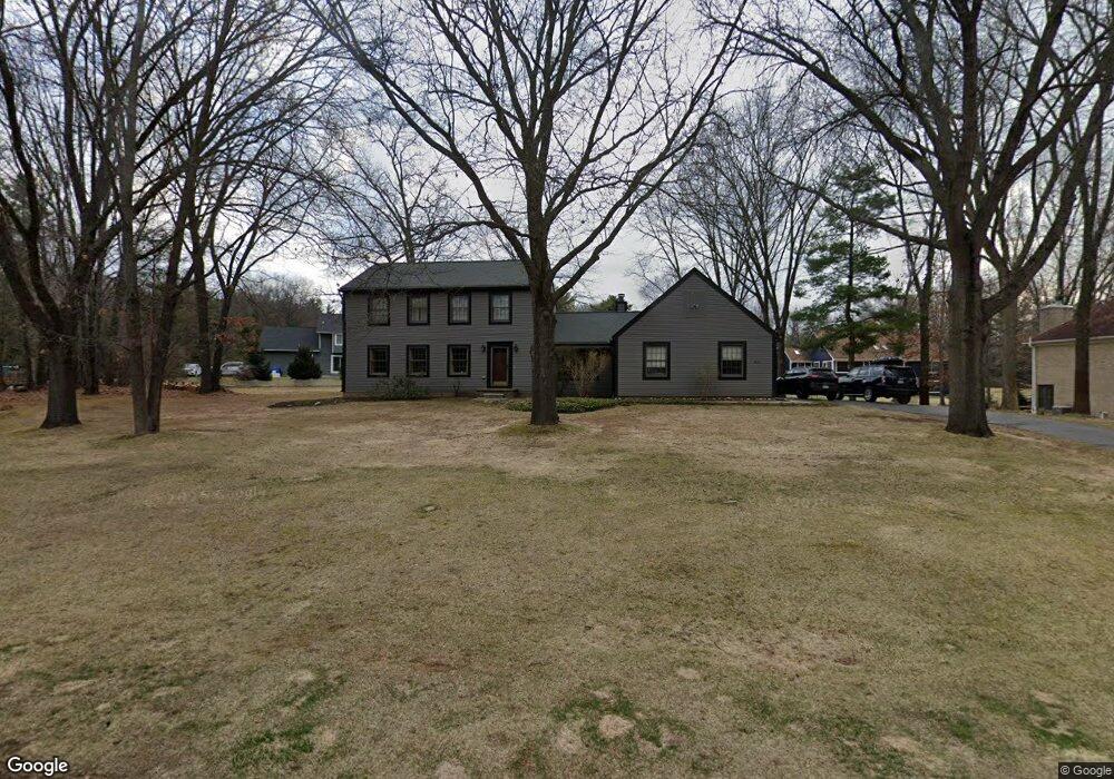
9111 Silver Pine Dr Unit Bldg-Unit South Lyon, MI 48178
Estimated Value: $498,876 - $553,000
--
Bed
3
Baths
2,236
Sq Ft
$238/Sq Ft
Est. Value
About This Home
This home is located at 9111 Silver Pine Dr Unit Bldg-Unit, South Lyon, MI 48178 and is currently estimated at $531,969, approximately $237 per square foot. 9111 Silver Pine Dr Unit Bldg-Unit is a home located in Livingston County with nearby schools including Hawkins Elementary School, Scranton Middle School, and Brighton High School.
Ownership History
Date
Name
Owned For
Owner Type
Purchase Details
Closed on
Mar 23, 2018
Sold by
Teff Gregory P
Bought by
Bedogne Anthony and Karolyi Rachel
Current Estimated Value
Home Financials for this Owner
Home Financials are based on the most recent Mortgage that was taken out on this home.
Original Mortgage
$256,000
Outstanding Balance
$219,475
Interest Rate
4.4%
Mortgage Type
New Conventional
Estimated Equity
$312,494
Purchase Details
Closed on
Sep 4, 2009
Sold by
Teff Deann
Bought by
Teff Gregory
Purchase Details
Closed on
Dec 30, 2002
Sold by
Deglee Gerrit and Ryan Deglee Maureen
Bought by
Teff Gregory P and Teff Deann M
Create a Home Valuation Report for This Property
The Home Valuation Report is an in-depth analysis detailing your home's value as well as a comparison with similar homes in the area
Home Values in the Area
Average Home Value in this Area
Purchase History
| Date | Buyer | Sale Price | Title Company |
|---|---|---|---|
| Bedogne Anthony | $320,000 | -- | |
| Teff Gregory | -- | -- | |
| Teff Gregory P | $284,000 | -- |
Source: Public Records
Mortgage History
| Date | Status | Borrower | Loan Amount |
|---|---|---|---|
| Open | Bedogne Anthony | $256,000 |
Source: Public Records
Tax History Compared to Growth
Tax History
| Year | Tax Paid | Tax Assessment Tax Assessment Total Assessment is a certain percentage of the fair market value that is determined by local assessors to be the total taxable value of land and additions on the property. | Land | Improvement |
|---|---|---|---|---|
| 2025 | $5,313 | $227,400 | $0 | $0 |
| 2024 | $2,287 | $200,600 | $0 | $0 |
| 2023 | $2,186 | $212,800 | $0 | $0 |
| 2022 | $4,471 | $155,600 | $0 | $0 |
| 2021 | $4,471 | $167,400 | $0 | $0 |
| 2020 | $4,434 | $167,400 | $0 | $0 |
| 2019 | $4,357 | $155,600 | $0 | $0 |
| 2018 | $3,356 | $145,200 | $0 | $0 |
| 2017 | $3,299 | $131,400 | $0 | $0 |
| 2016 | $3,283 | $125,400 | $0 | $0 |
| 2014 | $3,206 | $124,500 | $0 | $0 |
| 2012 | $3,206 | $109,000 | $0 | $0 |
Source: Public Records
Map
Nearby Homes
- 9112 Roger Scott Trail
- 0000 Stoney Point Unit 5
- 10993 Stoney Point Dr
- 11047 Silver View Ct
- 11035 Silver View Ct
- 11055 Silver View Ct
- 10611 Lighthouse Point
- 10817 Cliffview Dr
- 0 Hillview Dr Unit 25052269
- 11108 Silver Lake Rd
- 9044 Kemper Dr
- 8800 Evergreen Rd
- 00 Pier Point Ct
- 9736 Cross Creek Dr
- 9797 Rolling Pines Dr
- 9550 Silverside
- 8499 Bishop Rd
- 11390 Ridge Rd
- 11904 Moose Ridge Dr
- 12192 Doane Rd
- 9111 Silver Pine Dr
- 9143 Silver Pine Dr
- 9112 Ravinewood Ln
- 9074 Ravinewood Ln
- 9036 Ravinewood Ln
- 9110 Silver Pine Dr
- 9088 Silver Pine Dr
- 9150 Ravinewood Ln
- 9175 Silver Pine Dr
- 9066 Silver Pine Dr
- 9132 Silver Pine Dr
- 9091 Ravinewood Ln
- 9109 Ravinewood Ln
- 9164 Silver Pine Dr
- 9073 Ravinewood Ln
- 9019 Silver Pine Dr
- 9186 Silver Pine Dr
- 9034 Silver Pine Dr
- 9127 Ravinewood Ln
- 9055 Ravinewood Ln