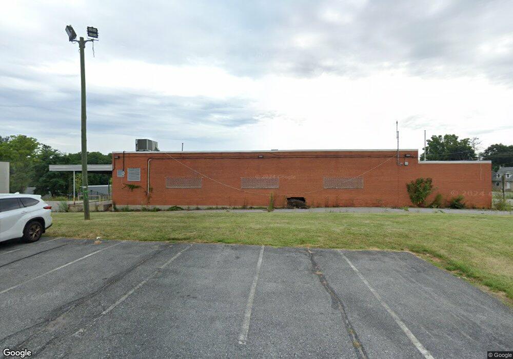
9113 Liberty Rd Randallstown, MD 21133
Estimated Value: $464,365
--
Bed
--
Bath
5,957
Sq Ft
$78/Sq Ft
Est. Value
About This Home
This home is located at 9113 Liberty Rd, Randallstown, MD 21133 and is currently estimated at $464,365, approximately $77 per square foot. 9113 Liberty Rd is a home located in Baltimore County with nearby schools including Randallstown Elementary School, Windsor Mill Middle School, and Randallstown High School.
Ownership History
Date
Name
Owned For
Owner Type
Purchase Details
Closed on
Jan 31, 2020
Sold by
Odd Lot Llc
Bought by
931 Liberty Road Randallstown Md Llc
Current Estimated Value
Purchase Details
Closed on
Jun 3, 2014
Sold by
Baltimore County Maryland
Bought by
Odd Lot Llc
Purchase Details
Closed on
Jan 29, 2004
Sold by
United States Postal Service
Bought by
Baltimore County Maryland
Purchase Details
Closed on
May 23, 1997
Sold by
Bair Scott S
Bought by
United States Postal Service
Create a Home Valuation Report for This Property
The Home Valuation Report is an in-depth analysis detailing your home's value as well as a comparison with similar homes in the area
Home Values in the Area
Average Home Value in this Area
Purchase History
| Date | Buyer | Sale Price | Title Company |
|---|---|---|---|
| 931 Liberty Road Randallstown Md Llc | $325,000 | Landmark Abstract Agency | |
| Odd Lot Llc | $275,000 | None Available | |
| Baltimore County Maryland | $400,000 | -- | |
| Baltimore County Maryland | $400,000 | -- | |
| United States Postal Service | $319,000 | -- |
Source: Public Records
Tax History Compared to Growth
Tax History
| Year | Tax Paid | Tax Assessment Tax Assessment Total Assessment is a certain percentage of the fair market value that is determined by local assessors to be the total taxable value of land and additions on the property. | Land | Improvement |
|---|---|---|---|---|
| 2025 | $7,479 | $560,700 | -- | -- |
| 2024 | $7,479 | $549,800 | $307,100 | $242,700 |
| 2023 | $3,974 | $474,867 | $0 | $0 |
| 2022 | $5,413 | $399,933 | $0 | $0 |
| 2021 | $4,488 | $325,000 | $307,100 | $17,900 |
| 2020 | $4,485 | $325,000 | $307,100 | $17,900 |
| 2019 | $6,597 | $544,300 | $307,100 | $237,200 |
| 2018 | $8,002 | $572,700 | $307,100 | $265,600 |
| 2017 | $5,894 | $506,800 | $0 | $0 |
| 2016 | $335 | $440,900 | $0 | $0 |
| 2015 | $335 | $375,000 | $0 | $0 |
| 2014 | $335 | $375,000 | $0 | $0 |
Source: Public Records
Map
Nearby Homes
- 9124 Liberty Rd
- 3506 Bayer Ave
- 3418 Carroll Ave
- 3402 Offutt Rd
- 3332 Offutt Rd
- 9202 Samoset Rd
- 3320 Offutt Rd
- 3705 Allenswood Ct
- 9303 Samoset Rd
- 8948 Harkate Way
- 9044 Allenswood Rd
- 1 Rock Story Ct
- 9302 Silver Charm Dr
- 3805 Terka Cir
- 9401 Summer Squal Dr
- 3816 Cassandra Rd
- 9311 Colorado Ave
- 8908 Meadow Heights Rd
- 8808 Church Ln
- 9112 Meadow Heights Rd
- 9115 Liberty Rd
- 9122 Liberty Rd
- 9109 Liberty Rd
- 9127 Liberty Rd
- 9101 Liberty Rd
- 9126 Liberty Rd
- 3508 Offutt Rd
- 9106 Tower Rd
- 3504 Offutt Rd
- 9130 Liberty Rd
- 3502 Offutt Rd
- 9131 Liberty Rd
- 9114 Tower Rd
- 3402 Tali Dr
- 9132 Liberty Rd
- 3402 8751 Tali Dr
- 9128 Liberty Rd
- 3400 Tali Dr
- 9134 Liberty Rd
- 3500 Offutt Rd