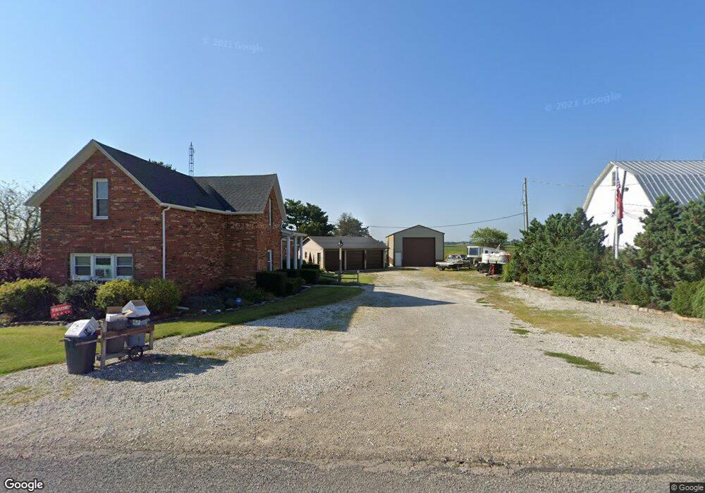
9115 Black Pike New Carlisle, OH 45344
Estimated Value: $317,000 - $360,000
3
Beds
1
Bath
2,389
Sq Ft
$141/Sq Ft
Est. Value
About This Home
This home is located at 9115 Black Pike, New Carlisle, OH 45344 and is currently estimated at $337,644, approximately $141 per square foot. 9115 Black Pike is a home located in Clark County with nearby schools including Northwestern Elementary School and Northwestern Junior/Senior High School.
Ownership History
Date
Name
Owned For
Owner Type
Purchase Details
Closed on
Dec 2, 2009
Sold by
Kesler Jill L and Kesler Jill Lee
Bought by
Kesler Eric and Von Kesler Eric
Current Estimated Value
Purchase Details
Closed on
Apr 24, 2004
Sold by
Aldredge Asa and Aldredge June E
Bought by
Aldredge Asa and Aldredge June E
Purchase Details
Closed on
Jun 30, 1994
Sold by
Scott Jimmie M
Bought by
Von Eric and Kesler Jill L
Home Financials for this Owner
Home Financials are based on the most recent Mortgage that was taken out on this home.
Original Mortgage
$315,000
Interest Rate
8.66%
Mortgage Type
New Conventional
Create a Home Valuation Report for This Property
The Home Valuation Report is an in-depth analysis detailing your home's value as well as a comparison with similar homes in the area
Home Values in the Area
Average Home Value in this Area
Purchase History
| Date | Buyer | Sale Price | Title Company |
|---|---|---|---|
| Kesler Eric | $267,900 | Attorney | |
| Aldredge Asa | -- | -- | |
| Von Eric | $420,000 | -- |
Source: Public Records
Mortgage History
| Date | Status | Borrower | Loan Amount |
|---|---|---|---|
| Previous Owner | Von Eric | $315,000 |
Source: Public Records
Tax History Compared to Growth
Tax History
| Year | Tax Paid | Tax Assessment Tax Assessment Total Assessment is a certain percentage of the fair market value that is determined by local assessors to be the total taxable value of land and additions on the property. | Land | Improvement |
|---|---|---|---|---|
| 2024 | $2,420 | $69,820 | $16,020 | $53,800 |
| 2023 | $2,420 | $69,820 | $16,020 | $53,800 |
| 2022 | $2,523 | $69,820 | $16,020 | $53,800 |
| 2021 | $2,882 | $52,870 | $11,690 | $41,180 |
| 2020 | $2,856 | $52,870 | $11,690 | $41,180 |
| 2019 | $2,884 | $52,870 | $11,690 | $41,180 |
| 2018 | $2,731 | $49,710 | $10,630 | $39,080 |
| 2017 | $2,732 | $49,718 | $10,633 | $39,085 |
| 2016 | $2,678 | $49,718 | $10,633 | $39,085 |
| 2015 | $2,514 | $47,649 | $10,633 | $37,016 |
| 2014 | $2,513 | $47,649 | $10,633 | $37,016 |
| 2013 | $2,497 | $47,649 | $10,633 | $37,016 |
Source: Public Records
Map
Nearby Homes
- 9398 Detrick Jordan Pike
- 3195 Liberty Rd
- 8650 Detrick Jordan Pike
- 9525 Detrick Jordan Pike
- 9551 Detrick Jordan Pike
- 2936 Liberty Rd
- 2875 Liberty Rd
- 9737 Troy Rd
- 9797 Detrick Jordan Pike
- 8450 Detrick Jordan Pike
- 2675 Liberty Rd
- 8420 Detrick Jordan Pike
- 8384 Detrick Jordan Pike
- 8364 Detrick Jordan Pike
- 2611 Liberty Rd
- 2665 Liberty Rd
- 8350 Detrick Jordan Pike
- 8800 Ulery Rd
- 8782 Ulery Rd
- 8790 Ulery Rd