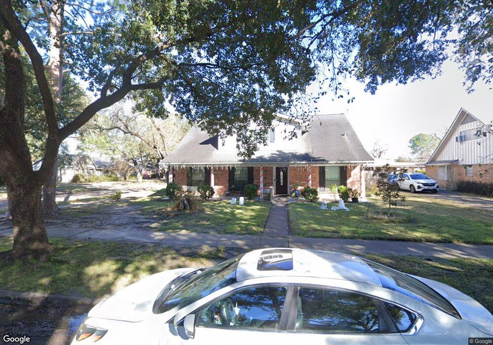
9118 Hendon Ln Houston, TX 77036
Chinatown NeighborhoodEstimated Value: $318,000 - $341,000
4
Beds
2
Baths
2,365
Sq Ft
$139/Sq Ft
Est. Value
About This Home
This home is located at 9118 Hendon Ln, Houston, TX 77036 and is currently estimated at $328,072, approximately $138 per square foot. 9118 Hendon Ln is a home located in Harris County with nearby schools including Ed White Elementary School, Sugar Grove Academy, and Sharpstown High School.
Ownership History
Date
Name
Owned For
Owner Type
Purchase Details
Closed on
May 2, 2005
Sold by
Schultze Fred L and Schultze Leslie
Bought by
Chao Jose Luis
Current Estimated Value
Home Financials for this Owner
Home Financials are based on the most recent Mortgage that was taken out on this home.
Original Mortgage
$171,954
Outstanding Balance
$90,922
Interest Rate
6.06%
Mortgage Type
Fannie Mae Freddie Mac
Estimated Equity
$237,150
Create a Home Valuation Report for This Property
The Home Valuation Report is an in-depth analysis detailing your home's value as well as a comparison with similar homes in the area
Home Values in the Area
Average Home Value in this Area
Purchase History
| Date | Buyer | Sale Price | Title Company |
|---|---|---|---|
| Chao Jose Luis | -- | Charter Title Co Fort Bend |
Source: Public Records
Mortgage History
| Date | Status | Borrower | Loan Amount |
|---|---|---|---|
| Open | Chao Jose Luis | $171,954 |
Source: Public Records
Tax History Compared to Growth
Tax History
| Year | Tax Paid | Tax Assessment Tax Assessment Total Assessment is a certain percentage of the fair market value that is determined by local assessors to be the total taxable value of land and additions on the property. | Land | Improvement |
|---|---|---|---|---|
| 2025 | $541 | $309,071 | $98,542 | $210,529 |
| 2024 | $541 | $262,000 | $98,542 | $163,458 |
| 2023 | $541 | $306,623 | $98,542 | $208,081 |
| 2022 | $6,344 | $296,890 | $57,483 | $239,407 |
| 2021 | $5,891 | $252,756 | $49,271 | $203,485 |
| 2020 | $6,021 | $240,701 | $49,271 | $191,430 |
| 2019 | $5,874 | $240,701 | $49,271 | $191,430 |
| 2018 | $3,860 | $228,628 | $49,271 | $179,357 |
| 2017 | $4,851 | $228,628 | $49,271 | $179,357 |
| 2016 | $4,410 | $213,202 | $49,271 | $163,931 |
| 2015 | $2,709 | $192,604 | $49,271 | $143,333 |
| 2014 | $2,709 | $179,819 | $49,271 | $130,548 |
Source: Public Records
Map
Nearby Homes
- 7939 Kendalia Dr
- 9215 Sharpcrest St
- 8923 Hendon Ln
- 8902 Langdon Ln
- 9234 Westwood Village Dr Unit 17
- 9345 Westwood Village Dr Unit 30
- 9506 Hendon Ln
- 9393 Westwood Village Dr Unit 64
- 9006 Roos Rd
- 9238 Stroud Dr
- 7303 Augustine Dr
- 8818 Roos Rd
- 9002 Grape St
- 8826 Tanager St
- 8918 Grape St
- 8326 Jorine Dr Unit 8326
- 8931 Jackwood St
- 7302 Redding Rd
- 8334 Jorine Dr Unit 8733
- 8826 Jackwood St
- 9114 Hendon Ln
- 9110 Hendon Ln
- 9115 Sharpcrest St
- 7630 Pella Dr
- 9111 Sharpcrest St
- 7626 Pella Dr
- 7634 Pella Dr
- 9119 Hendon Ln
- 7622 Pella Dr
- 9107 Sharpcrest St
- 9115 Hendon Ln
- 9106 Hendon Ln
- 7702 Pella Dr
- 9111 Hendon Ln
- 9103 Sharpcrest St
- 7618 Pella Dr
- 9107 Hendon Ln
- 7706 Pella Dr
- 9102 Hendon Ln
- 7614 Pella Dr