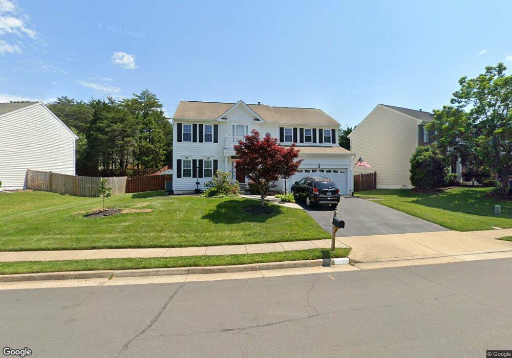
9119 Weathersfield Dr Bristow, VA 20136
Kingsbrooke NeighborhoodEstimated Value: $757,507 - $815,000
4
Beds
4
Baths
2,437
Sq Ft
$325/Sq Ft
Est. Value
About This Home
This home is located at 9119 Weathersfield Dr, Bristow, VA 20136 and is currently estimated at $792,627, approximately $325 per square foot. 9119 Weathersfield Dr is a home located in Prince William County with nearby schools including Bristow Run Elementary School, Patriot High School, and Gainesville Middle School.
Ownership History
Date
Name
Owned For
Owner Type
Purchase Details
Closed on
Aug 15, 2001
Sold by
Piantes Anthony H
Bought by
Reynolds Ronald J
Current Estimated Value
Home Financials for this Owner
Home Financials are based on the most recent Mortgage that was taken out on this home.
Original Mortgage
$226,800
Outstanding Balance
$87,447
Interest Rate
6.99%
Estimated Equity
$705,180
Purchase Details
Closed on
Sep 23, 1999
Sold by
Beazer Home Corp
Bought by
Piantes Anthony H and Piantes Reynolds,Ronald J
Home Financials for this Owner
Home Financials are based on the most recent Mortgage that was taken out on this home.
Original Mortgage
$177,600
Interest Rate
7.81%
Create a Home Valuation Report for This Property
The Home Valuation Report is an in-depth analysis detailing your home's value as well as a comparison with similar homes in the area
Home Values in the Area
Average Home Value in this Area
Purchase History
| Date | Buyer | Sale Price | Title Company |
|---|---|---|---|
| Reynolds Ronald J | -- | -- | |
| Piantes Anthony H | $222,000 | -- |
Source: Public Records
Mortgage History
| Date | Status | Borrower | Loan Amount |
|---|---|---|---|
| Open | Reynolds Ronald J | $226,800 | |
| Previous Owner | Piantes Anthony H | $177,600 |
Source: Public Records
Tax History Compared to Growth
Tax History
| Year | Tax Paid | Tax Assessment Tax Assessment Total Assessment is a certain percentage of the fair market value that is determined by local assessors to be the total taxable value of land and additions on the property. | Land | Improvement |
|---|---|---|---|---|
| 2025 | $6,953 | $738,800 | $230,600 | $508,200 |
| 2024 | $6,953 | $699,100 | $213,200 | $485,900 |
| 2023 | $6,830 | $656,400 | $201,200 | $455,200 |
| 2022 | $6,719 | $606,700 | $183,100 | $423,600 |
| 2021 | $6,217 | $510,000 | $147,800 | $362,200 |
| 2020 | $7,488 | $483,100 | $144,700 | $338,400 |
| 2019 | $7,142 | $460,800 | $144,700 | $316,100 |
| 2018 | $5,445 | $450,900 | $144,700 | $306,200 |
| 2017 | $5,250 | $426,000 | $136,900 | $289,100 |
| 2016 | $5,073 | $415,400 | $136,900 | $278,500 |
| 2015 | $5,099 | $421,000 | $136,900 | $284,100 |
| 2014 | $5,099 | $408,700 | $130,700 | $278,000 |
Source: Public Records
Map
Nearby Homes
- 9179 Weathersfield Dr
- 13552 Wembley Loop
- 13531 Grouserun Ln
- 9197 Broadlands Ln
- 13196 Scottish Hunt Ln
- 8878 Stable Forest Place
- 9066 Cottage Loop
- 8850 Benchmark Ln
- 9709 Kinloss Mews
- 9486 Broadlands Ln
- 8793 Partridge Run Way
- 9075 Falcon Glen Ct
- 9069 Slate Stone Loop
- 13625 America Dr
- 8781 Comfort Ct
- 9512 Silas Dr
- 9505 Dunblane Ct
- 9197 Rilda Place
- 8735 Diamond Hill Dr
- 13209 Dunnegan Head Place
- 9129 Weathersfield Dr
- 9109 Weathersfield Dr
- 9241 Lost Fields Ct
- 9139 Weathersfield Dr
- 9231 Lost Fields Ct
- 9099 Weathersfield Dr
- 9120 Weathersfield Dr
- 9110 Weathersfield Dr
- 9221 Lost Fields Ct
- 9130 Weathersfield Dr
- 9149 Weathersfield Dr
- 9079 Weathersfield Dr
- 9100 Weathersfield Dr
- 9261 Lost Fields Ct
- 9090 Weathersfield Dr
- 9140 Weathersfield Dr
- 9211 Lost Fields Ct
- 13371 Crowning Place
- 9159 Weathersfield Dr
- 9059 Weathersfield Dr