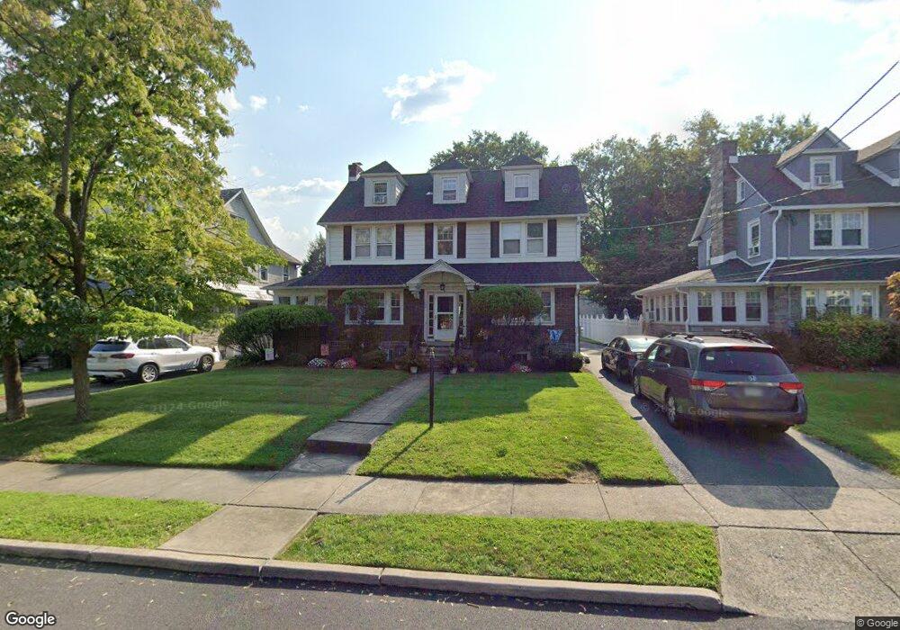
912 Childs Ave Drexel Hill, PA 19026
Estimated Value: $439,000 - $517,000
5
Beds
3
Baths
2,419
Sq Ft
$197/Sq Ft
Est. Value
About This Home
This home is located at 912 Childs Ave, Drexel Hill, PA 19026 and is currently estimated at $476,000, approximately $196 per square foot. 912 Childs Ave is a home located in Delaware County with nearby schools including Aronimink El School, Upper Darby Kdg Center, and Drexel Hill Middle School.
Ownership History
Date
Name
Owned For
Owner Type
Purchase Details
Closed on
Nov 8, 2006
Sold by
Oneill Richard F and Oneill Jeanne G
Bought by
Hunt Kevin T and Kelly Melissa A
Current Estimated Value
Home Financials for this Owner
Home Financials are based on the most recent Mortgage that was taken out on this home.
Original Mortgage
$262,000
Outstanding Balance
$155,845
Interest Rate
6.31%
Mortgage Type
Purchase Money Mortgage
Estimated Equity
$320,155
Create a Home Valuation Report for This Property
The Home Valuation Report is an in-depth analysis detailing your home's value as well as a comparison with similar homes in the area
Home Values in the Area
Average Home Value in this Area
Purchase History
| Date | Buyer | Sale Price | Title Company |
|---|---|---|---|
| Hunt Kevin T | $340,000 | None Available |
Source: Public Records
Mortgage History
| Date | Status | Borrower | Loan Amount |
|---|---|---|---|
| Open | Hunt Kevin T | $262,000 |
Source: Public Records
Tax History Compared to Growth
Tax History
| Year | Tax Paid | Tax Assessment Tax Assessment Total Assessment is a certain percentage of the fair market value that is determined by local assessors to be the total taxable value of land and additions on the property. | Land | Improvement |
|---|---|---|---|---|
| 2025 | $10,000 | $236,450 | $59,330 | $177,120 |
| 2024 | $10,000 | $236,450 | $59,330 | $177,120 |
| 2023 | $9,906 | $236,450 | $59,330 | $177,120 |
| 2022 | $9,639 | $236,450 | $59,330 | $177,120 |
| 2021 | $12,997 | $236,450 | $59,330 | $177,120 |
| 2020 | $11,285 | $174,450 | $55,420 | $119,030 |
| 2019 | $11,086 | $174,450 | $55,420 | $119,030 |
| 2018 | $10,959 | $174,450 | $0 | $0 |
| 2017 | $10,674 | $174,450 | $0 | $0 |
| 2016 | $957 | $174,450 | $0 | $0 |
| 2015 | $977 | $174,450 | $0 | $0 |
| 2014 | $957 | $174,450 | $0 | $0 |
Source: Public Records
Map
Nearby Homes
- 820 Wilde Ave
- 1005 Belfield Ave
- 833 Anderson Ave
- 914 Anderson Ave
- 1102 Childs Ave
- 1048 Morgan Ave
- 824 Lindale Ave
- 711 Roberts Ave
- 831 Concord Ave
- 930 Ormond Ave
- 1208 Belfield Ave
- 718 Concord Ave
- 844 Mason Ave
- 828 Mason Ave
- 4812 Woodland Ave
- 729 Edmonds Ave
- 1200 Ormond Ave
- 719 Mason Ave
- 5042 Sylvia Rd
- 4930 State Rd