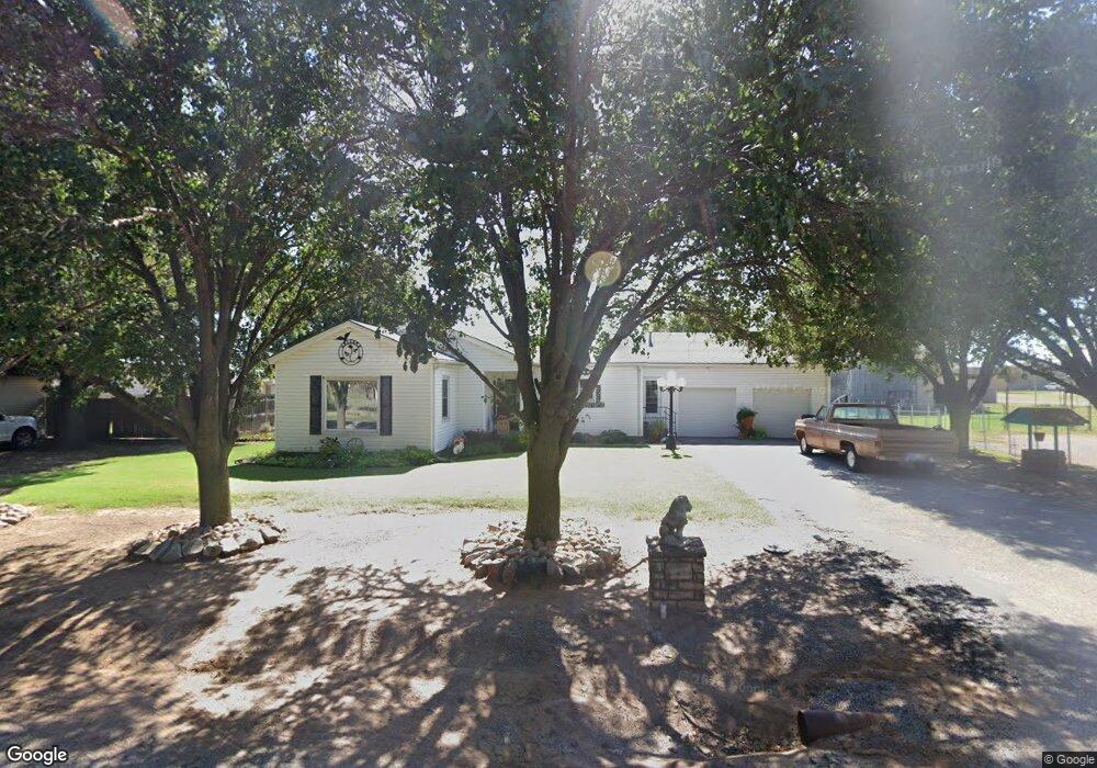
912 E Grant St Sentinel, OK 73664
Estimated Value: $72,000 - $131,000
3
Beds
1
Bath
1,362
Sq Ft
$70/Sq Ft
Est. Value
About This Home
This home is located at 912 E Grant St, Sentinel, OK 73664 and is currently estimated at $94,769, approximately $69 per square foot. 912 E Grant St is a home with nearby schools including McMurray Elementary School and Blanche Thomas High School.
Ownership History
Date
Name
Owned For
Owner Type
Purchase Details
Closed on
Dec 17, 2020
Sold by
Harris Linda D and Louis And Irene Hopkins Family
Bought by
Landers Diane Raley
Current Estimated Value
Home Financials for this Owner
Home Financials are based on the most recent Mortgage that was taken out on this home.
Original Mortgage
$49,094
Outstanding Balance
$35,133
Interest Rate
2.7%
Mortgage Type
New Conventional
Estimated Equity
$59,636
Purchase Details
Closed on
Feb 3, 2006
Sold by
Hopkins Louis and Hopkins Irene
Bought by
Hopkins Louis and Hopkins Irene
Create a Home Valuation Report for This Property
The Home Valuation Report is an in-depth analysis detailing your home's value as well as a comparison with similar homes in the area
Purchase History
| Date | Buyer | Sale Price | Title Company |
|---|---|---|---|
| Landers Diane Raley | $50,000 | Old Republic Title Company | |
| Hopkins Louis | -- | -- | |
| Hopkins Family Trust | -- | -- |
Source: Public Records
Mortgage History
| Date | Status | Borrower | Loan Amount |
|---|---|---|---|
| Open | Landers Diane Raley | $49,094 |
Source: Public Records
Tax History
| Year | Tax Paid | Tax Assessment Tax Assessment Total Assessment is a certain percentage of the fair market value that is determined by local assessors to be the total taxable value of land and additions on the property. | Land | Improvement |
|---|---|---|---|---|
| 2025 | $412 | $5,866 | $506 | $5,360 |
| 2024 | $426 | $6,064 | $506 | $5,558 |
| 2023 | $406 | $5,775 | $506 | $5,269 |
| 2022 | $387 | $5,500 | $506 | $4,994 |
| 2021 | $386 | $5,500 | $506 | $4,994 |
| 2020 | $253 | $3,774 | $506 | $3,268 |
| 2019 | $253 | $3,594 | $506 | $3,088 |
| 2018 | $241 | $3,422 | $506 | $2,916 |
| 2017 | $0 | $3,323 | $506 | $2,817 |
| 2016 | $0 | $3,226 | $506 | $2,720 |
| 2015 | $216 | $3,073 | $506 | $2,567 |
| 2014 | $216 | $2,926 | $506 | $2,420 |
Source: Public Records
Map
Nearby Homes
- 705 E Whitmer
- 114 S 5th St
- 1001 Main St
- 401 Means
- 22117 E 1250 Rd
- 12603 N 2210 Rd
- 0 E 1220 Rd
- 12499 N 2220 Rd
- 12004 N 2110 Rd
- 409 S McDonald St
- 116 Gaynelle Ln
- 615 N Lowe St
- 21480 E 1210 Rd
- 207 W Hillcrest Ln
- 530 N Lowe St
- 600 N Randlett St
- 401 N Stephens St
- 103 E Dogwood St
- 310 N Park Rd
- 205 E Dogwood St
- 920 E Grant St
- 900 E Grant St
- 208 S 10th St
- 122 S 10th St
- 911 E Washington St
- 901 E Grant St
- 911 Washington St
- 911 E Grant St
- 901 E Washington St
- 921 Washington St
- 823 E Grant St
- 1003 E Grant St
- 1001 E Washington St
- 1012 E Grant St
- 1011 E Grant St
- 900 E Main St
- 910 Washington St
- 920 E Washington St
- 922 E Main St
- 910 E Main St
Your Personal Tour Guide
Ask me questions while you tour the home.