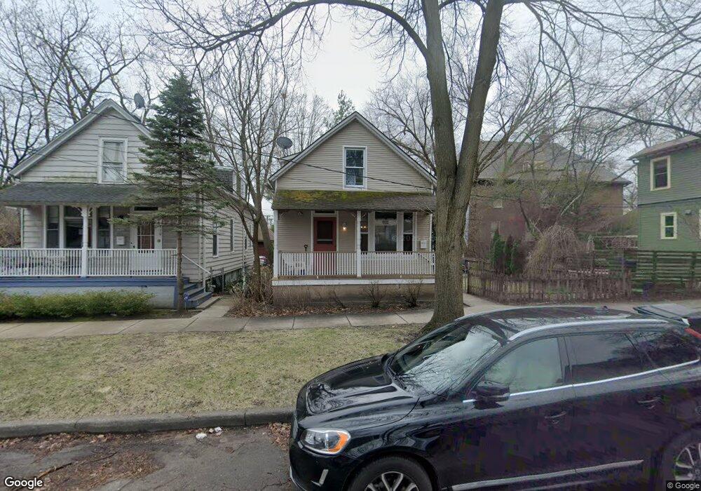
912 Gaffield Place Evanston, IL 60201
Northeast Evanston NeighborhoodEstimated Value: $615,195 - $813,000
4
Beds
2
Baths
1,334
Sq Ft
$530/Sq Ft
Est. Value
About This Home
This home is located at 912 Gaffield Place, Evanston, IL 60201 and is currently estimated at $707,049, approximately $530 per square foot. 912 Gaffield Place is a home located in Cook County with nearby schools including Dewey Elementary School, Washington Elementary School, and Nichols Middle School.
Ownership History
Date
Name
Owned For
Owner Type
Purchase Details
Closed on
May 28, 2016
Sold by
Joob Chris and Joob Nina
Bought by
Karoll Albert and Karoll Sara
Current Estimated Value
Home Financials for this Owner
Home Financials are based on the most recent Mortgage that was taken out on this home.
Original Mortgage
$360,000
Outstanding Balance
$284,253
Interest Rate
3.66%
Mortgage Type
New Conventional
Estimated Equity
$422,796
Purchase Details
Closed on
May 11, 2012
Sold by
Spurlin Robert and Spurlin Valerie
Bought by
Joob Chris and Joob Nina
Home Financials for this Owner
Home Financials are based on the most recent Mortgage that was taken out on this home.
Original Mortgage
$238,500
Interest Rate
3.92%
Mortgage Type
New Conventional
Create a Home Valuation Report for This Property
The Home Valuation Report is an in-depth analysis detailing your home's value as well as a comparison with similar homes in the area
Home Values in the Area
Average Home Value in this Area
Purchase History
| Date | Buyer | Sale Price | Title Company |
|---|---|---|---|
| Karoll Albert | $480,000 | Chicago Title | |
| Joob Chris | $265,000 | Fidelity National Title |
Source: Public Records
Mortgage History
| Date | Status | Borrower | Loan Amount |
|---|---|---|---|
| Open | Karoll Albert | $360,000 | |
| Previous Owner | Joob Chris | $238,500 |
Source: Public Records
Tax History
| Year | Tax Paid | Tax Assessment Tax Assessment Total Assessment is a certain percentage of the fair market value that is determined by local assessors to be the total taxable value of land and additions on the property. | Land | Improvement |
|---|---|---|---|---|
| 2025 | $10,891 | $50,000 | $8,363 | $41,637 |
| 2024 | $10,891 | $43,587 | $7,088 | $36,499 |
| 2023 | $11,172 | $48,095 | $7,088 | $41,007 |
| 2022 | $11,172 | $48,095 | $7,088 | $41,007 |
| 2021 | $9,734 | $36,680 | $4,677 | $32,003 |
| 2020 | $9,604 | $36,680 | $4,677 | $32,003 |
| 2019 | $9,885 | $42,191 | $4,677 | $37,514 |
| 2018 | $8,810 | $32,156 | $3,969 | $28,187 |
| 2017 | $8,979 | $33,651 | $3,969 | $29,682 |
| 2016 | $8,602 | $36,486 | $3,969 | $32,517 |
| 2015 | $6,812 | $28,027 | $3,402 | $24,625 |
| 2014 | $6,761 | $28,027 | $3,402 | $24,625 |
| 2013 | $7,272 | $28,027 | $3,402 | $24,625 |
Source: Public Records
Map
Nearby Homes
- 734 Noyes St Unit O2
- 2236 Ridge Ave
- 730 Noyes St Unit K3
- 2242 Sherman Ave Unit 2242G
- 819 Foster St Unit 3N
- 724 Noyes St Unit F1
- 2033 Sherman Ave Unit 507
- 2033 Sherman Ave Unit 409
- 2033 Sherman Ave Unit 306
- 2001 Sherman Ave Unit 203
- 1201 Noyes St
- 2043 Asbury Ave
- 2215 Wesley Ave
- 2319 Asbury Ave
- 726 Lincoln St
- 1864 Sherman Ave Unit 5NW
- 833 Lincoln St
- 1860 Sherman Ave Unit 4SW
- 1860 Sherman Ave Unit 5NW
- 1860 Sherman Ave Unit 7NE
- 910 Gaffield Place
- 2127 Maple Ave
- 2115 Maple Ave
- 2113 Maple Ave
- 2111 Maple Ave
- 2145 Maple Ave
- 2122 Maple Ave
- 2122 Maple Ave
- 2147 Maple Ave
- 2107 Maple Ave
- 2149 Maple Ave
- 2128 Maple Ave
- 2126 Maple Ave
- 911 Simpson St
- 2203 Maple Ave Unit E2
- 2103 Maple Ave
- 2138 Maple Ave
- 2114 Maple Ave
- 2118 Maple Ave
- 2124 Maple Ave
Your Personal Tour Guide
Ask me questions while you tour the home.