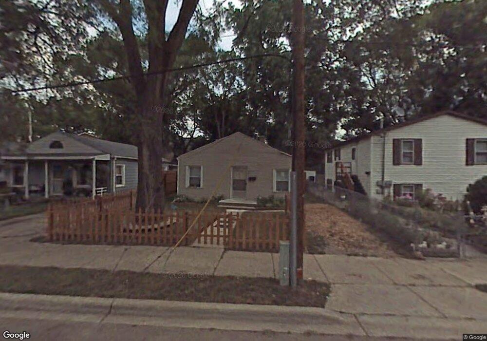
912 Low Ave Waukegan, IL 60085
Lyon Grove NeighborhoodEstimated Value: $137,903 - $194,000
2
Beds
1
Bath
720
Sq Ft
$221/Sq Ft
Est. Value
About This Home
This home is located at 912 Low Ave, Waukegan, IL 60085 and is currently estimated at $158,968, approximately $220 per square foot. 912 Low Ave is a home located in Lake County with nearby schools including H R McCall Elementary School, Miguel Juarez Middle School, and Waukegan High School.
Ownership History
Date
Name
Owned For
Owner Type
Purchase Details
Closed on
Sep 19, 2003
Sold by
Geevarghese Mathew
Bought by
Burk Jason K and Burk Carol A
Current Estimated Value
Home Financials for this Owner
Home Financials are based on the most recent Mortgage that was taken out on this home.
Original Mortgage
$77,520
Interest Rate
6.02%
Mortgage Type
VA
Create a Home Valuation Report for This Property
The Home Valuation Report is an in-depth analysis detailing your home's value as well as a comparison with similar homes in the area
Home Values in the Area
Average Home Value in this Area
Purchase History
| Date | Buyer | Sale Price | Title Company |
|---|---|---|---|
| Burk Jason K | $76,000 | -- |
Source: Public Records
Mortgage History
| Date | Status | Borrower | Loan Amount |
|---|---|---|---|
| Previous Owner | Burk Jason K | $77,520 |
Source: Public Records
Tax History Compared to Growth
Tax History
| Year | Tax Paid | Tax Assessment Tax Assessment Total Assessment is a certain percentage of the fair market value that is determined by local assessors to be the total taxable value of land and additions on the property. | Land | Improvement |
|---|---|---|---|---|
| 2024 | $1,482 | $27,171 | $8,200 | $18,971 |
| 2023 | $1,446 | $23,715 | $6,730 | $16,985 |
| 2022 | $1,446 | $20,795 | $6,128 | $14,667 |
| 2021 | $1,230 | $17,794 | $5,260 | $12,534 |
| 2020 | $1,199 | $16,577 | $4,900 | $11,677 |
| 2019 | $1,154 | $15,190 | $4,490 | $10,700 |
| 2018 | $771 | $12,343 | $5,083 | $7,260 |
| 2017 | $700 | $10,920 | $4,497 | $6,423 |
| 2016 | $539 | $9,489 | $3,908 | $5,581 |
| 2015 | $421 | $8,493 | $3,498 | $4,995 |
| 2014 | $695 | $9,646 | $2,914 | $6,732 |
| 2012 | $1,214 | $10,450 | $3,157 | $7,293 |
Source: Public Records
Map
Nearby Homes
- 511 Chestnut St
- 428 N Poplar St
- 522 N Poplar St
- 702 Franklin St
- 620 N Poplar St
- 452 North Ave
- 1109 Massena Ave
- 23 N Jackson St
- 824 N Butrick St
- 28 N Saint James St
- 917 N Linden Ave
- 1416 Hamilton Ct
- 918 N Ash St
- 1000 Pine St
- 613 Washington St
- 325 4th St
- 222 Grand Ave
- 968 Judge Ave
- 557 W Water St
- 1105 Woodlawn Cir