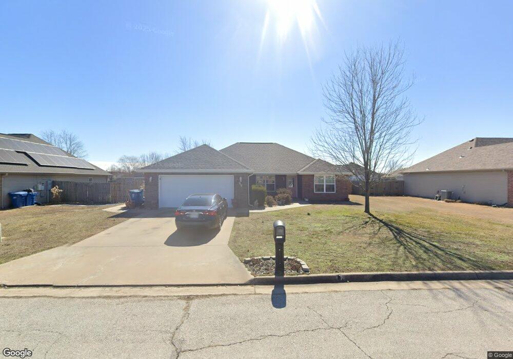
912 Monroe Cir Carl Junction, MO 64834
Estimated Value: $267,075 - $289,000
3
Beds
2
Baths
1,618
Sq Ft
$170/Sq Ft
Est. Value
About This Home
This home is located at 912 Monroe Cir, Carl Junction, MO 64834 and is currently estimated at $274,269, approximately $169 per square foot. 912 Monroe Cir is a home located in Jasper County with nearby schools including Carl Junction Primary School (K-1), Carl Junction Intermediate School, and Carl Junction Primary School (2-3).
Ownership History
Date
Name
Owned For
Owner Type
Purchase Details
Closed on
Jan 13, 2022
Sold by
Harrington Brian C and Harrington Michelle L
Bought by
Harrington Brian C and Harrington Michelle L
Current Estimated Value
Home Financials for this Owner
Home Financials are based on the most recent Mortgage that was taken out on this home.
Original Mortgage
$155,000
Outstanding Balance
$121,167
Interest Rate
2.33%
Mortgage Type
New Conventional
Estimated Equity
$153,102
Purchase Details
Closed on
Aug 1, 2018
Sold by
Blake Zacherie N
Bought by
Harrington Brian C
Home Financials for this Owner
Home Financials are based on the most recent Mortgage that was taken out on this home.
Original Mortgage
$155,138
Interest Rate
4.25%
Mortgage Type
FHA
Purchase Details
Closed on
Jun 22, 2011
Sold by
Red Wood Development Inc
Bought by
Black Zacherie N
Create a Home Valuation Report for This Property
The Home Valuation Report is an in-depth analysis detailing your home's value as well as a comparison with similar homes in the area
Purchase History
| Date | Buyer | Sale Price | Title Company |
|---|---|---|---|
| Harrington Brian C | $206,150 | None Listed On Document | |
| Harrington Brian C | -- | -- | |
| Black Zacherie N | -- | None Available |
Source: Public Records
Mortgage History
| Date | Status | Borrower | Loan Amount |
|---|---|---|---|
| Open | Harrington Brian C | $155,000 | |
| Previous Owner | Harrington Brian C | $155,138 |
Source: Public Records
Tax History
| Year | Tax Paid | Tax Assessment Tax Assessment Total Assessment is a certain percentage of the fair market value that is determined by local assessors to be the total taxable value of land and additions on the property. | Land | Improvement |
|---|---|---|---|---|
| 2025 | $1,542 | $29,770 | $2,160 | $27,610 |
| 2024 | $1,552 | $26,360 | $2,160 | $24,200 |
| 2023 | $1,552 | $26,360 | $2,160 | $24,200 |
| 2022 | $1,573 | $26,640 | $2,160 | $24,480 |
| 2021 | $1,349 | $26,640 | $2,160 | $24,480 |
| 2020 | $1,247 | $24,210 | $2,160 | $22,050 |
| 2019 | $1,184 | $24,210 | $2,160 | $22,050 |
| 2018 | $1,262 | $25,860 | $0 | $0 |
| 2017 | $1,265 | $25,860 | $0 | $0 |
| 2016 | $1,264 | $26,080 | $0 | $0 |
Source: Public Records
Map
Nearby Homes
- 904 Larson St
- TBD Route Yy
- 29320 State Highway Yy
- 29250 State Highway Yy
- 817 Delaney Dr
- Tract 3 Prairie Ln
- Tract 2 Prairie Ln
- Tract 1 Prairie Ln
- Tract 4 Prairie Ln
- 711 Prairie Ln
- 9129 Cr-290
- 505 N Broadway Ave
- 809 Aberdeen Ave
- 901 Aberdeen Ave
- 106 S Roney St
- 304 Belgian Blue Blvd
- 804 Aberdeen Ave
- 806 Aberdeen Ave
- 808 Aberdeen Ave
- 902 Aberdeen Ave
Your Personal Tour Guide
Ask me questions while you tour the home.