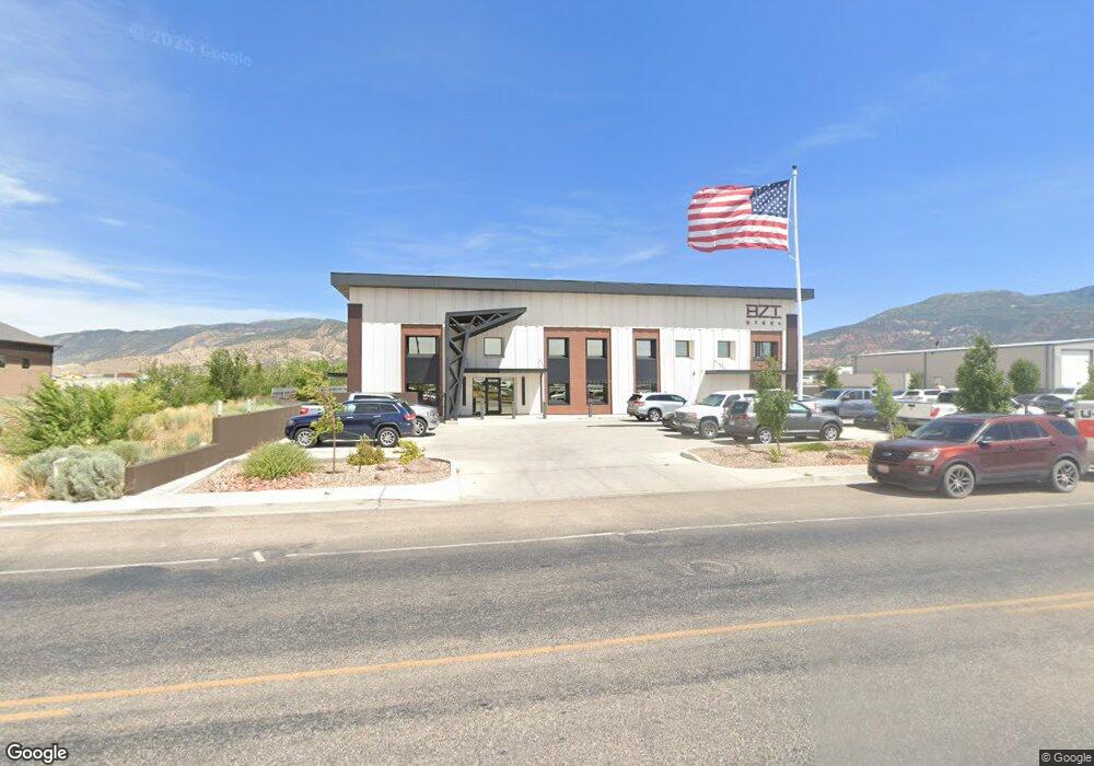
912 N Airport Rd Cedar City, UT 84721
--
Bed
--
Bath
18,743
Sq Ft
2.68
Acres
About This Home
This home is located at 912 N Airport Rd, Cedar City, UT 84721. 912 N Airport Rd is a home located in Iron County with nearby schools including Cedar North School, Cedar Middle School, and Cedar City High School.
Ownership History
Date
Name
Owned For
Owner Type
Purchase Details
Closed on
Oct 10, 2022
Sold by
Building Zone Industries Llc
Bought by
Ic Steel Holdings Llc
Purchase Details
Closed on
May 26, 2018
Sold by
Fisher Five Llc
Bought by
Building Zone Industries Llc
Purchase Details
Closed on
Sep 16, 2009
Sold by
Zions First National Bank
Bought by
Fisher Five Llc
Purchase Details
Closed on
Feb 24, 2009
Sold by
Eves Investments Lc
Bought by
Zions First National Bank
Purchase Details
Closed on
Dec 4, 2007
Sold by
Eves Jerry G
Bought by
Eves Investments Lc
Purchase Details
Closed on
Nov 10, 2005
Sold by
Corry Enterprises Inc
Bought by
Eves Derral E
Create a Home Valuation Report for This Property
The Home Valuation Report is an in-depth analysis detailing your home's value as well as a comparison with similar homes in the area
Home Values in the Area
Average Home Value in this Area
Purchase History
| Date | Buyer | Sale Price | Title Company |
|---|---|---|---|
| Ic Steel Holdings Llc | -- | Security Escrow & Title | |
| Building Zone Industries Llc | -- | American First Escrow & Titl | |
| Fisher Five Llc | -- | -- | |
| Zions First National Bank | $866,002 | -- | |
| Eves Investments Lc | -- | -- | |
| Eves Derral E | -- | -- |
Source: Public Records
Tax History Compared to Growth
Tax History
| Year | Tax Paid | Tax Assessment Tax Assessment Total Assessment is a certain percentage of the fair market value that is determined by local assessors to be the total taxable value of land and additions on the property. | Land | Improvement |
|---|---|---|---|---|
| 2025 | $17,572 | $2,259,167 | $805,330 | $1,453,837 |
| 2023 | $12,883 | $1,118,330 | $400,325 | $718,005 |
| 2022 | $9,310 | $1,012,745 | $328,930 | $683,815 |
| 2021 | $9,022 | $981,380 | $297,565 | $683,815 |
| 2020 | $9,250 | $892,185 | $297,565 | $594,620 |
| 2019 | $8,947 | $825,540 | $230,920 | $594,620 |
| 2018 | $8,638 | $770,865 | $211,320 | $559,545 |
| 2017 | $8,773 | $770,865 | $211,320 | $559,545 |
| 2016 | $8,799 | $720,000 | $211,320 | $508,680 |
| 2015 | $9,280 | $720,000 | $0 | $0 |
| 2014 | $8,329 | $604,440 | $0 | $0 |
Source: Public Records
Map
Nearby Homes
- 4482 W 250 N
- 4591 W 250 N
- 960 N 1400 W
- 799 N 2325 W
- 147.9141 Acre Ft Water Right 73-1201
- 495 N 2150 W
- 2502 W 850 N
- 374 N 1500 W
- 364 N 1500 W
- 6333 N 1600 W
- 1120 Bulloch Cir
- 325 N 1500 W
- 300 N Airport Rd
- 305 N Airport Rd
- 827 W 1175 N Unit 56
- 780 W 1125 N Unit 46
- 780 W 1125 N Unit 23
- 780 W 1125 N Unit 22
- 15.98 Ac. N Airport Rd
- 2300 N Airport Rd
- 21 Acres N Airport Rd
- 1450 W Industry Way
- 887 N Airport Rd
- Lot 64 Iron Mountain Subdivision
- 850 N Airport Rd
- Lot 102 Iron Mountain Subdivision
- Lot 104 Iron Mountain Subdivision
- 2114 W 850 N
- 2113 W 850 N
- 4571 W 250 N Unit Lot 133
- 4591 W 250 N Unit Lot 132
- 4512 W 250 N
- 4532 W 250 N
- 4572 W 250 N
- 4552 W 250 N
- 4592 W 250 N
- 4551 W 250 N Unit Lot 134
- 4571 W 250 N