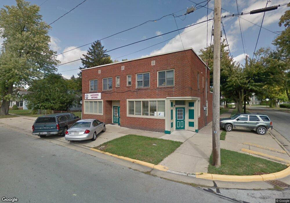
912 Perry St Sandusky, OH 44870
Estimated Value: $220,212
--
Bed
--
Bath
4,161
Sq Ft
$53/Sq Ft
Est. Value
About This Home
This home is located at 912 Perry St, Sandusky, OH 44870 and is currently estimated at $220,212, approximately $52 per square foot. 912 Perry St is a home located in Erie County with nearby schools including Sandusky High School, Monroe Preparatory Academy, and Sandusky Central Catholic School.
Ownership History
Date
Name
Owned For
Owner Type
Purchase Details
Closed on
Jun 10, 2022
Sold by
Antoni Sapecki Roman
Bought by
The R & S Saecki Family Irrevocable Trust
Current Estimated Value
Purchase Details
Closed on
Sep 21, 2000
Sold by
Poggiali Richard V
Bought by
Roberts Bruce and Roberts Brenda
Home Financials for this Owner
Home Financials are based on the most recent Mortgage that was taken out on this home.
Original Mortgage
$80,000
Interest Rate
8.05%
Mortgage Type
Commercial
Create a Home Valuation Report for This Property
The Home Valuation Report is an in-depth analysis detailing your home's value as well as a comparison with similar homes in the area
Home Values in the Area
Average Home Value in this Area
Purchase History
| Date | Buyer | Sale Price | Title Company |
|---|---|---|---|
| The R & S Saecki Family Irrevocable Trust | -- | -- | |
| Roberts Bruce | $100,000 | -- |
Source: Public Records
Mortgage History
| Date | Status | Borrower | Loan Amount |
|---|---|---|---|
| Previous Owner | Roberts Bruce | $80,000 |
Source: Public Records
Tax History Compared to Growth
Tax History
| Year | Tax Paid | Tax Assessment Tax Assessment Total Assessment is a certain percentage of the fair market value that is determined by local assessors to be the total taxable value of land and additions on the property. | Land | Improvement |
|---|---|---|---|---|
| 2024 | $2,702 | $47,200 | $2,040 | $45,160 |
| 2023 | $2,702 | $41,524 | $1,813 | $39,711 |
| 2022 | $2,793 | $41,520 | $1,813 | $39,707 |
| 2021 | $3,021 | $41,520 | $1,810 | $39,710 |
| 2020 | $2,722 | $38,140 | $1,810 | $36,330 |
| 2019 | $2,774 | $38,140 | $1,810 | $36,330 |
| 2018 | $2,759 | $38,140 | $1,810 | $36,330 |
| 2017 | $2,903 | $39,670 | $1,810 | $37,860 |
| 2016 | $2,916 | $39,670 | $1,810 | $37,860 |
| 2015 | $3,588 | $39,670 | $1,810 | $37,860 |
| 2014 | $3,732 | $38,510 | $6,240 | $32,270 |
| 2013 | $3,154 | $38,510 | $6,240 | $32,270 |
Source: Public Records
Map
Nearby Homes
- 510 Reese St
- 919 3rd St
- 404 Reese St
- 909 1st St
- 1005 1st St
- 611 Lockwood Ave
- 0 Milan Rd Unit 3997231
- 0 Milan Rd Unit 3805445
- 0 Milan Rd Unit 20182198
- 514 Lockwood Ave
- 919 Hancock St
- 604 E Jefferson St
- 522 E Jefferson St
- 516 Franklin St
- 221 Scott St
- 514 Franklin St
- 221 Reese St
- 444 Hasting Dr
- 1311 Franklin St
- 425-429 Anderson Annex