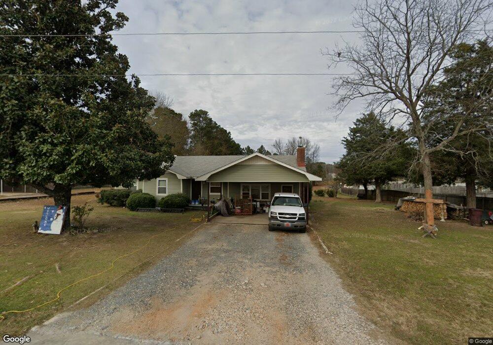
912 Skyline Dr Sheridan, AR 72150
Estimated Value: $171,479 - $272,000
--
Bed
1
Bath
1,921
Sq Ft
$116/Sq Ft
Est. Value
About This Home
This home is located at 912 Skyline Dr, Sheridan, AR 72150 and is currently estimated at $222,370, approximately $115 per square foot. 912 Skyline Dr is a home located in Grant County with nearby schools including Sheridan High School.
Ownership History
Date
Name
Owned For
Owner Type
Purchase Details
Closed on
May 20, 2005
Sold by
Jones Guy P and Jones Michelle B
Bought by
Montiho Donna F and Montiho Augustinc
Current Estimated Value
Home Financials for this Owner
Home Financials are based on the most recent Mortgage that was taken out on this home.
Original Mortgage
$103,000
Interest Rate
8.75%
Mortgage Type
Adjustable Rate Mortgage/ARM
Purchase Details
Closed on
May 28, 2004
Bought by
Cancellation Of Sale
Purchase Details
Closed on
Mar 23, 2004
Bought by
Notice Of Default
Purchase Details
Closed on
Dec 27, 1993
Create a Home Valuation Report for This Property
The Home Valuation Report is an in-depth analysis detailing your home's value as well as a comparison with similar homes in the area
Home Values in the Area
Average Home Value in this Area
Purchase History
| Date | Buyer | Sale Price | Title Company |
|---|---|---|---|
| Montiho Donna F | $102,969 | Stewart Title Of Arkansas | |
| Cancellation Of Sale | -- | -- | |
| Notice Of Default | -- | -- | |
| -- | $87,000 | -- |
Source: Public Records
Mortgage History
| Date | Status | Borrower | Loan Amount |
|---|---|---|---|
| Previous Owner | Montiho Donna F | $103,000 |
Source: Public Records
Tax History Compared to Growth
Tax History
| Year | Tax Paid | Tax Assessment Tax Assessment Total Assessment is a certain percentage of the fair market value that is determined by local assessors to be the total taxable value of land and additions on the property. | Land | Improvement |
|---|---|---|---|---|
| 2024 | $759 | $24,550 | $2,480 | $22,070 |
| 2023 | $334 | $24,550 | $2,480 | $22,070 |
| 2022 | $384 | $24,550 | $2,480 | $22,070 |
| 2021 | $384 | $24,550 | $2,480 | $22,070 |
| 2020 | $384 | $22,360 | $3,600 | $18,760 |
| 2019 | $384 | $22,360 | $3,600 | $18,760 |
| 2018 | $409 | $22,360 | $3,600 | $18,760 |
| 2017 | $409 | $22,360 | $3,600 | $18,760 |
| 2015 | -- | $16,870 | $3,600 | $13,270 |
| 2014 | -- | $16,870 | $3,600 | $13,270 |
| 2012 | -- | $16,870 | $3,600 | $13,270 |
Source: Public Records
Map
Nearby Homes
- 6 Smokey Ridge Ct
- 58 Horton Hills Dr
- 1001 N Red St
- 60 Horton Hills Dr
- 1005 N Red St
- Lot 3 & 4 Horton Ln
- 12 Horton Ln
- 701 N Red St
- 703 N Briarwood Dr
- 1210 Skyline Dr
- Lot 1 & 2 Pinecrest Cir
- 000 Pinecrest Cir
- 52 Pinecrest Cir
- 3400 U S Highway 270
- 923 W Center St
- 19 Stephanie Ln
- 1000 N Arch St
- 711 W Church St
- 709 W Church St
- 611 W Church St
- 1 Smokey Ridge Ct
- 1000 Skyline Dr
- 7 Smokey Ridge Ct
- 1004 Skyline Dr
- 3 Smokey Ln
- 8 Smokey Ln
- 0 Smokey Ridge Ct Unit 17012917
- 0 Smokey Ridge Ct Unit 17008195
- 9 Smokey Ridge Ct
- 4 Smokey Ridge Ct
- 2 Smokey Ridge Ct
- 0 Smokey Ridge Unit 15018948
- 0 Smokey Ridge Unit 16002282
- 11 Smokey Ridge Ct
- 47 Horton Hills Dr
- 43 Horton Hills Dr
- 1012 Skyline Dr
- 12 Smokey Ridge Ct Unit 900 W. Center St
- 10 Smokey Ridge Ct
- 41 Horton Hills Dr