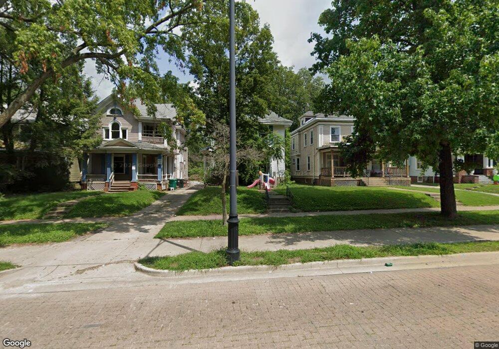
912 W Main St Decatur, IL 62522
Millikin Home NeighborhoodEstimated Value: $40,000 - $120,000
--
Bed
--
Bath
914
Sq Ft
$87/Sq Ft
Est. Value
About This Home
This home is located at 912 W Main St, Decatur, IL 62522 and is currently estimated at $79,197, approximately $86 per square foot. 912 W Main St is a home located in Macon County with nearby schools including Dennis Lab School, St. Patrick School, and Teen Challenge-Home For Girls.
Ownership History
Date
Name
Owned For
Owner Type
Purchase Details
Closed on
Nov 9, 2012
Sold by
Reynolds Robert and Reynolds Debbie
Bought by
Mechling Ronald
Current Estimated Value
Purchase Details
Closed on
Jul 7, 2009
Sold by
Macholl Gregory and Macholl Ellen
Bought by
Mcchiling Ronald
Purchase Details
Closed on
May 6, 2009
Sold by
Deutsche Bank National Trust Company
Bought by
Macholl Gregory and Macholl Ellen
Purchase Details
Closed on
Sep 30, 2008
Sold by
Carver Chadd and Carver Tammy
Bought by
Deutsce Bank Na
Purchase Details
Closed on
Oct 1, 2001
Create a Home Valuation Report for This Property
The Home Valuation Report is an in-depth analysis detailing your home's value as well as a comparison with similar homes in the area
Home Values in the Area
Average Home Value in this Area
Purchase History
| Date | Buyer | Sale Price | Title Company |
|---|---|---|---|
| Mechling Ronald | $2,500 | -- | |
| Mcchiling Ronald | -- | None Available | |
| Macholl Gregory | $11,500 | Macon County Title Company | |
| Deutsce Bank Na | -- | None Available | |
| -- | $33,000 | -- |
Source: Public Records
Tax History Compared to Growth
Tax History
| Year | Tax Paid | Tax Assessment Tax Assessment Total Assessment is a certain percentage of the fair market value that is determined by local assessors to be the total taxable value of land and additions on the property. | Land | Improvement |
|---|---|---|---|---|
| 2024 | $353 | $3,651 | $541 | $3,110 |
| 2023 | $351 | $3,522 | $522 | $3,000 |
| 2022 | $1,674 | $16,371 | $1,486 | $14,885 |
| 2021 | $677 | $6,575 | $1,388 | $5,187 |
| 2020 | $1,036 | $9,740 | $2,236 | $7,504 |
| 2019 | $1,036 | $9,740 | $2,236 | $7,504 |
| 2018 | $1,027 | $9,772 | $2,243 | $7,529 |
| 2017 | $1,051 | $10,033 | $2,303 | $7,730 |
| 2016 | $1,794 | $16,978 | $2,326 | $14,652 |
| 2015 | $1,705 | $16,678 | $2,285 | $14,393 |
| 2014 | $1,583 | $16,512 | $2,262 | $14,250 |
| 2013 | $1,636 | $17,132 | $2,347 | $14,785 |
Source: Public Records
Map
Nearby Homes
- 899 W Main St
- 1005 W Main St
- 717 W Prairie Ave Unit 2
- 657 W Wood St
- 254 N Pine St
- 958 W William St
- 612 W Macon St
- 609 W William St
- 441 S Seigel St
- 617 W Decatur St
- 628 W Forest Ave
- 450 W Macon St
- 452 W Prairie Ave
- 442 W Prairie Ave
- 440 W Macon St
- 437 Powers Ln
- 233 N Edward St
- 422 W William St
- 650 S Crea St
- 366 W Prairie Ave
- 906 W Main St
- 920 W Main St
- 904 W Main St
- 928 W Main St
- 940 W Main St
- 6 Millikin Place
- 950 W Main St
- 5 Millikin Place
- 915 W Main St
- 935 W Main St
- 907 W Main St
- 905 W Main St
- 953 W Main St
- 110 N Haworth Ave
- 955 W Main St
- 120 N Haworth Ave
- 895 W Main St
- 140 N Haworth Ave
- 160 N Haworth Ave
- 965 W Main St