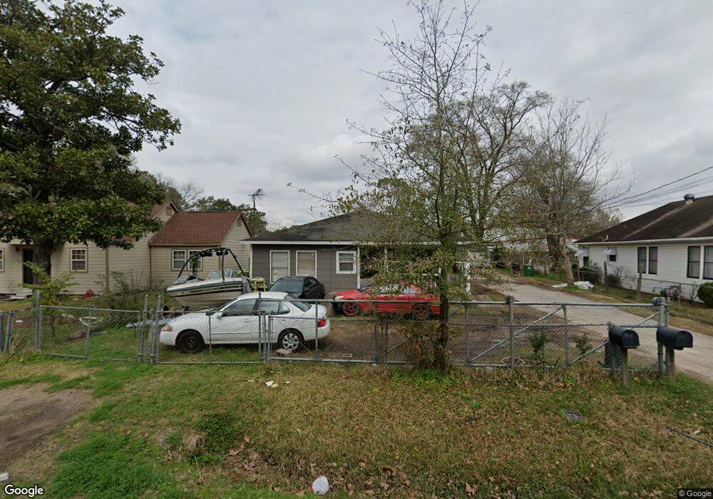
912 Woodcrest Dr Houston, TX 77018
Oak Forest-Garden Oaks NeighborhoodEstimated Value: $397,451 - $557,000
4
Beds
3
Baths
1,705
Sq Ft
$263/Sq Ft
Est. Value
About This Home
This home is located at 912 Woodcrest Dr, Houston, TX 77018 and is currently estimated at $448,363, approximately $262 per square foot. 912 Woodcrest Dr is a home located in Harris County with nearby schools including Durham Elementary School, Frank Black Middle School, and Waltrip High School.
Ownership History
Date
Name
Owned For
Owner Type
Purchase Details
Closed on
Jan 9, 2019
Sold by
Finister Belinda
Bought by
Ampm Construction Lp
Current Estimated Value
Purchase Details
Closed on
Dec 13, 2018
Sold by
Finister Roosevelt
Bought by
Finister Belinda
Purchase Details
Closed on
Nov 27, 1996
Sold by
Morse Edwin Douglas and Morse Joann
Bought by
Finister Roosevelt and Finister Martha
Home Financials for this Owner
Home Financials are based on the most recent Mortgage that was taken out on this home.
Original Mortgage
$27,000
Interest Rate
9.37%
Create a Home Valuation Report for This Property
The Home Valuation Report is an in-depth analysis detailing your home's value as well as a comparison with similar homes in the area
Home Values in the Area
Average Home Value in this Area
Purchase History
| Date | Buyer | Sale Price | Title Company |
|---|---|---|---|
| Ampm Construction Lp | -- | Old Republic Title | |
| Finister Belinda | -- | None Available | |
| Finister Roosevelt | -- | Regency Title |
Source: Public Records
Mortgage History
| Date | Status | Borrower | Loan Amount |
|---|---|---|---|
| Previous Owner | Finister Roosevelt | $27,000 |
Source: Public Records
Tax History Compared to Growth
Tax History
| Year | Tax Paid | Tax Assessment Tax Assessment Total Assessment is a certain percentage of the fair market value that is determined by local assessors to be the total taxable value of land and additions on the property. | Land | Improvement |
|---|---|---|---|---|
| 2025 | $8,369 | $456,404 | $420,441 | $35,963 |
| 2024 | $8,369 | $400,000 | $370,389 | $29,611 |
| 2023 | $8,369 | $381,987 | $320,336 | $61,651 |
| 2022 | $7,046 | $320,000 | $300,315 | $19,685 |
| 2021 | $7,496 | $321,621 | $280,294 | $41,327 |
| 2020 | $5,820 | $275,843 | $230,242 | $45,601 |
| 2019 | $5,519 | $218,085 | $170,179 | $47,906 |
| 2018 | $5,519 | $218,085 | $120,126 | $97,959 |
| 2017 | $4,826 | $190,847 | $60,063 | $130,784 |
| 2016 | $4,826 | $190,847 | $60,063 | $130,784 |
| 2015 | $3,974 | $187,317 | $60,063 | $127,254 |
| 2014 | $3,974 | $154,603 | $60,063 | $94,540 |
Source: Public Records
Map
Nearby Homes
- 808 Woodcrest Dr Unit A
- 4854 Brinkman St
- 910 1/2 Oak St
- 807 Martin St Unit D
- 807 Martin St Unit C
- 810 Martin St
- 817 Thornton Rd Unit G
- 817 Thornton Rd Unit F
- 812 Thornton Rd Unit B
- 811 Thornton Rd Unit B
- 9388 Plan at Thornton Oaks
- 9384 Plan at Thornton Oaks
- 4510 Curtin Park Ct
- 717 Janisch Rd Unit C
- 717 Janisch Rd Unit I
- 717 Janisch Rd Unit E
- 717 Janisch Rd Unit D
- 719 Thornton Rd Unit B
- 719 Thornton Rd Unit E
- 719 Thornton Rd Unit A
- 920 Woodcrest Dr
- 910 Woodcrest Dr
- 4720 Brinkman St
- 906 Woodcrest Dr
- 924 Woodcrest Dr
- 4724 Brinkman St
- 4722 Brinkman St
- 4712 Brinkman St
- 915 Woodcrest Dr
- 824 Woodcrest Dr
- 4714 Brinkman St
- 911 Woodcrest Dr
- 917 Woodcrest Dr
- 907 Martin St
- 909 Woodcrest Dr
- 822 Woodcrest Dr
- 4710 Brinkman St
- 4710 Brinkman St Unit A
- 4708 Brinkman St
- 907 Woodcrest Dr