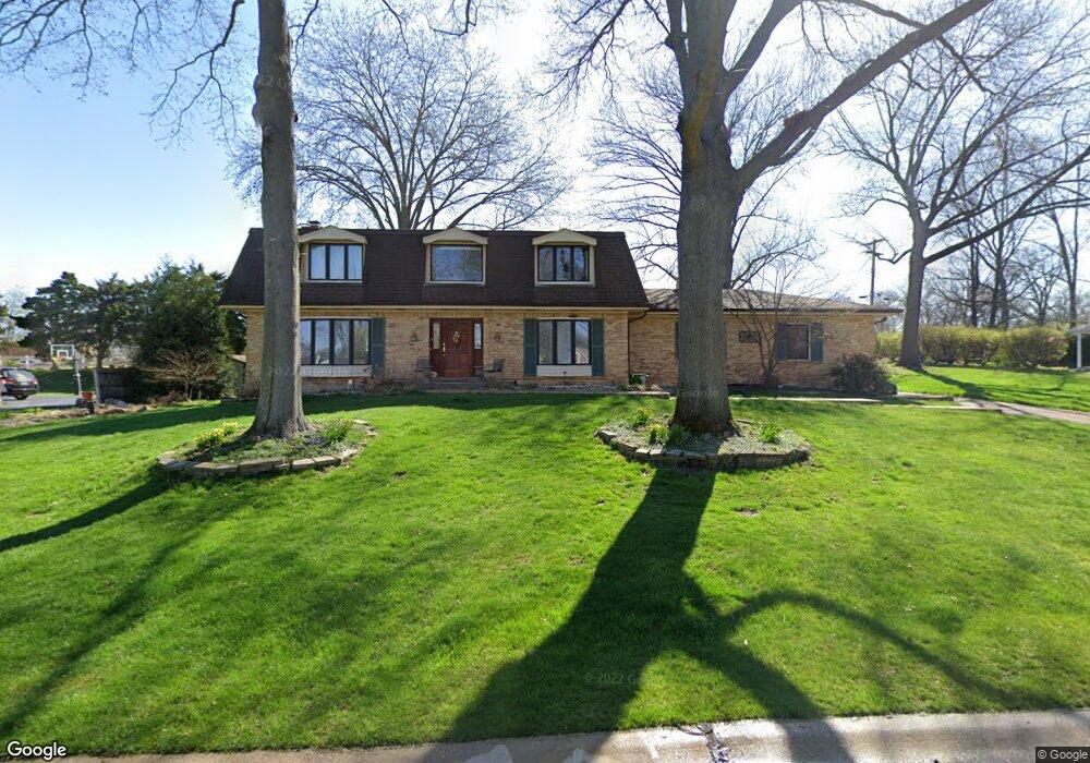
9120 Fox Estates Dr Saint Louis, MO 63127
Estimated Value: $669,826 - $955,000
4
Beds
4
Baths
3,252
Sq Ft
$239/Sq Ft
Est. Value
About This Home
This home is located at 9120 Fox Estates Dr, Saint Louis, MO 63127 and is currently estimated at $776,957, approximately $238 per square foot. 9120 Fox Estates Dr is a home located in St. Louis County with nearby schools including Long Elementary, Truman Middle School, and Lindbergh High School.
Ownership History
Date
Name
Owned For
Owner Type
Purchase Details
Closed on
Oct 31, 2013
Sold by
Connelly Patricia A
Bought by
Gnau Karl G and Gnau Jennifer L
Current Estimated Value
Home Financials for this Owner
Home Financials are based on the most recent Mortgage that was taken out on this home.
Original Mortgage
$373,500
Outstanding Balance
$282,143
Interest Rate
4.56%
Mortgage Type
New Conventional
Estimated Equity
$494,814
Purchase Details
Closed on
May 23, 2005
Sold by
Connelly Michael P
Bought by
Connelly Patricia A
Create a Home Valuation Report for This Property
The Home Valuation Report is an in-depth analysis detailing your home's value as well as a comparison with similar homes in the area
Home Values in the Area
Average Home Value in this Area
Purchase History
| Date | Buyer | Sale Price | Title Company |
|---|---|---|---|
| Gnau Karl G | $415,000 | Investors Title Co Clayton | |
| Connelly Patricia A | -- | -- |
Source: Public Records
Mortgage History
| Date | Status | Borrower | Loan Amount |
|---|---|---|---|
| Open | Gnau Karl G | $373,500 |
Source: Public Records
Tax History Compared to Growth
Tax History
| Year | Tax Paid | Tax Assessment Tax Assessment Total Assessment is a certain percentage of the fair market value that is determined by local assessors to be the total taxable value of land and additions on the property. | Land | Improvement |
|---|---|---|---|---|
| 2025 | $6,914 | $120,360 | $31,880 | $88,480 |
| 2024 | $6,914 | $105,410 | $24,280 | $81,130 |
| 2023 | $6,895 | $105,410 | $24,280 | $81,130 |
| 2022 | $6,898 | $93,760 | $24,280 | $69,480 |
| 2021 | $6,111 | $93,760 | $24,280 | $69,480 |
| 2020 | $5,475 | $81,040 | $17,860 | $63,180 |
| 2019 | $5,461 | $81,040 | $17,860 | $63,180 |
| 2018 | $5,529 | $74,630 | $11,060 | $63,570 |
| 2017 | $5,468 | $74,630 | $11,060 | $63,570 |
| 2016 | $6,024 | $78,070 | $12,010 | $66,060 |
| 2015 | $6,051 | $78,070 | $12,010 | $66,060 |
| 2014 | $5,847 | $74,730 | $12,560 | $62,170 |
Source: Public Records
Map
Nearby Homes
- 3906 Courtyard Place Dr
- 9320 Lincoln Dr
- 8867 Red Oak Dr
- 10225 E Watson Rd
- 8726 Gayle Ave
- 9448 Parklind Dr
- 9404 Gates Manor Ct
- 9411 Gates Manor Ct
- 9506 Trinadad Ln
- 8619 Del Vista Dr
- 8737 Villa Crest Dr
- 0 Unknown Unit MIS25071866
- 0 Unknown Unit MIS25071884
- 8563 Old Sappington Rd
- 12420 Rott Rd Unit 1B
- 9606 Castanet Ct
- 1412 Windward Ridge Dr
- 118 Monica Dr
- 421 Spears St
- 119 Monica Dr
- 9108 Fox Estates Dr
- 9132 Fox Estates Dr
- 9123 Fox Estates Dr
- 9105 Fox Estates Dr
- 9140 Fox Estates Dr
- 9131 Fox Estates Dr
- 12100 Westwick Place
- 9102 Fox Estates Dr
- 12103 Westwick Place
- 12104 Westwick Place
- 12041 Eddie and Park Rd
- 12045 Eddie and Park Rd
- 12035 Eddie and Park Rd
- 16 Fox Meadows
- 12107 Westwick Place
- 12031 Eddie and Park Rd
- 12108 Westwick Place
- 12105 Trentmore Place
- 12025 Eddie and Park Rd
- 12109 Eddie and Park Rd