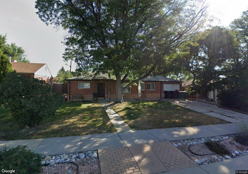
9120 Hoffman Way Thornton, CO 80229
South Thornton NeighborhoodEstimated Value: $406,983 - $432,000
3
Beds
2
Baths
1,176
Sq Ft
$358/Sq Ft
Est. Value
About This Home
This home is located at 9120 Hoffman Way, Thornton, CO 80229 and is currently estimated at $420,496, approximately $357 per square foot. 9120 Hoffman Way is a home located in Adams County with nearby schools including Thornton Elementary School, Thornton Middle School, and Thornton High School.
Ownership History
Date
Name
Owned For
Owner Type
Purchase Details
Closed on
Nov 18, 2005
Sold by
Dewitt Michael Sean
Bought by
Montoya Roberta
Current Estimated Value
Home Financials for this Owner
Home Financials are based on the most recent Mortgage that was taken out on this home.
Original Mortgage
$135,920
Outstanding Balance
$77,668
Interest Rate
6.75%
Mortgage Type
Unknown
Estimated Equity
$342,828
Create a Home Valuation Report for This Property
The Home Valuation Report is an in-depth analysis detailing your home's value as well as a comparison with similar homes in the area
Home Values in the Area
Average Home Value in this Area
Purchase History
| Date | Buyer | Sale Price | Title Company |
|---|---|---|---|
| Montoya Roberta | $169,900 | Security Title |
Source: Public Records
Mortgage History
| Date | Status | Borrower | Loan Amount |
|---|---|---|---|
| Open | Montoya Roberta | $135,920 |
Source: Public Records
Tax History Compared to Growth
Tax History
| Year | Tax Paid | Tax Assessment Tax Assessment Total Assessment is a certain percentage of the fair market value that is determined by local assessors to be the total taxable value of land and additions on the property. | Land | Improvement |
|---|---|---|---|---|
| 2024 | $2,472 | $23,820 | $5,630 | $18,190 |
| 2023 | $2,447 | $27,600 | $6,090 | $21,510 |
| 2022 | $2,352 | $21,350 | $5,280 | $16,070 |
| 2021 | $2,431 | $21,350 | $5,280 | $16,070 |
| 2020 | $2,355 | $21,110 | $5,430 | $15,680 |
| 2019 | $2,360 | $21,110 | $5,430 | $15,680 |
| 2018 | $1,860 | $16,160 | $5,180 | $10,980 |
| 2017 | $1,691 | $16,160 | $5,180 | $10,980 |
| 2016 | $1,298 | $12,080 | $2,550 | $9,530 |
| 2015 | $1,296 | $12,080 | $2,550 | $9,530 |
| 2014 | -- | $10,420 | $1,990 | $8,430 |
Source: Public Records
Map
Nearby Homes
- 9171 Fir Dr
- 1250 Eppinger Blvd
- 9270 Fir Dr
- 9121 Lilly Ct
- 1290 Ash Ct
- 1050 Ash Ct
- 1010 Ash Ct
- 991 Oak Place
- 9330 Lilly Ct
- 9355 Lilly Ct
- 400 Russell Blvd
- 1490 Oak Place
- 8861 Poze Blvd
- 9361 Gail Ct
- 9410 Lilly Ct
- 8770 Corona St Unit 304
- 9491 Dorothy Blvd
- 8731 Dawson St Unit 301
- 9211 Harris St
- 8960 Vine St
- 9110 Hoffman Way
- 9130 Hoffman Way
- 1400 Locust Place
- 9100 Hoffman Way
- 1401 E 91st Ave
- 1410 Locust Place
- 9150 Hoffman Way
- 1411 E 91st Ave
- 9121 Hoffman Way
- 1401 Locust Place
- 9091 Hoffman Way
- 9080 Hoffman Way
- 9160 Hoffman Way
- 9131 Hoffman Way
- 1420 Locust Place
- 1421 E 91st Ave
- 9081 Hoffman Way
- 1411 Locust Place
- 1400 E 91st Ave
- 9141 Hoffman Way