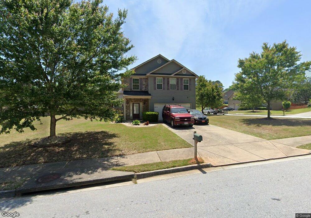
9120 Saunders Dr SW Covington, GA 30014
Estimated Value: $288,000 - $347,000
Studio
2
Baths
2,400
Sq Ft
$134/Sq Ft
Est. Value
About This Home
This home is located at 9120 Saunders Dr SW, Covington, GA 30014 and is currently estimated at $320,829, approximately $133 per square foot. 9120 Saunders Dr SW is a home located in Newton County with nearby schools including Middle Ridge Elementary School, Clements Middle School, and Newton High School.
Ownership History
Date
Name
Owned For
Owner Type
Purchase Details
Closed on
Sep 30, 2010
Sold by
Jefferson Homes Inc
Bought by
Green Julian L
Current Estimated Value
Home Financials for this Owner
Home Financials are based on the most recent Mortgage that was taken out on this home.
Original Mortgage
$137,907
Outstanding Balance
$90,256
Interest Rate
4.42%
Mortgage Type
VA
Estimated Equity
$230,573
Create a Home Valuation Report for This Property
The Home Valuation Report is an in-depth analysis detailing your home's value as well as a comparison with similar homes in the area
Home Values in the Area
Average Home Value in this Area
Purchase History
| Date | Buyer | Sale Price | Title Company |
|---|---|---|---|
| Green Julian L | $141,300 | -- |
Source: Public Records
Mortgage History
| Date | Status | Borrower | Loan Amount |
|---|---|---|---|
| Open | Green Julian L | $137,907 |
Source: Public Records
Tax History
| Year | Tax Paid | Tax Assessment Tax Assessment Total Assessment is a certain percentage of the fair market value that is determined by local assessors to be the total taxable value of land and additions on the property. | Land | Improvement |
|---|---|---|---|---|
| 2025 | $46 | $124,760 | $20,000 | $104,760 |
| 2024 | -- | $116,560 | $20,000 | $96,560 |
| 2023 | $3,570 | $115,000 | $6,000 | $109,000 |
| 2022 | $3,016 | $96,040 | $6,000 | $90,040 |
| 2021 | $3,029 | $86,640 | $6,000 | $80,640 |
| 2020 | $2,780 | $72,960 | $6,000 | $66,960 |
| 2019 | $2,640 | $68,240 | $6,000 | $62,240 |
| 2018 | $2,559 | $65,520 | $6,000 | $59,520 |
| 2017 | $2,447 | $62,800 | $6,000 | $56,800 |
| 2016 | $2,296 | $59,120 | $6,000 | $53,120 |
| 2015 | $2,068 | $53,520 | $6,000 | $47,520 |
| 2014 | $2,070 | $53,520 | $0 | $0 |
Source: Public Records
Map
Nearby Homes
- 8230 Laurel Dr SW
- 7630 Saffron Ave
- 8184 Laurel Dr SW
- 8141 Hickory Dr SW
- 8120 Highland Dr SW
- 6191 Indian Creek Cir SW
- 9182 SW Flat Shoals Rd None
- 8330 N Sterling Lakes Dr
- 9248 Flat Shoals Rd SW
- 9142 Ford St SW
- 7205 Lakeview Dr SW
- 9184 Thrash St SW
- 7117 Pineneedle Dr SW
- 5160 Avery St SW
- 10142 Washington St SW
- 163 Kingfisher Walk
- 8196 Lakeview Dr SW
- 8150 Lakeview Dr SW
- 9102 Morris Dr SW
- 10114 Allen Dr SW
- 8225 Laurel Dr SW
- 9110 Saunders Dr SW
- 9172 Saunders Dr SW
- 9125 Saunders Dr SW
- 9115 Saunders Dr SW
- 9135 Saunders Dr SW
- 9100 Saunders Dr SW
- 8215 Laurel Dr SW
- 8220 Laurel Dr SW
- 9180 Saunders Dr SW
- 9145 Saunders Dr SW
- 9215 Gallitin Dr SW
- 9105 Saunders Dr SW
- 9145 Gallitin Dr SW
- 9135 Gallitin Dr SW
- 9165 Gallitin Dr SW
- 9160 Saunders Dr SW
- 9155 Saunders Dr SW
- 9125 Gallitin Dr SW
- 9205 Gallitin Dr SW
Your Personal Tour Guide
Ask me questions while you tour the home.