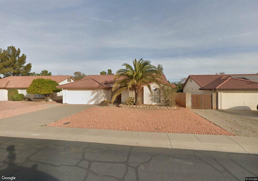
9120 W Maui Ln Peoria, AZ 85381
Estimated Value: $363,629 - $475,000
--
Bed
2
Baths
1,838
Sq Ft
$228/Sq Ft
Est. Value
About This Home
This home is located at 9120 W Maui Ln, Peoria, AZ 85381 and is currently estimated at $419,407, approximately $228 per square foot. 9120 W Maui Ln is a home located in Maricopa County with nearby schools including Desert Harbor Elementary School, Centennial High School, and Sonoran Science Academy-Peoria.
Ownership History
Date
Name
Owned For
Owner Type
Purchase Details
Closed on
Mar 19, 2001
Sold by
Mannino Sam and Mannino Patricia J
Bought by
Mannino Sam and Mannino Patricia J
Current Estimated Value
Purchase Details
Closed on
Oct 20, 2000
Sold by
Weichert Robin R
Bought by
Weichert James R
Home Financials for this Owner
Home Financials are based on the most recent Mortgage that was taken out on this home.
Original Mortgage
$95,000
Interest Rate
7.9%
Create a Home Valuation Report for This Property
The Home Valuation Report is an in-depth analysis detailing your home's value as well as a comparison with similar homes in the area
Home Values in the Area
Average Home Value in this Area
Purchase History
| Date | Buyer | Sale Price | Title Company |
|---|---|---|---|
| Mannino Sam | -- | -- | |
| Weichert James R | -- | Ati Title Agency |
Source: Public Records
Mortgage History
| Date | Status | Borrower | Loan Amount |
|---|---|---|---|
| Closed | Weichert James R | $95,000 |
Source: Public Records
Tax History Compared to Growth
Tax History
| Year | Tax Paid | Tax Assessment Tax Assessment Total Assessment is a certain percentage of the fair market value that is determined by local assessors to be the total taxable value of land and additions on the property. | Land | Improvement |
|---|---|---|---|---|
| 2025 | $1,433 | $18,927 | -- | -- |
| 2024 | $1,451 | $18,025 | -- | -- |
| 2023 | $1,451 | $31,360 | $6,270 | $25,090 |
| 2022 | $1,421 | $23,570 | $4,710 | $18,860 |
| 2021 | $1,521 | $21,460 | $4,290 | $17,170 |
| 2020 | $1,536 | $20,020 | $4,000 | $16,020 |
| 2019 | $1,486 | $18,560 | $3,710 | $14,850 |
| 2018 | $1,437 | $17,480 | $3,490 | $13,990 |
| 2017 | $1,437 | $16,030 | $3,200 | $12,830 |
| 2016 | $1,413 | $15,230 | $3,040 | $12,190 |
| 2015 | $1,328 | $14,770 | $2,950 | $11,820 |
Source: Public Records
Map
Nearby Homes
- 9114 W Maui Ln
- 9056 W Port Royale Ln
- 9151 W Greenway Rd Unit 288
- 9151 W Greenway Rd Unit 150
- 9151 W Greenway Rd Unit 162
- 15091 N 90th Dr
- 14830 N Cameo Dr
- 9002 W Caribbean Ln
- 15099 N 89th Ave
- 15430 N Bowling Green Dr
- 9409 W Indian Hills Dr
- 15211 N 89th Ave
- 15401 N Cameo Dr
- 14618 N Shiprock Dr
- 14407 N 75th Dr
- 14429 N 75th Dr
- 14861 N 88th Ln
- 9405 W Rolling Hills Dr
- 9434 W Greenway Rd
- 14566 N 90th Ln
- 9126 W Maui Ln
- 9108 W Maui Ln
- 9132 W Maui Ln
- 15040 N 91st Ln
- 15041 N 92nd Ave
- 9102 W Maui Ln
- 15030 N 91st Ln
- 15062 N 92nd Ave
- 15031 N 92nd Ave
- 15041 N 91st Ln
- 15052 N 92nd Ave
- 15042 N 92nd Ave
- 9151 W Greenway Bld 13 #274 Rd
- 15020 N 91st Ln
- 9151 W Greenway #161 Bldg 11 Rd
- 15021 N 92nd Ave
- 9202 W Newport Dr
- 9151 W Rd Unit 263,
- 15032 N 92nd Ave