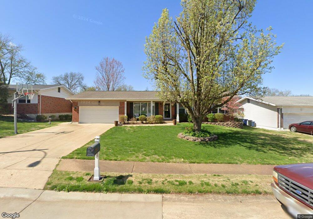
9121 Lavant Dr Saint Louis, MO 63126
Estimated Value: $351,754 - $394,000
3
Beds
2
Baths
1,545
Sq Ft
$242/Sq Ft
Est. Value
About This Home
This home is located at 9121 Lavant Dr, Saint Louis, MO 63126 and is currently estimated at $373,189, approximately $241 per square foot. 9121 Lavant Dr is a home located in St. Louis County with nearby schools including Long Elementary, Truman Middle School, and Lindbergh High School.
Ownership History
Date
Name
Owned For
Owner Type
Purchase Details
Closed on
Mar 28, 2001
Sold by
Egan Ellen Jame and Egan Ellen J
Bought by
Schmitt Thomas M and Schmitt Karen M
Current Estimated Value
Home Financials for this Owner
Home Financials are based on the most recent Mortgage that was taken out on this home.
Original Mortgage
$148,750
Outstanding Balance
$54,610
Interest Rate
7.13%
Estimated Equity
$318,579
Create a Home Valuation Report for This Property
The Home Valuation Report is an in-depth analysis detailing your home's value as well as a comparison with similar homes in the area
Home Values in the Area
Average Home Value in this Area
Purchase History
| Date | Buyer | Sale Price | Title Company |
|---|---|---|---|
| Schmitt Thomas M | $175,000 | -- | |
| Schmitt Thomas M | $175,000 | -- |
Source: Public Records
Mortgage History
| Date | Status | Borrower | Loan Amount |
|---|---|---|---|
| Open | Schmitt Thomas M | $148,750 | |
| Closed | Schmitt Thomas M | $148,750 | |
| Closed | Schmitt Thomas M | $6,250 |
Source: Public Records
Tax History Compared to Growth
Tax History
| Year | Tax Paid | Tax Assessment Tax Assessment Total Assessment is a certain percentage of the fair market value that is determined by local assessors to be the total taxable value of land and additions on the property. | Land | Improvement |
|---|---|---|---|---|
| 2025 | $3,718 | $59,760 | $24,400 | $35,360 |
| 2024 | $3,718 | $53,500 | $20,900 | $32,600 |
| 2023 | $3,437 | $53,500 | $20,900 | $32,600 |
| 2022 | $3,549 | $49,230 | $20,900 | $28,330 |
| 2021 | $3,234 | $49,230 | $20,900 | $28,330 |
| 2020 | $3,062 | $44,940 | $15,680 | $29,260 |
| 2019 | $3,054 | $44,940 | $15,680 | $29,260 |
| 2018 | $2,690 | $35,840 | $9,580 | $26,260 |
| 2017 | $2,661 | $35,840 | $9,580 | $26,260 |
| 2016 | $2,493 | $34,000 | $9,580 | $24,420 |
| 2015 | $2,507 | $34,000 | $9,580 | $24,420 |
| 2014 | $2,682 | $36,010 | $6,080 | $29,930 |
Source: Public Records
Map
Nearby Homes
- 9188 Rusticwood Trail
- 7910 Royal Arms Ct Unit 1
- 9218 Bent Pine Ct Unit H
- 7904 Camelot Ln Unit 4
- 8914 Chasebury Terrace
- 8907 Grantway Ct
- 9209 Bent Pine Ct Unit H
- 7508 Bull Run Dr
- 9535 Arban Dr
- 11102 Wedgestone Ct
- 9606 Castanet Ct
- 11206 Santa Clara Dr
- 9610 Carrimae Ct
- 7636 Fort Henry Dr
- 9742 Croftwood Dr
- 11042 Wylestone Ct
- 10649 W Knollshire Dr
- 9405 Vandervoort Ct
- 8737 Villa Crest Dr
- 1637 Ridgewood Dr
- 9201 Lavant Dr
- 9115 Lavant Dr
- 9128 Queenston Dr
- 9122 Queenston Dr
- 9205 Lavant Dr
- 9134 Queenston Dr
- 9200 Laramie Dr
- 9116 Queenston Dr
- 9140 Queenston Dr
- 9203 Laramie Dr
- 9201 Cordoba Ln
- 9209 Lavant Dr
- 9049 Cordoba Ln
- 9110 Queenston Dr
- 9206 Laramie Dr
- 9207 Cordoba Ln
- 9210 Lavant Dr
- 9200 Queenston Dr
- 9123 Hatton Dr
- 9129 Queenston Dr