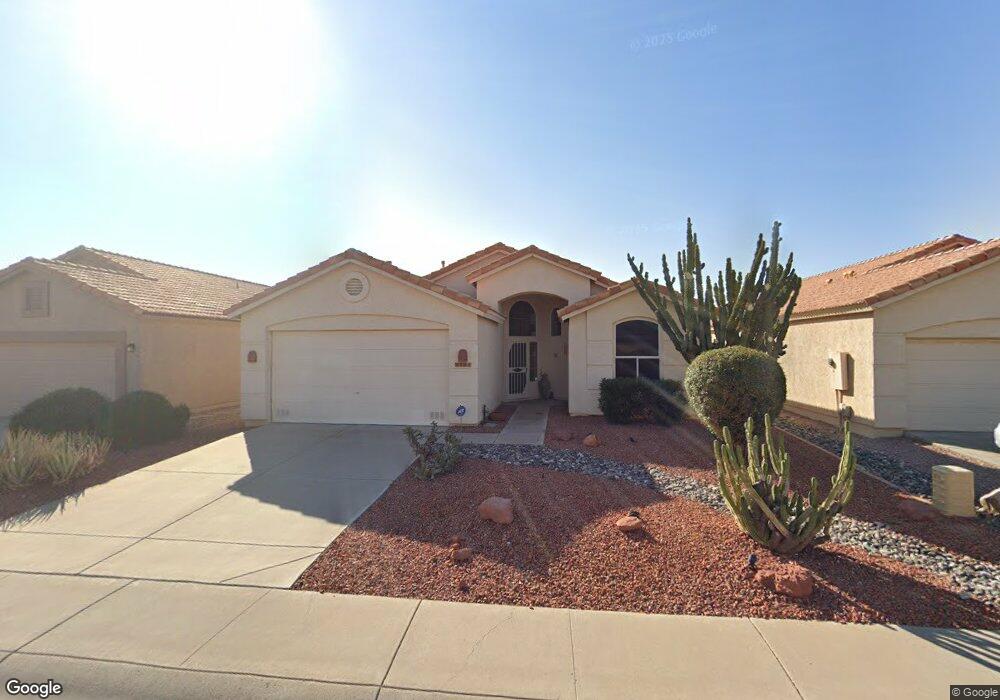
9121 W Menadota Dr Peoria, AZ 85382
Estimated Value: $329,591 - $378,000
2
Beds
2
Baths
1,439
Sq Ft
$253/Sq Ft
Est. Value
About This Home
This home is located at 9121 W Menadota Dr, Peoria, AZ 85382 and is currently estimated at $364,648, approximately $253 per square foot. 9121 W Menadota Dr is a home located in Maricopa County with nearby schools including Apache Elementary School, Sunrise Mountain High School, and Sonoran Science Academy-Peoria.
Ownership History
Date
Name
Owned For
Owner Type
Purchase Details
Closed on
Nov 13, 2015
Sold by
Nagl Gary J and Nagl Patricia K
Bought by
Nagl Gary J and Nagl Patricia K
Current Estimated Value
Purchase Details
Closed on
Dec 12, 2003
Sold by
Cunningham Robert P and Cunningham Eileen K
Bought by
Nagl Gary J and Nagl Patricia K
Purchase Details
Closed on
Jul 23, 1999
Sold by
Cunningham Robert P and Cunningham Eileen K
Bought by
Cunningham Robert P and Cunningham Eileen K
Create a Home Valuation Report for This Property
The Home Valuation Report is an in-depth analysis detailing your home's value as well as a comparison with similar homes in the area
Home Values in the Area
Average Home Value in this Area
Purchase History
| Date | Buyer | Sale Price | Title Company |
|---|---|---|---|
| Nagl Gary J | -- | None Available | |
| Nagl Gary J | $150,000 | Century Title Agency Inc | |
| Cunningham Robert P | -- | -- |
Source: Public Records
Tax History Compared to Growth
Tax History
| Year | Tax Paid | Tax Assessment Tax Assessment Total Assessment is a certain percentage of the fair market value that is determined by local assessors to be the total taxable value of land and additions on the property. | Land | Improvement |
|---|---|---|---|---|
| 2025 | $1,989 | $20,832 | -- | -- |
| 2024 | $1,945 | $19,840 | -- | -- |
| 2023 | $1,945 | $26,100 | $5,220 | $20,880 |
| 2022 | $1,906 | $21,360 | $4,270 | $17,090 |
| 2021 | $1,986 | $20,080 | $4,010 | $16,070 |
| 2020 | $2,005 | $19,080 | $3,810 | $15,270 |
| 2019 | $1,946 | $17,380 | $3,470 | $13,910 |
| 2018 | $1,881 | $16,150 | $3,230 | $12,920 |
| 2017 | $1,878 | $14,850 | $2,970 | $11,880 |
| 2016 | $1,843 | $13,910 | $2,780 | $11,130 |
| 2015 | $1,727 | $13,910 | $2,780 | $11,130 |
Source: Public Records
Map
Nearby Homes
- 9152 W Escuda Dr
- 20143 N 92nd Ave
- 19835 N 90th Ln
- 20149 N 92nd Ave
- 19817 N 92nd Ave
- 20138 N 92nd Ave
- 9064 W Marco Polo Rd
- 9032 W Sierra Pinta Dr
- 19812 N 90th Dr
- 9203 W Behrend Dr
- 9238 W Behrend Dr
- 20459 N 91st Dr
- 20466 N 90th Ln
- 20477 N 91st Dr
- 9013 W Marco Polo Rd
- 9321 W Clara Ln
- 9225 W Runion Dr
- 8874 W Piute Ave
- 9403 W Escuda Dr
- 9250 W Runion Dr
- 9127 W Menadota Dr
- 9115 W Menadota Dr
- 9133 W Menadota Dr
- 9109 W Menadota Dr
- 9128 W Escuda Dr
- 9134 W Escuda Dr
- 9122 W Escuda Dr
- 9140 W Escuda Dr
- 9139 W Menadota Dr
- 9116 W Escuda Dr
- 9103 W Menadota Dr
- 9146 W Escuda Dr
- 9110 W Escuda Dr
- 9151 W Menadota Dr
- 9121 W Escuda Dr
- 9158 W Escuda Dr
- 9127 W Escuda Dr
- 9115 W Escuda Dr
- 9135 W Pontiac Dr
- 9129 W Pontiac Dr