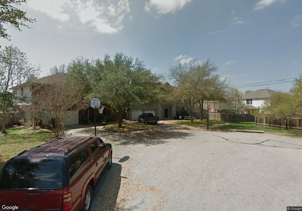
9123 Brimstone Ln Austin, TX 78717
Brushy Creek NeighborhoodEstimated Value: $609,000 - $632,000
4
Beds
4
Baths
3,060
Sq Ft
$203/Sq Ft
Est. Value
About This Home
This home is located at 9123 Brimstone Ln, Austin, TX 78717 and is currently estimated at $620,589, approximately $202 per square foot. 9123 Brimstone Ln is a home located in Williamson County with nearby schools including Great Oaks Elementary School, Cedar Valley Middle School, and Round Rock High School.
Ownership History
Date
Name
Owned For
Owner Type
Purchase Details
Closed on
Jun 3, 2005
Sold by
Horrell Ben A and Horrell Karen B
Bought by
Lin Susan Marie
Current Estimated Value
Home Financials for this Owner
Home Financials are based on the most recent Mortgage that was taken out on this home.
Original Mortgage
$20,100
Interest Rate
5.67%
Mortgage Type
Unknown
Create a Home Valuation Report for This Property
The Home Valuation Report is an in-depth analysis detailing your home's value as well as a comparison with similar homes in the area
Home Values in the Area
Average Home Value in this Area
Purchase History
| Date | Buyer | Sale Price | Title Company |
|---|---|---|---|
| Lin Susan Marie | -- | None Available |
Source: Public Records
Mortgage History
| Date | Status | Borrower | Loan Amount |
|---|---|---|---|
| Closed | Lin Susan Marie | $20,100 | |
| Open | Lin Susan Marie | $160,800 |
Source: Public Records
Tax History Compared to Growth
Tax History
| Year | Tax Paid | Tax Assessment Tax Assessment Total Assessment is a certain percentage of the fair market value that is determined by local assessors to be the total taxable value of land and additions on the property. | Land | Improvement |
|---|---|---|---|---|
| 2025 | $9,330 | $558,877 | $115,000 | $443,877 |
| 2024 | $9,330 | $552,030 | -- | -- |
| 2023 | $8,445 | $501,845 | $0 | $0 |
| 2022 | $9,442 | $456,223 | $0 | $0 |
| 2021 | $9,812 | $414,748 | $85,000 | $360,057 |
| 2020 | $8,968 | $377,044 | $79,917 | $297,127 |
| 2019 | $8,970 | $366,341 | $72,600 | $293,741 |
| 2018 | $8,102 | $344,520 | $66,340 | $278,180 |
| 2017 | $8,143 | $326,256 | $62,000 | $272,492 |
| 2016 | $7,403 | $296,596 | $62,000 | $245,873 |
| 2015 | $5,966 | $269,633 | $50,400 | $236,132 |
| 2014 | $5,966 | $245,121 | $0 | $0 |
Source: Public Records
Map
Nearby Homes
- 9409 Lisi Anne Dr
- 9405 Billingham Trail
- 8900 Brushygate Cove
- 16304 Fincastle Dr
- 9201 Cessna Ln
- 506 Conservation Dr Unit 506
- 16001 Mickey Dr
- 16710 Whitebrush Loop
- 6059 Almelo Dr
- 16600 Barrhead Cove
- 8802 Pepper Rock Dr
- 16413 Broadbay Dr
- 3917 Rolling Hill
- 16800 Tomcat Dr
- 4011 Hillside Dr
- 16420 Along Creek Cove
- 8507 Chat Ln
- 10709 Lavon Bend
- 16437 Along Creek Cove
- 16413 Along Creek Cove
- 9121 Brimstone Ln
- 9405 Meyrick Park Trail
- 9409 Meyrick Park Trail
- 9413 Meyrick Park Trail
- 9401 Meyrick Park Trail
- 16412 Rockgate Dr
- 16429 Horse Trap Ln
- 9417 Meyrick Park Trail
- 9337 Meyrick Park Trail
- 16410 Rockgate Dr
- 9333 Meyrick Park Trail
- 9421 Meyrick Park Trail
- 16425 Horse Trap Ln
- 9114 Brimstone Ln
- 9329 Meyrick Park Trail
- 9408 Meyrick Park Trail
- 9412 Meyrick Park Trail
- 9404 Meyrick Park Trail
- 9425 Meyrick Park Trail
- 16421 Horse Trap Ln