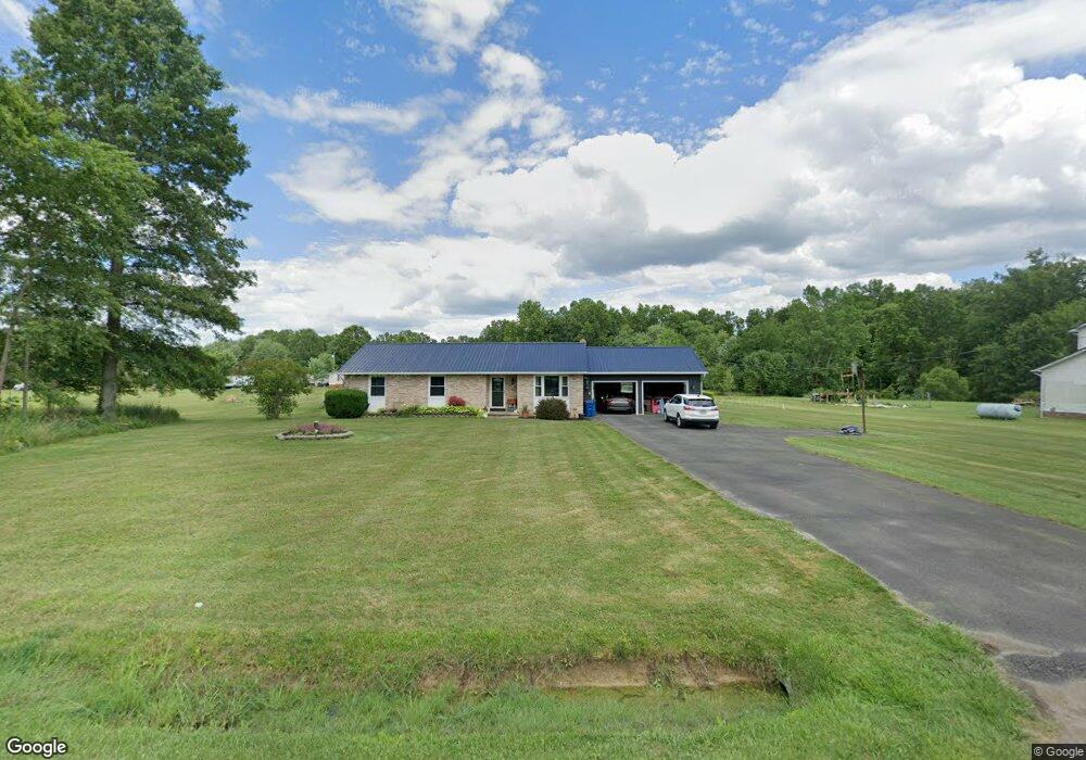
9123 Martin Rd North Benton, OH 44449
Estimated Value: $215,107 - $250,000
3
Beds
2
Baths
1,326
Sq Ft
$178/Sq Ft
Est. Value
About This Home
This home is located at 9123 Martin Rd, North Benton, OH 44449 and is currently estimated at $236,527, approximately $178 per square foot. 9123 Martin Rd is a home located in Mahoning County with nearby schools including West Branch Middle School, West Branch Early Learning Center, and West Branch High School.
Ownership History
Date
Name
Owned For
Owner Type
Purchase Details
Closed on
Jun 5, 2017
Sold by
Solomon Trina and Solomon George D
Bought by
Solomon Trina and Solomon Trina J
Current Estimated Value
Home Financials for this Owner
Home Financials are based on the most recent Mortgage that was taken out on this home.
Original Mortgage
$89,700
Interest Rate
4.02%
Mortgage Type
New Conventional
Purchase Details
Closed on
Oct 1, 1984
Bought by
Solomon George D
Create a Home Valuation Report for This Property
The Home Valuation Report is an in-depth analysis detailing your home's value as well as a comparison with similar homes in the area
Home Values in the Area
Average Home Value in this Area
Purchase History
| Date | Buyer | Sale Price | Title Company |
|---|---|---|---|
| Solomon Trina | -- | None Available | |
| Solomon George D | $57,800 | -- |
Source: Public Records
Mortgage History
| Date | Status | Borrower | Loan Amount |
|---|---|---|---|
| Previous Owner | Solomon Trina | $89,700 |
Source: Public Records
Tax History Compared to Growth
Tax History
| Year | Tax Paid | Tax Assessment Tax Assessment Total Assessment is a certain percentage of the fair market value that is determined by local assessors to be the total taxable value of land and additions on the property. | Land | Improvement |
|---|---|---|---|---|
| 2024 | $1,888 | $52,200 | $6,200 | $46,000 |
| 2023 | $1,852 | $52,200 | $6,200 | $46,000 |
| 2022 | $1,609 | $40,780 | $4,960 | $35,820 |
| 2021 | $1,611 | $40,780 | $4,960 | $35,820 |
| 2020 | $1,618 | $40,780 | $4,960 | $35,820 |
| 2019 | $1,453 | $34,810 | $4,960 | $29,850 |
| 2018 | $1,446 | $34,810 | $4,960 | $29,850 |
| 2017 | $1,443 | $34,810 | $4,960 | $29,850 |
| 2016 | $1,284 | $31,140 | $5,230 | $25,910 |
| 2015 | $1,245 | $31,140 | $5,230 | $25,910 |
| 2014 | $1,252 | $31,140 | $5,230 | $25,910 |
| 2013 | $1,238 | $31,140 | $5,230 | $25,910 |
Source: Public Records
Map
Nearby Homes
- 20871 N Benton Rd W
- 9663 Berlin Heights Dr
- 0 Knoll St NE
- 15789 Coalbank St NE
- 10985 Johnson Rd
- 15520 Coalbank St NE
- 105 Hartzell Rd
- 7374 Virginia Rd
- 11030 12th St
- 639 Hartzell Rd
- 10745 Leffingwell Rd
- 1731 Ohio 225
- 15995 Elbrook St NE
- 15832 Waverly St NE
- 1864 State Route 225
- 11310 Webb Ave NE
- 11344 Walnut Ave NE
- 1440 Porter Rd
- 90 N Jefferson St
- 14723 Bolton St NE
- 9173 Martin Rd
- 22980 Martin Rd
- 9193 Martin Rd
- 22027 Smith Northwest Rd
- 0 Smith NW Unit 3045234
- 0 Smith NW Unit 3096350
- 0 Smith NW Unit 3128247
- 21851 Smith Northwest Rd
- 9225 Martin Rd
- 9283 Martin Rd
- 8879 German Church Rd
- 9009 German Church Rd
- 8905 German Church Rd
- 8857 German Church Rd
- 9317 Martin Rd
- 8983 German Church Rd
- 21151 German Church Rd
- 21840 N Benton West Rd
- 22319 Smith Northwest Rd
- 9575 Martin Rd