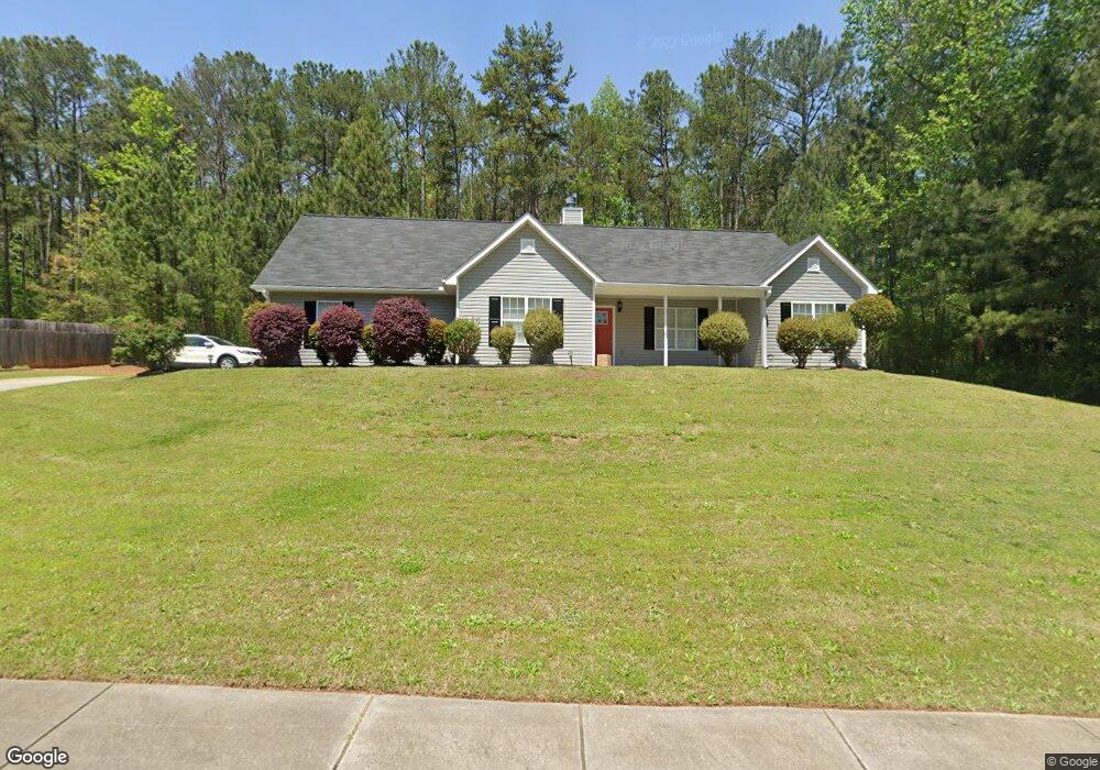
9124 Comstock Ct Unit 44 Covington, GA 30014
Estimated Value: $257,000 - $258,000
4
Beds
2
Baths
1,708
Sq Ft
$151/Sq Ft
Est. Value
About This Home
This home is located at 9124 Comstock Ct Unit 44, Covington, GA 30014 and is currently estimated at $257,533, approximately $150 per square foot. 9124 Comstock Ct Unit 44 is a home located in Newton County with nearby schools including Middle Ridge Elementary School, Clements Middle School, and Newton High School.
Ownership History
Date
Name
Owned For
Owner Type
Purchase Details
Closed on
Aug 12, 2025
Sold by
Sfrtb Owner Gp Llc
Bought by
Ladson Isaac
Current Estimated Value
Home Financials for this Owner
Home Financials are based on the most recent Mortgage that was taken out on this home.
Original Mortgage
$255,290
Outstanding Balance
$254,849
Interest Rate
6.75%
Mortgage Type
FHA
Estimated Equity
$2,684
Purchase Details
Closed on
Aug 1, 2025
Sold by
Star 2021 Sfr2 Borrower Gp Llc
Bought by
Sfrtb Owner Lp
Home Financials for this Owner
Home Financials are based on the most recent Mortgage that was taken out on this home.
Original Mortgage
$255,290
Outstanding Balance
$254,849
Interest Rate
6.75%
Mortgage Type
FHA
Estimated Equity
$2,684
Purchase Details
Closed on
Sep 24, 2020
Sold by
Rock N Roll Real Estate Llc
Bought by
Sfr Atl Owner 9 Lp
Purchase Details
Closed on
Jun 13, 2016
Sold by
Cliette Alprentice
Bought by
Dobbs Katrina M
Home Financials for this Owner
Home Financials are based on the most recent Mortgage that was taken out on this home.
Original Mortgage
$108,007
Interest Rate
3.87%
Mortgage Type
FHA
Purchase Details
Closed on
Apr 9, 2012
Sold by
Federal National Mortgage Association
Bought by
Cliette Alprentice
Home Financials for this Owner
Home Financials are based on the most recent Mortgage that was taken out on this home.
Original Mortgage
$43,761
Interest Rate
3.75%
Mortgage Type
FHA
Purchase Details
Closed on
Dec 6, 2011
Sold by
Parker Michael
Bought by
Federal National Mtg Associati
Create a Home Valuation Report for This Property
The Home Valuation Report is an in-depth analysis detailing your home's value as well as a comparison with similar homes in the area
Home Values in the Area
Average Home Value in this Area
Purchase History
| Date | Buyer | Sale Price | Title Company |
|---|---|---|---|
| Ladson Isaac | $260,000 | -- | |
| Sfrtb Owner Lp | -- | -- | |
| Sfr Atl Owner 9 Lp | $130,000 | -- | |
| Rock N Roll Real Estate Llc | $128,000 | -- | |
| Dobbs Katrina M | $110,000 | -- | |
| Cliette Alprentice | $44,900 | -- | |
| Federal National Mtg Associati | $104,633 | -- |
Source: Public Records
Mortgage History
| Date | Status | Borrower | Loan Amount |
|---|---|---|---|
| Open | Ladson Isaac | $255,290 | |
| Previous Owner | Dobbs Katrina M | $108,007 | |
| Previous Owner | Cliette Alprentice | $43,761 |
Source: Public Records
Tax History Compared to Growth
Tax History
| Year | Tax Paid | Tax Assessment Tax Assessment Total Assessment is a certain percentage of the fair market value that is determined by local assessors to be the total taxable value of land and additions on the property. | Land | Improvement |
|---|---|---|---|---|
| 2024 | $3,285 | $108,800 | $11,536 | $97,264 |
| 2023 | $3,536 | $108,800 | $11,600 | $97,200 |
| 2022 | $2,938 | $90,400 | $7,800 | $82,600 |
| 2021 | $1,888 | $61,800 | $7,800 | $54,000 |
| 2020 | $2,336 | $61,840 | $7,800 | $54,040 |
| 2019 | $2,272 | $59,200 | $7,800 | $51,400 |
| 2018 | $1,908 | $49,680 | $6,800 | $42,880 |
| 2017 | $1,633 | $43,000 | $6,800 | $36,200 |
| 2016 | $1,264 | $30,760 | $2,800 | $27,960 |
| 2015 | $1,169 | $28,400 | $2,000 | $26,400 |
| 2014 | $1,168 | $28,400 | $0 | $0 |
Source: Public Records
Map
Nearby Homes
- 9184 Thrash St SW
- 9142 Ford St SW
- 8330 N Sterling Lakes Dr
- 9126 Griffin Ln SW
- 10178 Allen Dr SW
- 8201 N Sterling Lakes Dr
- 9102 Morris Dr SW
- 9107 Morris Dr SW
- 0 Morris Dr SW Unit 10609869
- 10214 Allen Dr SW
- 9182 SW Flat Shoals Rd None
- 9174 Flat Shoals Rd SW
- 10133 Morris Dr SW
- 8141 Hickory Dr SW
- 45 Wyndmont Way
- 8184 Laurel Dr SW
- 10182 Blackwell St
- 80 Taunton Rd
- 9200 Jefferson Ave SW
- 7127 Greenway Cove SW
- 9120 Comstock Ct Unit LOT 45
- 9120 Comstock Ct
- 9126 Comstock Ct
- 9129 Comstock Ct Unit 1
- 9125 Comstock Ct
- 9125 Comstock Ct
- 9125 Comstock Ct Unit 1
- 9133 Comstock Ct
- 10127 Flat Shoals Rd SW
- 9116 Comstock Ct
- 9121 Comstock Ct
- 9119 Comstock Ct
- 9121 S Sterling Lakes Dr
- 9121 S Sterling Lakes Dr Unit 49
- 9115 S Sterling Lakes Dr
- 9127 S Sterling Lakes Dr Unit 1
- 9108 Comstock Ct
- 9117 Sterling Lakes Cir
- 10218 Sunny Dr SW
- 9151 S Sterling Lakes Dr