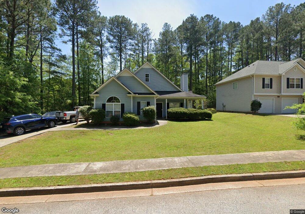
9125 Comstock Ct Unit 1 Covington, GA 30014
Estimated Value: $221,000 - $245,000
3
Beds
2
Baths
1,378
Sq Ft
$169/Sq Ft
Est. Value
About This Home
This home is located at 9125 Comstock Ct Unit 1, Covington, GA 30014 and is currently estimated at $233,466, approximately $169 per square foot. 9125 Comstock Ct Unit 1 is a home located in Newton County with nearby schools including Middle Ridge Elementary School, Clements Middle School, and Newton High School.
Ownership History
Date
Name
Owned For
Owner Type
Purchase Details
Closed on
Jun 18, 2020
Sold by
Baf 1 Llc
Bought by
Baf Assets Llc
Current Estimated Value
Purchase Details
Closed on
Jul 24, 2019
Sold by
Atl Residential I Llc
Bought by
Baf 1 Llc
Purchase Details
Closed on
Feb 22, 2013
Sold by
Blake Roger David
Bought by
Atl Residential 1 Llc
Purchase Details
Closed on
Mar 25, 2009
Sold by
First Frankl Trust 2006-Ff16
Bought by
Blake Roger D
Home Financials for this Owner
Home Financials are based on the most recent Mortgage that was taken out on this home.
Original Mortgage
$60,463
Interest Rate
5.1%
Mortgage Type
FHA
Purchase Details
Closed on
Oct 7, 2008
Sold by
Weston Angela
Bought by
First Franklin Trust 2006-Ff16
Purchase Details
Closed on
Jul 25, 2002
Sold by
Phoenix Custom Homes
Bought by
Weston Angela
Home Financials for this Owner
Home Financials are based on the most recent Mortgage that was taken out on this home.
Original Mortgage
$118,000
Interest Rate
9.56%
Mortgage Type
New Conventional
Create a Home Valuation Report for This Property
The Home Valuation Report is an in-depth analysis detailing your home's value as well as a comparison with similar homes in the area
Home Values in the Area
Average Home Value in this Area
Purchase History
| Date | Buyer | Sale Price | Title Company |
|---|---|---|---|
| Baf Assets Llc | $5,275,641 | -- | |
| Baf 1 Llc | $4,722,220 | -- | |
| Atl Residential 1 Llc | $71,000 | -- | |
| Blake Roger D | $61,600 | -- | |
| First Franklin Trust 2006-Ff16 | $76,181 | -- | |
| Weston Angela | $132,200 | -- |
Source: Public Records
Mortgage History
| Date | Status | Borrower | Loan Amount |
|---|---|---|---|
| Previous Owner | Blake Roger D | $60,463 | |
| Previous Owner | Weston Angela | $118,000 |
Source: Public Records
Tax History Compared to Growth
Tax History
| Year | Tax Paid | Tax Assessment Tax Assessment Total Assessment is a certain percentage of the fair market value that is determined by local assessors to be the total taxable value of land and additions on the property. | Land | Improvement |
|---|---|---|---|---|
| 2024 | $2,902 | $96,120 | $7,554 | $88,566 |
| 2023 | $2,874 | $88,440 | $11,600 | $76,840 |
| 2022 | $2,335 | $71,840 | $7,800 | $64,040 |
| 2021 | $1,925 | $53,000 | $7,800 | $45,200 |
| 2020 | $2,002 | $50,200 | $7,800 | $42,400 |
| 2019 | $1,424 | $35,040 | $6,762 | $28,278 |
| 2018 | $1,440 | $35,040 | $6,762 | $28,278 |
| 2017 | $1,440 | $35,040 | $6,800 | $28,240 |
| 2016 | $1,044 | $25,400 | $2,800 | $22,600 |
| 2015 | $1,014 | $24,640 | $2,000 | $22,640 |
| 2014 | $1,014 | $24,640 | $0 | $0 |
Source: Public Records
Map
Nearby Homes
- 9184 Thrash St SW
- 9142 Ford St SW
- 8330 N Sterling Lakes Dr
- 9126 Griffin Ln SW
- 10178 Allen Dr SW
- 9102 Morris Dr SW
- 9107 Morris Dr SW
- 0 Morris Dr SW Unit 10609869
- 10214 Allen Dr SW
- 8201 N Sterling Lakes Dr
- 10133 Morris Dr SW
- 45 Wyndmont Way
- 9182 SW Flat Shoals Rd None
- 8141 Hickory Dr SW
- 9174 Flat Shoals Rd SW
- 10182 Blackwell St
- 8184 Laurel Dr SW
- 80 Taunton Rd
- 9200 Jefferson Ave SW
- 7127 Greenway Cove SW
- 9125 Comstock Ct
- 9125 Comstock Ct
- 9121 Comstock Ct
- 9129 Comstock Ct Unit 1
- 9120 Comstock Ct Unit LOT 45
- 9120 Comstock Ct
- 9124 Comstock Ct Unit 44
- 9116 Comstock Ct
- 9119 Comstock Ct
- 10190 Sunny Dr SW
- 9133 Comstock Ct
- 9126 Comstock Ct
- 10218 Sunny Dr SW
- 9111 Comstock Ct
- 9108 Comstock Ct
- 9115 S Sterling Lakes Dr
- 9156 Fair St SW
- 10127 Flat Shoals Rd SW
- 9121 S Sterling Lakes Dr
- 9121 S Sterling Lakes Dr Unit 49