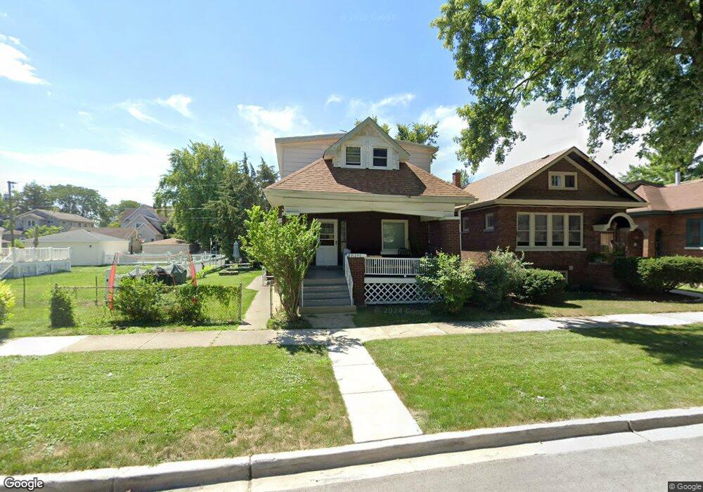
9125 Sheridan Ave Brookfield, IL 60513
Estimated Value: $360,205 - $470,000
5
Beds
5
Baths
1,674
Sq Ft
$254/Sq Ft
Est. Value
About This Home
This home is located at 9125 Sheridan Ave, Brookfield, IL 60513 and is currently estimated at $424,551, approximately $253 per square foot. 9125 Sheridan Ave is a home located in Cook County with nearby schools including S. E. Gross Middle School, Brook Park Elementary School, and Riverside Brookfield High School.
Ownership History
Date
Name
Owned For
Owner Type
Purchase Details
Closed on
Oct 14, 2004
Sold by
First National Bank Of Lagrange
Bought by
Dahms Richard C and Zalig Donna R
Current Estimated Value
Home Financials for this Owner
Home Financials are based on the most recent Mortgage that was taken out on this home.
Original Mortgage
$225,000
Interest Rate
6.5%
Mortgage Type
Purchase Money Mortgage
Create a Home Valuation Report for This Property
The Home Valuation Report is an in-depth analysis detailing your home's value as well as a comparison with similar homes in the area
Home Values in the Area
Average Home Value in this Area
Purchase History
| Date | Buyer | Sale Price | Title Company |
|---|---|---|---|
| Dahms Richard C | $300,000 | Atgf Inc |
Source: Public Records
Mortgage History
| Date | Status | Borrower | Loan Amount |
|---|---|---|---|
| Closed | Dahms Richard C | $225,000 |
Source: Public Records
Tax History Compared to Growth
Tax History
| Year | Tax Paid | Tax Assessment Tax Assessment Total Assessment is a certain percentage of the fair market value that is determined by local assessors to be the total taxable value of land and additions on the property. | Land | Improvement |
|---|---|---|---|---|
| 2024 | $10,355 | $29,001 | $4,688 | $24,313 |
| 2023 | $11,849 | $29,001 | $4,688 | $24,313 |
| 2022 | $11,849 | $28,438 | $4,063 | $24,375 |
| 2021 | $11,495 | $28,436 | $4,062 | $24,374 |
| 2020 | $11,197 | $28,436 | $4,062 | $24,374 |
| 2019 | $11,841 | $30,027 | $3,593 | $26,434 |
| 2018 | $11,370 | $30,027 | $3,593 | $26,434 |
| 2017 | $10,481 | $30,027 | $3,593 | $26,434 |
| 2016 | $9,424 | $25,318 | $3,281 | $22,037 |
| 2015 | $9,059 | $25,318 | $3,281 | $22,037 |
| 2014 | $8,927 | $25,318 | $3,281 | $22,037 |
| 2013 | $8,970 | $27,236 | $3,281 | $23,955 |
Source: Public Records
Map
Nearby Homes
- 3617 Park Ave
- 9003 Burlington Ave
- 3621 Madison Ave
- 3713 Grand Blvd Unit 10
- 3931 Maple Ave
- 8911 Burlington Ave
- 3923 Madison Ave
- 3800 Harrison Ave
- 3417 Oak Ave
- 3831 Grove Ave Unit 1S
- 3913 Grove Ave
- 4009 Forest Ave
- 4144 Elm Ave
- 4154 Elm Ave
- 4125 Deyo Ave
- 3336 Grand Blvd
- 4118 Prairie Ave
- 3328 Vernon Ave
- 326 Kemman Ave
- 4210 Maple Ave
- 9127 Sheridan Ave
- 9117 Sheridan Ave
- 9131 Sheridan Ave
- 9115 Sheridan Ave
- 9133 Sheridan Ave
- 9120 Fairview Ave
- 9130 Fairview Ave
- 9111 Sheridan Ave
- 9118 Sheridan Ave
- 9114 Fairview Ave
- 9114 Fairview Ave
- 9137 Sheridan Ave
- 9122 Sheridan Ave
- 9120 Sheridan Ave
- 9130 Sheridan Ave
- 9130 Sheridan Ave
- 9134 Fairview Ave
- 9107 Sheridan Ave
- 9114 Sheridan Ave
- 9143 Sheridan Ave