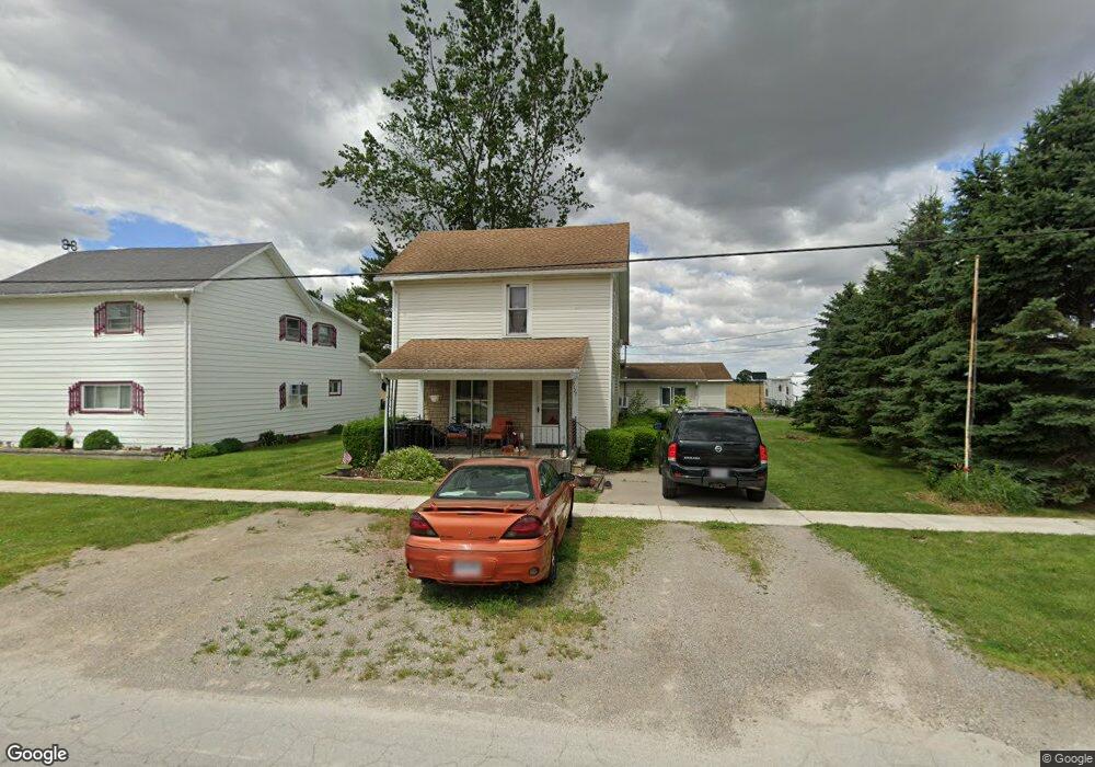
9127 Custar Rd Custar, OH 43511
Estimated Value: $126,308 - $167,000
4
Beds
2
Baths
2,044
Sq Ft
$70/Sq Ft
Est. Value
About This Home
This home is located at 9127 Custar Rd, Custar, OH 43511 and is currently estimated at $143,327, approximately $70 per square foot. 9127 Custar Rd is a home located in Wood County with nearby schools including Bowling Green High School.
Ownership History
Date
Name
Owned For
Owner Type
Purchase Details
Closed on
May 7, 2007
Sold by
Parker Michelle D and United States Of America
Bought by
Cavanaugh Philip Jayson and Norden Kimberly Joyce
Current Estimated Value
Home Financials for this Owner
Home Financials are based on the most recent Mortgage that was taken out on this home.
Original Mortgage
$34,000
Outstanding Balance
$20,283
Interest Rate
6.27%
Mortgage Type
Purchase Money Mortgage
Estimated Equity
$123,044
Purchase Details
Closed on
Dec 29, 1999
Sold by
Bechstein Philip L and Bechstein Kimberly S
Bought by
Parker Michelle D
Home Financials for this Owner
Home Financials are based on the most recent Mortgage that was taken out on this home.
Original Mortgage
$83,375
Interest Rate
7.69%
Purchase Details
Closed on
Nov 19, 1987
Bought by
Bechstein Philip L
Create a Home Valuation Report for This Property
The Home Valuation Report is an in-depth analysis detailing your home's value as well as a comparison with similar homes in the area
Purchase History
| Date | Buyer | Sale Price | Title Company |
|---|---|---|---|
| Cavanaugh Philip Jayson | $28,000 | None Available | |
| Parker Michelle D | $82,500 | -- | |
| Bechstein Philip L | $30,000 | -- |
Source: Public Records
Mortgage History
| Date | Status | Borrower | Loan Amount |
|---|---|---|---|
| Open | Cavanaugh Philip Jayson | $34,000 | |
| Previous Owner | Parker Michelle D | $83,375 |
Source: Public Records
Tax History
| Year | Tax Paid | Tax Assessment Tax Assessment Total Assessment is a certain percentage of the fair market value that is determined by local assessors to be the total taxable value of land and additions on the property. | Land | Improvement |
|---|---|---|---|---|
| 2025 | $1,355 | $29,750 | $3,465 | $26,285 |
| 2024 | $1,347 | $29,750 | $3,465 | $26,285 |
| 2023 | $1,347 | $29,760 | $3,470 | $26,290 |
| 2021 | $1,049 | $22,160 | $2,310 | $19,850 |
| 2020 | $2,150 | $22,160 | $2,310 | $19,850 |
| 2019 | $1,013 | $21,210 | $2,310 | $18,900 |
| 2018 | $1,007 | $21,210 | $2,310 | $18,900 |
| 2017 | $2,024 | $21,210 | $2,310 | $18,900 |
| 2016 | $860 | $18,240 | $2,700 | $15,540 |
| 2015 | $860 | $18,240 | $2,700 | $15,540 |
| 2014 | $902 | $18,240 | $2,700 | $15,540 |
| 2013 | $998 | $18,240 | $2,700 | $15,540 |
Source: Public Records
Map
Nearby Homes
- 22759 Defiance Pike
- 21490 Portage Rd
- 24642 Hammansburg Rd Unit 309-0700
- 20175 Taylor St
- 20280 Locust St
- 13439 Ash St
- 117 Meadow Ln
- 115 Meadow Ln
- 113 N Meadow Ln
- 116 Meadow Ln
- 119 N Harvest St
- 112 N Harvest Dr
- 121 N Harvest St
- 118 N Harvest Dr
- 120 N Harvest Dr
- 102 N Harvest Dr
- 107 N Harvest St
- 125 N Harvest Dr
- 117 N Harvest St
- 123 N Harvest St
- 9081 Custar Rd
- 9175 Custar Rd
- 9172 Custar Rd
- 9148 Custar Rd
- 9073 Custar Rd
- 9188 Custar Rd
- 9051 Custar Rd
- 9060 Custar Rd
- 9043 Custar Rd
- 9042 Custar Rd
- 9225 Custar Rd
- 9025 Custar Rd
- 22965 Perry St
- 9028 Custar Rd
- 9066 N North High
- 0 N High St
- 9066 High St
- 9238 Custar Rd
- 22797 Defiance Pike
- 23008 Defiance Pike
Your Personal Tour Guide
Ask me questions while you tour the home.