Estimated Value: $177,000 - $250,000
3
Beds
1
Bath
1,200
Sq Ft
$177/Sq Ft
Est. Value
About This Home
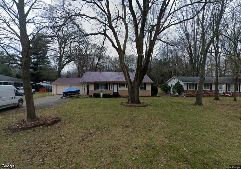
This home is located at 9127 Field Rd, Clay, MI 48001 and is currently estimated at $211,958, approximately $176 per square foot. 9127 Field Rd is a home located in St. Clair County.
Ownership History
Date
Name
Owned For
Owner Type
Purchase Details
Closed on
Dec 8, 2008
Sold by
Heim Eric D and Maeseele Michael K
Bought by
Frank Timothy J
Current Estimated Value
Home Financials for this Owner
Home Financials are based on the most recent Mortgage that was taken out on this home.
Original Mortgage
$83,163
Outstanding Balance
$55,404
Interest Rate
6.3%
Mortgage Type
New Conventional
Estimated Equity
$156,554
Purchase Details
Closed on
Jul 30, 1998
Sold by
Heim Alvia
Bought by
Heim Alvia and Maeseele Michael K
Create a Home Valuation Report for This Property
The Home Valuation Report is an in-depth analysis detailing your home's value as well as a comparison with similar homes in the area
Home Values in the Area
Average Home Value in this Area
Purchase History
| Date | Buyer | Sale Price | Title Company |
|---|---|---|---|
| Frank Timothy J | $81,500 | Devon Title Agency | |
| Heim Alvia | -- | Blue Water Title Company |
Source: Public Records
Mortgage History
| Date | Status | Borrower | Loan Amount |
|---|---|---|---|
| Open | Frank Timothy J | $83,163 |
Source: Public Records
Tax History
| Year | Tax Paid | Tax Assessment Tax Assessment Total Assessment is a certain percentage of the fair market value that is determined by local assessors to be the total taxable value of land and additions on the property. | Land | Improvement |
|---|---|---|---|---|
| 2025 | $774 | $69,400 | $0 | $0 |
| 2024 | $760 | $64,900 | $0 | $0 |
| 2023 | $732 | $57,800 | $0 | $0 |
| 2022 | $1,419 | $54,100 | $0 | $0 |
| 2020 | $1,350 | $49,300 | $49,300 | $0 |
| 2019 | $1,330 | $40,400 | $0 | $0 |
| 2018 | $1,315 | $39,800 | $0 | $0 |
| 2017 | $1,217 | $41,400 | $0 | $0 |
| 2016 | $601 | $41,400 | $0 | $0 |
| 2015 | -- | $38,800 | $38,800 | $0 |
| 2014 | -- | $35,500 | $35,500 | $0 |
| 2013 | -- | $30,500 | $0 | $0 |
Source: Public Records
Map
Nearby Homes
- 00 Dickinson Island
- 3202 Fruit St
- 9279 Oakdale St
- 1103 Beth Ct
- 9188 Marsh Rd
- 9399 Oakdale St
- 9084 Island Dr
- 9642 Nook Rd Unit 7
- 24 Vacant Lots Land
- 9665 River St
- 8846 Stone Rd
- 919 Smith St
- 8866 Marsh Rd
- 6303 High Rd
- 0000 Taft Rd
- 00 Taft Rd
- 00000 N Channel Dr
- 407-425 N Channel Dr
- 00 N Channel Dr
- 6136 High Rd
- 9131 Field Rd
- 9135 Field Rd
- 0 Russell Dr Unit 50179629
- 00 Russell
- 9143 Field Rd
- 9138 Field Rd
- 9150 Field Rd
- 9150 Field Rd
- 9149 Field Rd
- 9121 Field Rd
- 0 V L Stone Unit 58050138202
- 0 V L Stone
- 9140 Field Rd
- 9181 Field Rd
- 9181 Field Rd
- 9187 Field Rd
- 9112 Field Rd
- 9156 Field Rd
- 9179 Field Rd
- 9165 Field Rd
Your Personal Tour Guide
Ask me questions while you tour the home.