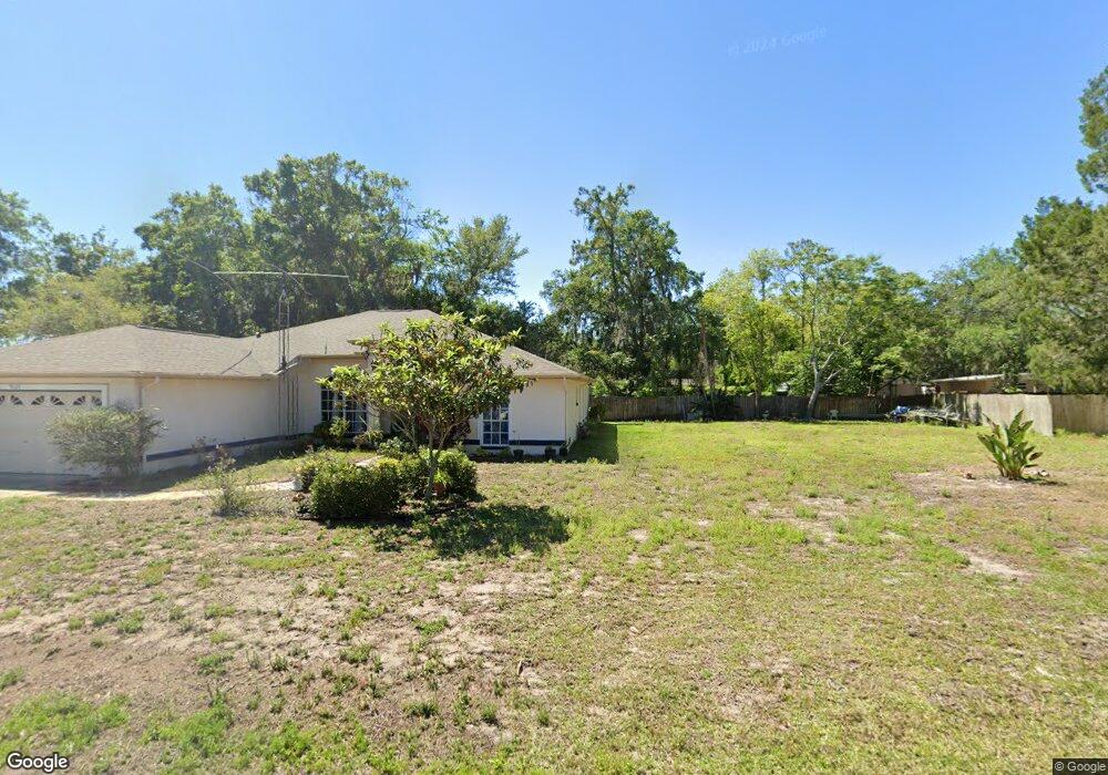
9127 Outpost Dr New Port Richey, FL 34654
Estimated Value: $366,669 - $443,000
--
Bed
2
Baths
2,153
Sq Ft
$188/Sq Ft
Est. Value
About This Home
This home is located at 9127 Outpost Dr, New Port Richey, FL 34654 and is currently estimated at $405,417, approximately $188 per square foot. 9127 Outpost Dr is a home located in Pasco County with nearby schools including Cypress Elementary School, River Ridge High School, and River Ridge Middle School.
Ownership History
Date
Name
Owned For
Owner Type
Purchase Details
Closed on
Sep 19, 2005
Sold by
Doane Hugh A and Doane Elba N
Bought by
Brewer Frank G and Brewer Ming L
Current Estimated Value
Home Financials for this Owner
Home Financials are based on the most recent Mortgage that was taken out on this home.
Original Mortgage
$244,800
Outstanding Balance
$131,051
Interest Rate
5.86%
Mortgage Type
Fannie Mae Freddie Mac
Estimated Equity
$274,366
Purchase Details
Closed on
Feb 2, 1996
Sold by
Warfel Jean
Bought by
Doane Hugh A and Doane Elba N
Create a Home Valuation Report for This Property
The Home Valuation Report is an in-depth analysis detailing your home's value as well as a comparison with similar homes in the area
Home Values in the Area
Average Home Value in this Area
Purchase History
| Date | Buyer | Sale Price | Title Company |
|---|---|---|---|
| Brewer Frank G | $272,000 | Pioneer Title Inc | |
| Doane Hugh A | $10,500 | -- |
Source: Public Records
Mortgage History
| Date | Status | Borrower | Loan Amount |
|---|---|---|---|
| Open | Brewer Frank G | $244,800 |
Source: Public Records
Tax History Compared to Growth
Tax History
| Year | Tax Paid | Tax Assessment Tax Assessment Total Assessment is a certain percentage of the fair market value that is determined by local assessors to be the total taxable value of land and additions on the property. | Land | Improvement |
|---|---|---|---|---|
| 2025 | $1,075 | $94,880 | -- | -- |
| 2024 | $1,075 | $92,210 | -- | -- |
| 2023 | $1,375 | $89,530 | $0 | $0 |
| 2022 | $905 | $86,930 | $0 | $0 |
| 2021 | $875 | $84,400 | $18,845 | $65,555 |
| 2020 | $852 | $83,240 | $8,595 | $74,645 |
| 2019 | $825 | $81,370 | $0 | $0 |
| 2018 | $800 | $79,862 | $0 | $0 |
| 2017 | $790 | $79,862 | $0 | $0 |
| 2016 | $734 | $76,610 | $0 | $0 |
| 2015 | $841 | $81,840 | $0 | $0 |
| 2014 | $812 | $84,817 | $11,570 | $73,247 |
Source: Public Records
Map
Nearby Homes
- 8531 Bass Lake Dr
- 9229 Creston Ave
- 9217 Maynard Ave
- 9210 Maynard Ave
- 8624 Brookwood Dr
- 9240 Creston Ave
- 0 Royal Palm Ave Unit MFRW7858646
- 8617 Broad St
- 8518 Thrasher Ct
- 8057 Moonlight Ln
- 0 0 Unit MFRTB8421780
- 8823 Crescent Forest Blvd
- 8522 Cranes Roost Dr
- 7946 Callan Ct
- 8711 Crescent Forest Blvd
- 8741 Planters Ln
- 7941 Sycamore Dr
- 9166 Sunshine Blvd
- 9911 Mendel Dr
- 0 Hilltop Dr Unit MFRW7868266
- 9133 Outpost Dr
- 8602 Bass Lake Dr
- 9115 Outpost Dr
- 8616 Bass Lake Dr
- 9120 Outpost Dr
- 8548 Bass Lake Dr
- 9053 Weslock Dr
- 9114 Outpost Dr
- 9140 Outpost Dr
- 9040 Royal Palm Ave
- 8540 Bass Lake Dr
- 00000 Outpost Dr
- 9145 Outpost Dr
- 9050 Royal Palm Ave
- 9106 Outpost Dr
- 9148 Outpost Dr
- 00000 00000 Outpost Dr
- 9135 Maynard Ave
- Lot 20-21 Bass Lake Dr
- Lot 22-23 Bass Lake Dr