Estimated Value: $545,000 - $594,324
3
Beds
2
Baths
2,282
Sq Ft
$249/Sq Ft
Est. Value
About This Home
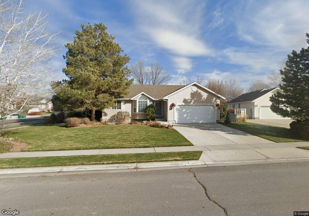
This home is located at 913 E 1960 N, Lehi, UT 84043 and is currently estimated at $568,081, approximately $248 per square foot. 913 E 1960 N is a home located in Utah County with nearby schools including Freedom Elementary School, Lehi Junior High School, and Skyridge High School.
Ownership History
Date
Name
Owned For
Owner Type
Purchase Details
Closed on
Sep 4, 2019
Sold by
Kerner Wayne and The Wayne Kerner 2015 Trust
Bought by
Angeles Long
Current Estimated Value
Home Financials for this Owner
Home Financials are based on the most recent Mortgage that was taken out on this home.
Original Mortgage
$355,500
Interest Rate
3.6%
Purchase Details
Closed on
Aug 15, 2017
Sold by
Kerner Wayne
Bought by
Kerner Wayne and The Wayne Kerner 2015 Trust
Home Financials for this Owner
Home Financials are based on the most recent Mortgage that was taken out on this home.
Original Mortgage
$202,700
Interest Rate
3.96%
Purchase Details
Closed on
Aug 8, 2017
Sold by
Kerner Wayne and The Wayne Kerner 2015 Trust
Bought by
Kerner Wayne
Home Financials for this Owner
Home Financials are based on the most recent Mortgage that was taken out on this home.
Original Mortgage
$202,700
Interest Rate
3.96%
Purchase Details
Closed on
Sep 1, 2015
Sold by
Kerner Wayne W
Bought by
Kerner Wayne
Purchase Details
Closed on
Aug 31, 2009
Sold by
Kerner Wayne W and Kerner Diane M
Bought by
Kerner Wayne W
Purchase Details
Closed on
Jul 20, 2007
Sold by
Vanderwerken John M and Van Derwerken Christy Q
Bought by
Kerner Wayne W and Kerner Diane M
Home Financials for this Owner
Home Financials are based on the most recent Mortgage that was taken out on this home.
Original Mortgage
$41,400
Interest Rate
6.66%
Mortgage Type
Stand Alone Second
Purchase Details
Closed on
Feb 16, 2006
Sold by
Schoonover Daniel P and Schoonover Emilee J
Bought by
Vanderwerken John M and Vanderwerken Christy Q
Home Financials for this Owner
Home Financials are based on the most recent Mortgage that was taken out on this home.
Original Mortgage
$157,520
Interest Rate
6.2%
Purchase Details
Closed on
May 28, 1999
Sold by
Patterson Construction Inc
Bought by
Schoonover Daniel P and Schoonover Emilee J
Home Financials for this Owner
Home Financials are based on the most recent Mortgage that was taken out on this home.
Original Mortgage
$137,679
Interest Rate
6.86%
Create a Home Valuation Report for This Property
The Home Valuation Report is an in-depth analysis detailing your home's value as well as a comparison with similar homes in the area
Home Values in the Area
Average Home Value in this Area
Purchase History
| Date | Buyer | Sale Price | Title Company |
|---|---|---|---|
| Angeles Long | -- | First American American Fork | |
| Kerner Wayne | -- | Linear Title Agency Of Utah | |
| Kerner Wayne | -- | Linear Title & Closing Ltd | |
| Kerner Wayne | -- | None Available | |
| Kerner Wayne W | -- | None Available | |
| Kerner Wayne W | -- | Title West Title Company | |
| Vanderwerken John M | -- | Select Title Insurance Agen | |
| Schoonover Daniel P | -- | First American Title Ins Co |
Source: Public Records
Mortgage History
| Date | Status | Borrower | Loan Amount |
|---|---|---|---|
| Closed | Angeles Long | $355,500 | |
| Previous Owner | Kerner Wayne | $202,700 | |
| Previous Owner | Kerner Wayne W | $41,400 | |
| Previous Owner | Kerner Wayne W | $220,800 | |
| Previous Owner | Vanderwerken John M | $157,520 | |
| Previous Owner | Schoonover Daniel P | $137,679 |
Source: Public Records
Tax History Compared to Growth
Tax History
| Year | Tax Paid | Tax Assessment Tax Assessment Total Assessment is a certain percentage of the fair market value that is determined by local assessors to be the total taxable value of land and additions on the property. | Land | Improvement |
|---|---|---|---|---|
| 2025 | $2,318 | $298,980 | $219,800 | $323,800 |
| 2024 | $2,318 | $271,260 | $0 | $0 |
| 2023 | $2,138 | $271,645 | $0 | $0 |
| 2022 | $2,394 | $294,855 | $0 | $0 |
| 2021 | $2,139 | $398,300 | $127,200 | $271,100 |
| 2020 | $2,016 | $371,200 | $117,800 | $253,400 |
| 2019 | $1,790 | $342,600 | $117,800 | $224,800 |
| 2018 | $1,722 | $311,500 | $112,700 | $198,800 |
| 2017 | $1,653 | $158,950 | $0 | $0 |
| 2016 | $1,535 | $137,005 | $0 | $0 |
| 2015 | $1,543 | $130,680 | $0 | $0 |
| 2014 | $1,526 | $128,535 | $0 | $0 |
Source: Public Records
Map
Nearby Homes
- 975 E 2125 N
- 859 E 2125 N
- 2208 N 825 E
- 4333 N Baiken Ridge Dr Unit 1020
- 192 E 2200 N
- 9967 N 6670 W
- 6692 W 9770 N
- 2539 N 300 E
- 1175 E 900 N
- 975 E 2850 N
- 9435 N Aspen Hollow Cir
- 1295 N 190 E
- 9924 N 6630 W Unit 9
- 832 N Somerset Alley
- 2159 N Banbury Ct
- 1329 N 100 E Unit 21
- 893 N 1580 E
- 735 N 1000 E
- 1755 N 250 W
- 595 N 1200 E
- 931 E 1960 N
- 943 E 1960 N
- 1956 N Airport Dr
- 984 E 1960 N
- 2041 Airport Dr
- 2002 Airport Dr
- 1989 N Airport Dr
- 2007 Airport Dr
- 910 E 1960 N
- 1959 Airport Dr
- 1979 N Airport Dr
- 1979 N Airport Dr
- 970 E 2040 N
- 924 E 1960 N
- 2023 Airport Dr
- 988 E 2040 N
- 938 E 1960 N
- 955 E 1960 N
- 1935 Airport Dr
- 1928 N Airport Dr