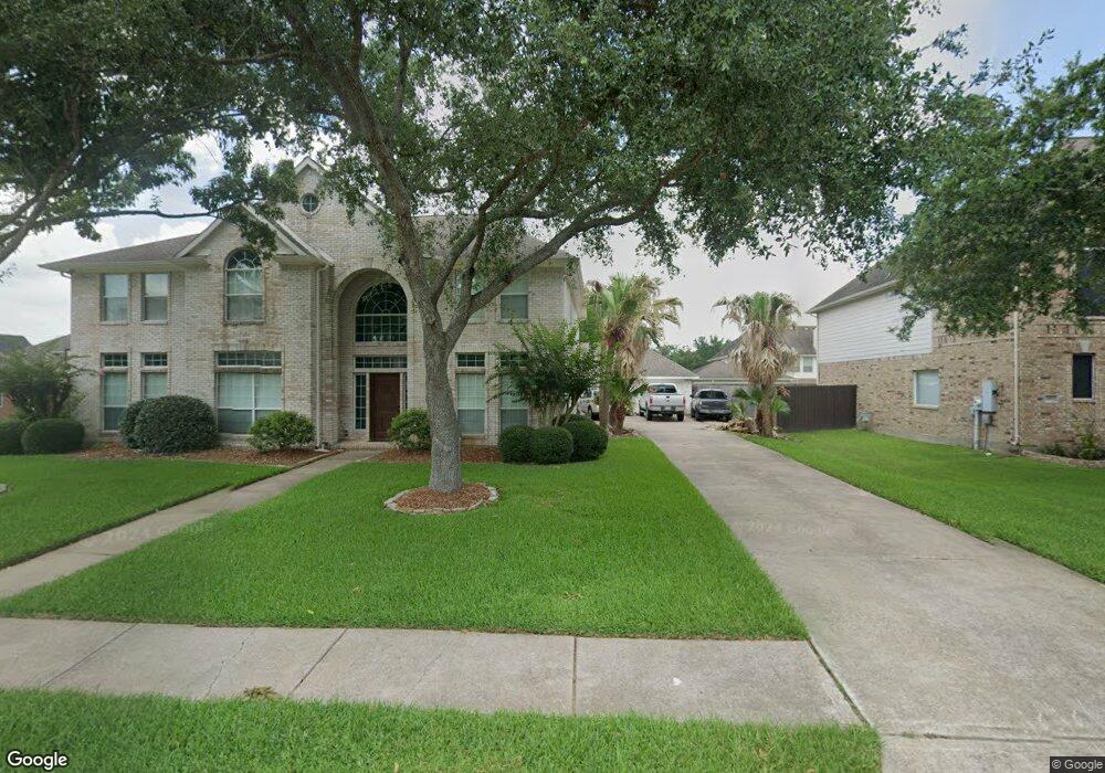
913 High Ridge Dr Friendswood, TX 77546
Estimated Value: $511,691 - $571,000
4
Beds
4
Baths
3,083
Sq Ft
$172/Sq Ft
Est. Value
About This Home
This home is located at 913 High Ridge Dr, Friendswood, TX 77546 and is currently estimated at $530,923, approximately $172 per square foot. 913 High Ridge Dr is a home located in Galveston County with nearby schools including C.W. Cline Elementary School, Windsong Elementary School, and Friendswood Junior High School.
Ownership History
Date
Name
Owned For
Owner Type
Purchase Details
Closed on
Jul 9, 2020
Sold by
Lambeth Tanny Kay
Bought by
Bunn Amanda Kay
Current Estimated Value
Purchase Details
Closed on
May 26, 2017
Sold by
Carper Christopher and Carper Rogers
Bought by
Bunn Amanda K and Lambeth Tanny Kay
Home Financials for this Owner
Home Financials are based on the most recent Mortgage that was taken out on this home.
Original Mortgage
$259,608
Interest Rate
4.08%
Mortgage Type
New Conventional
Purchase Details
Closed on
May 9, 2006
Sold by
K Hovnanian Of Houston Ii Lp
Bought by
Carper Christopher and Carper Jessica Rogers
Home Financials for this Owner
Home Financials are based on the most recent Mortgage that was taken out on this home.
Original Mortgage
$214,750
Interest Rate
6.4%
Mortgage Type
Purchase Money Mortgage
Create a Home Valuation Report for This Property
The Home Valuation Report is an in-depth analysis detailing your home's value as well as a comparison with similar homes in the area
Home Values in the Area
Average Home Value in this Area
Purchase History
| Date | Buyer | Sale Price | Title Company |
|---|---|---|---|
| Bunn Amanda Kay | -- | None Available | |
| Bunn Amanda K | -- | South Land Title Llc | |
| Carper Christopher | -- | Alamo Title Company |
Source: Public Records
Mortgage History
| Date | Status | Borrower | Loan Amount |
|---|---|---|---|
| Previous Owner | Bunn Amanda K | $259,608 | |
| Previous Owner | Carper Christopher | $214,750 |
Source: Public Records
Tax History Compared to Growth
Tax History
| Year | Tax Paid | Tax Assessment Tax Assessment Total Assessment is a certain percentage of the fair market value that is determined by local assessors to be the total taxable value of land and additions on the property. | Land | Improvement |
|---|---|---|---|---|
| 2025 | $7,760 | $483,800 | $44,430 | $439,370 |
| 2024 | $7,760 | $483,800 | $44,430 | $439,370 |
| 2023 | $7,760 | $478,694 | $0 | $0 |
| 2022 | $9,585 | $435,176 | $44,430 | $390,746 |
| 2021 | $9,347 | $400,160 | $44,430 | $355,730 |
| 2020 | $9,481 | $398,080 | $44,430 | $353,650 |
| 2019 | $9,084 | $357,750 | $44,430 | $313,320 |
| 2018 | $9,138 | $357,750 | $44,430 | $313,320 |
| 2017 | $9,291 | $357,750 | $44,430 | $313,320 |
| 2016 | $8,428 | $324,510 | $44,430 | $280,080 |
| 2015 | $2,718 | $324,510 | $44,430 | $280,080 |
| 2014 | $2,559 | $271,990 | $44,430 | $227,560 |
Source: Public Records
Map
Nearby Homes
- 1906 Blue Quail Dr
- 1010 High Ridge Dr
- 705 High Ridge Dr
- 1802 Creekside Dr
- 1217 Red Wing Dr
- 1302 Eagle Lakes Dr
- 1305 Edgewater Dr
- 506 Lakeside Ln
- 2304 Old Rd
- 2202 Calm Pond Ct
- 2120 Lila Sky Ln
- 505 Hunters Ln
- 2305 Farris Valley Ln
- 1532 River Point Dr
- 1608 Keystone Dr
- 1673 Birch Lake Bend
- 1556 River Point Dr
- 1601 Birch Lake Bend
- 1657 Birch Lake Ln
- 1673 Birch Lake Ln
- 909 High Ridge Dr
- 1001 High Ridge Dr
- 1913 Blue Quail Dr
- 1911 Blue Quail Dr
- 1915 Blue Quail Dr
- 905 High Ridge Dr
- 1005 High Ridge Dr
- 910 High Ridge Dr
- 1002 High Ridge Dr
- 1909 Blue Quail Dr
- 1917 Blue Quail Dr
- 906 High Ridge Dr
- 1006 High Ridge Dr
- 1009 High Ridge Dr
- 1907 Blue Quail Dr
- 1919 Blue Quail Dr
- 806 Condor Dr
- 1912 Blue Quail Dr
- 903 High Ridge Dr
- 900 High Ridge Dr