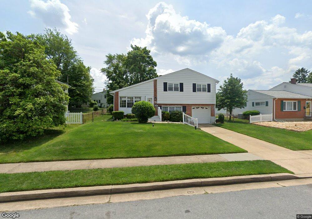
913 Kent Ave Catonsville, MD 21228
Estimated Value: $333,328 - $400,000
--
Bed
2
Baths
1,876
Sq Ft
$198/Sq Ft
Est. Value
About This Home
This home is located at 913 Kent Ave, Catonsville, MD 21228 and is currently estimated at $371,832, approximately $198 per square foot. 913 Kent Ave is a home located in Baltimore County with nearby schools including Johnnycake Elementary School, Southwest Academy, and Woodlawn High School.
Ownership History
Date
Name
Owned For
Owner Type
Purchase Details
Closed on
Nov 11, 2021
Sold by
Charlie Dozier
Bought by
Moore Sarah Dozier and Brown Charles Gregory
Current Estimated Value
Purchase Details
Closed on
Dec 8, 2018
Sold by
Dozier Charlie and Dozier Annie
Bought by
Dozier Charlie and Dozier Annie
Purchase Details
Closed on
Dec 4, 1996
Sold by
Chang Hyon Su
Bought by
Dozier Charlie and Dozier Annie
Purchase Details
Closed on
Dec 15, 1993
Sold by
Basso G
Bought by
Chang Hyon S
Home Financials for this Owner
Home Financials are based on the most recent Mortgage that was taken out on this home.
Original Mortgage
$91,800
Interest Rate
7.03%
Create a Home Valuation Report for This Property
The Home Valuation Report is an in-depth analysis detailing your home's value as well as a comparison with similar homes in the area
Home Values in the Area
Average Home Value in this Area
Purchase History
| Date | Buyer | Sale Price | Title Company |
|---|---|---|---|
| Moore Sarah Dozier | -- | None Listed On Document | |
| Dozier Charlie | -- | Title Nation Llc | |
| Dozier Charlie | $101,500 | -- | |
| Chang Hyon S | $102,000 | -- |
Source: Public Records
Mortgage History
| Date | Status | Borrower | Loan Amount |
|---|---|---|---|
| Previous Owner | Chang Hyon S | $91,800 |
Source: Public Records
Tax History Compared to Growth
Tax History
| Year | Tax Paid | Tax Assessment Tax Assessment Total Assessment is a certain percentage of the fair market value that is determined by local assessors to be the total taxable value of land and additions on the property. | Land | Improvement |
|---|---|---|---|---|
| 2025 | $3,320 | $252,333 | -- | -- |
| 2024 | $3,320 | $232,600 | $77,000 | $155,600 |
| 2023 | $1,605 | $223,500 | $0 | $0 |
| 2022 | $3,033 | $214,400 | $0 | $0 |
| 2021 | $2,661 | $205,300 | $77,000 | $128,300 |
| 2020 | $2,479 | $204,500 | $0 | $0 |
| 2019 | $2,469 | $203,700 | $0 | $0 |
| 2018 | $2,675 | $202,900 | $63,500 | $139,400 |
| 2017 | $2,387 | $188,833 | $0 | $0 |
| 2016 | $2,101 | $174,767 | $0 | $0 |
| 2015 | $2,101 | $160,700 | $0 | $0 |
| 2014 | $2,101 | $160,700 | $0 | $0 |
Source: Public Records
Map
Nearby Homes
- 910 Prestwood Rd
- 6028 Moorehead Rd
- 930 Sedgley Rd
- 920 Vanderwood Rd
- 908 Vanderwood Rd
- 1007 Marksworth Rd
- 1007 Kent Ave
- 67 Walden Mill Way
- 6001 Johnnycake Rd
- 3 Mcgrady Square
- 1068 Craftswood Rd
- 6011 Johnnycake Rd
- 1102 Kent Ave
- 1009 Rowe Ln
- 6031 Burnt Oak Rd
- 800 Crosby Rd
- 1109 Marksworth Rd
- 1113 Kent Ave
- 1124 Brigadoon Trail
- 6200 Gilston Park Rd