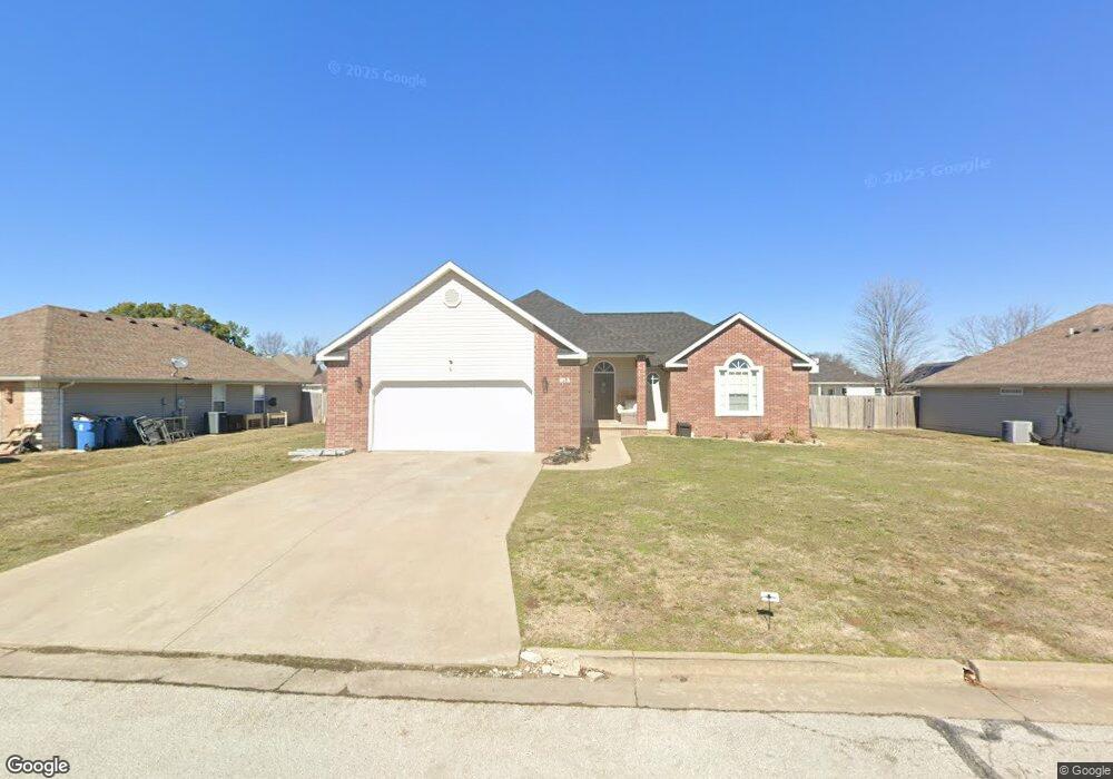
913 Larson St Carl Junction, MO 64834
Estimated Value: $237,441 - $293,000
3
Beds
2
Baths
1,636
Sq Ft
$157/Sq Ft
Est. Value
About This Home
This home is located at 913 Larson St, Carl Junction, MO 64834 and is currently estimated at $257,360, approximately $157 per square foot. 913 Larson St is a home located in Jasper County with nearby schools including Carl Junction Primary School (K-1), Carl Junction Intermediate School, and Carl Junction Primary School (2-3).
Ownership History
Date
Name
Owned For
Owner Type
Purchase Details
Closed on
Jun 30, 2022
Sold by
Powell Timothy R and Powell Stacey A
Bought by
Lee Chayse
Current Estimated Value
Home Financials for this Owner
Home Financials are based on the most recent Mortgage that was taken out on this home.
Original Mortgage
$180,500
Outstanding Balance
$171,471
Interest Rate
5.25%
Mortgage Type
New Conventional
Estimated Equity
$85,889
Purchase Details
Closed on
May 31, 2006
Sold by
Fields Larry E and Fields Deborah K
Bought by
Powell Timothy R and Powell Stacey A
Home Financials for this Owner
Home Financials are based on the most recent Mortgage that was taken out on this home.
Original Mortgage
$98,000
Interest Rate
6.56%
Mortgage Type
Fannie Mae Freddie Mac
Purchase Details
Closed on
Feb 8, 2005
Sold by
Redwood Development Inc
Bought by
Fields Larry E and Fields Deborah K
Home Financials for this Owner
Home Financials are based on the most recent Mortgage that was taken out on this home.
Original Mortgage
$110,925
Interest Rate
5.85%
Mortgage Type
Construction
Create a Home Valuation Report for This Property
The Home Valuation Report is an in-depth analysis detailing your home's value as well as a comparison with similar homes in the area
Purchase History
| Date | Buyer | Sale Price | Title Company |
|---|---|---|---|
| Lee Chayse | -- | New Title Company Name | |
| Powell Timothy R | -- | Bronson | |
| Fields Larry E | -- | -- |
Source: Public Records
Mortgage History
| Date | Status | Borrower | Loan Amount |
|---|---|---|---|
| Open | Lee Chayse | $180,500 | |
| Previous Owner | Powell Timothy R | $98,000 | |
| Previous Owner | Fields Larry E | $110,925 |
Source: Public Records
Tax History
| Year | Tax Paid | Tax Assessment Tax Assessment Total Assessment is a certain percentage of the fair market value that is determined by local assessors to be the total taxable value of land and additions on the property. | Land | Improvement |
|---|---|---|---|---|
| 2025 | $1,381 | $25,290 | $2,130 | $23,160 |
| 2024 | $1,390 | $23,610 | $2,130 | $21,480 |
| 2023 | $1,390 | $23,610 | $2,130 | $21,480 |
| 2022 | $1,437 | $24,340 | $2,130 | $22,210 |
| 2021 | $1,233 | $24,340 | $2,130 | $22,210 |
| 2020 | $1,153 | $22,370 | $2,130 | $20,240 |
| 2019 | $1,094 | $22,370 | $2,130 | $20,240 |
| 2018 | $1,114 | $22,820 | $0 | $0 |
| 2016 | $1,130 | $23,310 | $0 | $0 |
Source: Public Records
Map
Nearby Homes
- 904 Larson St
- TBD Route Yy
- 29320 State Highway Yy
- 29250 State Highway Yy
- Tract 3 Prairie Ln
- Tract 2 Prairie Ln
- Tract 1 Prairie Ln
- Tract 4 Prairie Ln
- 711 Prairie Ln
- 817 Delaney Dr
- 9129 Cr-290
- 505 N Broadway Ave
- 809 Aberdeen Ave
- 901 Aberdeen Ave
- 106 S Roney St
- 509 W Gault St
- 29865 State Highway Yy
- 304 Belgian Blue Blvd
- 804 Aberdeen Ave
- 806 Aberdeen Ave
Your Personal Tour Guide
Ask me questions while you tour the home.