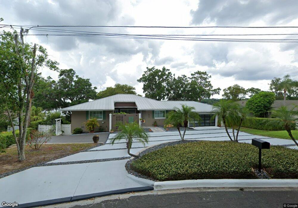
913 Northside Dr Mount Dora, FL 32757
Estimated Value: $595,000 - $936,000
4
Beds
4
Baths
3,579
Sq Ft
$217/Sq Ft
Est. Value
About This Home
This home is located at 913 Northside Dr, Mount Dora, FL 32757 and is currently estimated at $775,732, approximately $216 per square foot. 913 Northside Dr is a home located in Lake County with nearby schools including Triangle Elementary School, Mt. Dora Middle School, and Mt. Dora High School.
Ownership History
Date
Name
Owned For
Owner Type
Purchase Details
Closed on
Jan 29, 2015
Sold by
Vaught Donn D
Bought by
Vaught Kirk S and Vaught Beth
Current Estimated Value
Purchase Details
Closed on
Mar 24, 2005
Sold by
Griner Ward John and Griner Sandra
Bought by
Vaught Kirk and Vaught Beth
Home Financials for this Owner
Home Financials are based on the most recent Mortgage that was taken out on this home.
Original Mortgage
$280,000
Outstanding Balance
$146,015
Interest Rate
6.25%
Mortgage Type
Purchase Money Mortgage
Estimated Equity
$629,717
Create a Home Valuation Report for This Property
The Home Valuation Report is an in-depth analysis detailing your home's value as well as a comparison with similar homes in the area
Home Values in the Area
Average Home Value in this Area
Purchase History
| Date | Buyer | Sale Price | Title Company |
|---|---|---|---|
| Vaught Kirk S | -- | None Available | |
| Vaught Kirk | $350,000 | Apple Title Ltd |
Source: Public Records
Mortgage History
| Date | Status | Borrower | Loan Amount |
|---|---|---|---|
| Open | Vaught Kirk | $280,000 |
Source: Public Records
Tax History
| Year | Tax Paid | Tax Assessment Tax Assessment Total Assessment is a certain percentage of the fair market value that is determined by local assessors to be the total taxable value of land and additions on the property. | Land | Improvement |
|---|---|---|---|---|
| 2026 | $6,371 | $414,130 | -- | -- |
| 2025 | $6,425 | $402,850 | -- | -- |
| 2024 | $6,425 | $402,850 | -- | -- |
| 2023 | $6,425 | $379,730 | $0 | $0 |
| 2022 | $6,358 | $368,670 | $0 | $0 |
| 2021 | $6,133 | $357,935 | $0 | $0 |
| 2020 | $6,363 | $352,994 | $0 | $0 |
| 2019 | $6,374 | $345,058 | $0 | $0 |
| 2018 | $5,679 | $313,796 | $0 | $0 |
| 2017 | $5,404 | $307,342 | $0 | $0 |
| 2016 | $5,280 | $301,021 | $0 | $0 |
| 2015 | $5,378 | $298,929 | $0 | $0 |
| 2014 | $5,315 | $296,557 | $0 | $0 |
Source: Public Records
Map
Nearby Homes
- 809 Northside Dr
- 1824 Crestview Dr
- 1765 Hilltop Dr
- 1630 Crestview Dr
- 2314 Hillside Dr
- 600 Old Eustis Rd
- 611 Old Eustis Rd
- 576 Casey Loop
- 1438 Crestview Dr
- 2108 Dogwood Cir
- 407 Forest Rd
- 333 Forest Rd
- 1450 Hilltop Dr
- 2115 Oak Leaf Cir
- 1405 Hilltop Dr
- 654 James Moore Dr
- 995 W 11th Ave
- 1321 Heim Rd
- 1535 Sunset Cir
- 1120 Gardner St
- 911 Northside Dr
- 915 Northside Dr
- 916 Northside Dr
- 2223 Overlook Dr
- 2101 Overlook Dr
- 921 Northside Dr
- 904 Drive
- 904 Northside Dr
- 2233 Overlook Dr
- 2229 Overlook Dr
- 922 Northside Dr
- 901 Northside Dr
- 2087 Overlook Dr
- 2025 Sunset Rd
- 2085 Overlook Dr
- 926 Northside Dr
- 820 Northside Dr
- 2225 Overlook Dr
- 815 Northside Dr
- 1945 Sunset Rd
Your Personal Tour Guide
Ask me questions while you tour the home.