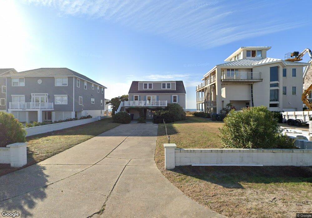
913 Ocean Ridge Dr Atlantic Beach, NC 28512
Estimated Value: $1,672,000 - $3,406,000
--
Bed
4
Baths
2,868
Sq Ft
$770/Sq Ft
Est. Value
About This Home
This home is located at 913 Ocean Ridge Dr, Atlantic Beach, NC 28512 and is currently estimated at $2,208,022, approximately $769 per square foot. 913 Ocean Ridge Dr is a home with nearby schools including Morehead City Primary School, Morehead Elementary School at Camp Glenn, and Morehead City Middle School.
Ownership History
Date
Name
Owned For
Owner Type
Purchase Details
Closed on
Jan 6, 2025
Sold by
Washington Isabel R and Washington Royster S
Bought by
913 Ocean Ridge Llc
Current Estimated Value
Purchase Details
Closed on
Aug 18, 2005
Sold by
Dudley Katherine R and Dudley George H
Bought by
Roberson Edward L and Washington Isabel R
Create a Home Valuation Report for This Property
The Home Valuation Report is an in-depth analysis detailing your home's value as well as a comparison with similar homes in the area
Home Values in the Area
Average Home Value in this Area
Purchase History
| Date | Buyer | Sale Price | Title Company |
|---|---|---|---|
| 913 Ocean Ridge Llc | -- | None Listed On Document | |
| 913 Ocean Ridge Llc | -- | None Listed On Document | |
| Roberson Edward L | $75,000 | None Available |
Source: Public Records
Tax History Compared to Growth
Tax History
| Year | Tax Paid | Tax Assessment Tax Assessment Total Assessment is a certain percentage of the fair market value that is determined by local assessors to be the total taxable value of land and additions on the property. | Land | Improvement |
|---|---|---|---|---|
| 2025 | $5,733 | $2,504,387 | $1,460,238 | $1,044,149 |
| 2024 | $4,959 | $1,429,789 | $1,238,760 | $191,029 |
| 2023 | $4,876 | $1,429,789 | $1,238,760 | $191,029 |
| 2022 | $4,733 | $1,429,789 | $1,238,760 | $191,029 |
| 2021 | $4,733 | $1,429,789 | $1,238,760 | $191,029 |
| 2020 | $4,733 | $1,429,789 | $1,238,760 | $191,029 |
| 2019 | $4,400 | $1,414,569 | $1,198,800 | $215,769 |
| 2017 | $4,400 | $1,414,569 | $1,198,800 | $215,769 |
| 2016 | $4,400 | $1,414,569 | $1,198,800 | $215,769 |
| 2015 | $4,259 | $1,414,569 | $1,198,800 | $215,769 |
| 2014 | $4,135 | $1,373,470 | $1,110,037 | $263,433 |
Source: Public Records
Map
Nearby Homes
- 413 W Fort MacOn Rd
- 221 Sound Side Dr
- 101 Bay Ridge Dr
- 123 & 125 Coral Bay Ct
- 2111 W Ft MacOn Rd Unit 251
- 2111 W Fort MacOn Rd Unit 336 Dunescape
- 113 Hoop Pole Creek Dr
- 602 Ft MacOn Rd W Unit 117
- 602 Ft MacOn Rd Unit 132
- 602 Ft MacOn Rd W Unit 231
- 602 W Fort MacOn Rd Unit 118
- 602 W Fort MacOn Rd Unit 242
- 602 W Fort MacOn Rd Unit 135
- 602 W Fort MacOn Rd Unit 204/139
- 602 W Fort MacOn Rd Unit 109
- 602 W Fort MacOn Rd Unit 139
- 602 Fort MacOn Rd
- 602 W Fort MacOn Rd Unit 231
- 2305 W Fort MacOn Rd Unit 207
- 2306 W Ft MacOn Rd W Unit 308 H
- 915 Ocean Ridge Dr
- 911 Ocean Ridge Dr
- 909 Ocean Ridge Dr
- 1001 Ocean Ridge Dr
- 907 Ocean Ridge Dr
- 1003 Ocean Ridge Dr
- 912 Ocean Ridge Dr
- 914 Ocean Ridge Dr
- 905 Ocean Ridge Dr
- 1005 Ocean Ridge Dr
- 906 Ocean Ridge Dr
- 1000 Ocean Ridge Dr
- 903 Ocean Ridge Dr
- 1002 Ocean Ridge Dr
- 904 Ocean Ridge Dr
- 1007 Ocean Ridge Dr
- 901 Ocean Ridge Dr
- 902 Ocean Ridge Dr
- 1009 Ocean Ridge Dr
- 204 Oak Forest Ln