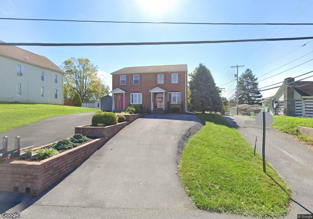
913 Security Rd Hagerstown, MD 21742
East End NeighborhoodEstimated Value: $194,000 - $256,000
2
Beds
2
Baths
1,360
Sq Ft
$171/Sq Ft
Est. Value
About This Home
This home is located at 913 Security Rd, Hagerstown, MD 21742 and is currently estimated at $231,918, approximately $170 per square foot. 913 Security Rd is a home located in Washington County with nearby schools including Pangborn Elementary School, Northern Middle School, and North Hagerstown High School.
Ownership History
Date
Name
Owned For
Owner Type
Purchase Details
Closed on
Feb 6, 2002
Sold by
Latterner Sheryl A & Jay T
Bought by
Owings Stephen M
Current Estimated Value
Purchase Details
Closed on
Dec 28, 1998
Sold by
Owings Sheryl A
Bought by
Latterner Sheryl A & Jay T
Create a Home Valuation Report for This Property
The Home Valuation Report is an in-depth analysis detailing your home's value as well as a comparison with similar homes in the area
Home Values in the Area
Average Home Value in this Area
Purchase History
| Date | Buyer | Sale Price | Title Company |
|---|---|---|---|
| Owings Stephen M | $95,000 | -- | |
| Latterner Sheryl A & Jay T | -- | -- |
Source: Public Records
Mortgage History
| Date | Status | Borrower | Loan Amount |
|---|---|---|---|
| Closed | Latterner Sheryl A & Jay T | -- |
Source: Public Records
Tax History
| Year | Tax Paid | Tax Assessment Tax Assessment Total Assessment is a certain percentage of the fair market value that is determined by local assessors to be the total taxable value of land and additions on the property. | Land | Improvement |
|---|---|---|---|---|
| 2025 | $1,224 | $127,200 | $0 | $0 |
| 2024 | $1,224 | $118,200 | $46,700 | $71,500 |
| 2023 | $1,213 | $117,167 | $0 | $0 |
| 2022 | $1,202 | $116,133 | $0 | $0 |
| 2021 | $1,220 | $115,100 | $46,700 | $68,400 |
| 2020 | $1,211 | $114,767 | $0 | $0 |
| 2019 | $1,213 | $114,433 | $0 | $0 |
| 2018 | $1,209 | $114,100 | $46,700 | $67,400 |
| 2017 | $1,209 | $114,100 | $0 | $0 |
| 2016 | -- | $114,100 | $0 | $0 |
| 2015 | $1,485 | $123,700 | $0 | $0 |
| 2014 | $1,485 | $123,700 | $0 | $0 |
Source: Public Records
Map
Nearby Homes
- 466 Pangborn Blvd
- 43 Sunbrook Ln Unit 6
- 340 Sunbrook Ln
- 319 Sunbrook Ln Unit 98
- 313 Sunbrook Ln Unit 95
- 250 Sunbrook Ln Unit 132
- 713 Medway Rd
- 747 Monet Dr
- 1005 Valleybrook Dr
- 613 Westwood St
- 953 View St
- 939 View St
- 344 Hollymead Terrace
- 1056 Valleybrook Dr
- 216 Willard St
- 838 Mulberry Ave
- 1275 Jefferson Blvd
- 486 Antietam Dr
- 120 E Irvin Ave
- 1023 Klick Way
- 911 Security Rd
- 915 Security Rd
- 905 Security Rd
- 25 Sunbrook Ln
- 27 Sunbrook Ln
- 0 Security Rd Unit 1002043654
- 0 Security Rd Unit WA9940768
- 0 Security Rd Unit WA8404760
- 0 Security Rd Unit MDWA2011616
- 0 Security Rd Unit MDWA176352
- 0 Security Rd Unit MDWA174566
- 0 Security Rd Unit MDWA172274
- 0 Security Rd Unit MDWA172272
- 0 Security Rd Unit MDWA166330
- 0 Security Rd Unit MDWA166320
- 0 Security Rd Unit 1000071039
- 0 Security Rd Unit 1000070161
- 29 Sunbrook Ln Unit 3
- 29 Sunbrook Ln
- 31 Sunbrook Ln
Your Personal Tour Guide
Ask me questions while you tour the home.