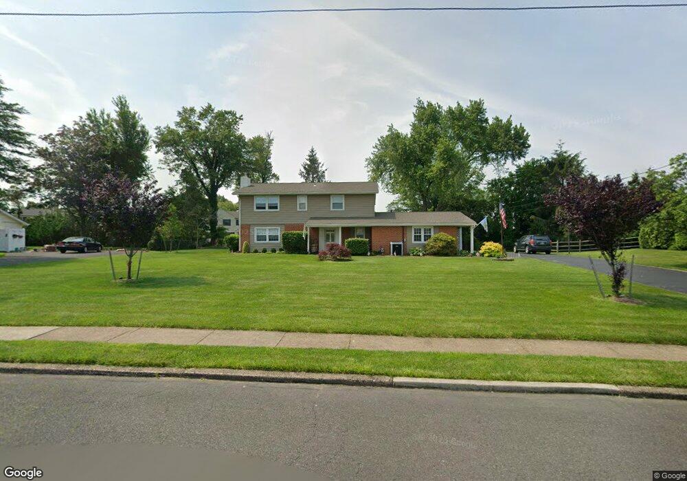
913 Thornton Rd Horsham, PA 19044
Estimated Value: $659,000 - $680,040
4
Beds
3
Baths
2,678
Sq Ft
$250/Sq Ft
Est. Value
About This Home
This home is located at 913 Thornton Rd, Horsham, PA 19044 and is currently estimated at $669,510, approximately $250 per square foot. 913 Thornton Rd is a home located in Montgomery County with nearby schools including Simmons Elementary School, Keith Valley Middle School, and Hatboro-Horsham Senior High School.
Ownership History
Date
Name
Owned For
Owner Type
Purchase Details
Closed on
Nov 28, 2011
Sold by
Wenhold Mary Jane
Bought by
Meehan Gina L and Meehan Gerald F
Current Estimated Value
Home Financials for this Owner
Home Financials are based on the most recent Mortgage that was taken out on this home.
Original Mortgage
$284,000
Outstanding Balance
$195,020
Interest Rate
4.09%
Estimated Equity
$474,490
Purchase Details
Closed on
Jun 10, 2009
Sold by
Wenhold Mary Jane
Bought by
Wenhold Mary Jane
Create a Home Valuation Report for This Property
The Home Valuation Report is an in-depth analysis detailing your home's value as well as a comparison with similar homes in the area
Home Values in the Area
Average Home Value in this Area
Purchase History
| Date | Buyer | Sale Price | Title Company |
|---|---|---|---|
| Meehan Gina L | $355,000 | None Available | |
| Wenhold Mary Jane | -- | None Available |
Source: Public Records
Mortgage History
| Date | Status | Borrower | Loan Amount |
|---|---|---|---|
| Open | Meehan Gina L | $284,000 |
Source: Public Records
Tax History Compared to Growth
Tax History
| Year | Tax Paid | Tax Assessment Tax Assessment Total Assessment is a certain percentage of the fair market value that is determined by local assessors to be the total taxable value of land and additions on the property. | Land | Improvement |
|---|---|---|---|---|
| 2025 | $7,127 | $181,310 | -- | -- |
| 2024 | $7,127 | $181,310 | -- | -- |
| 2023 | $6,784 | $181,310 | $0 | $0 |
| 2022 | $6,564 | $181,310 | $0 | $0 |
| 2021 | $6,409 | $181,310 | $0 | $0 |
| 2020 | $6,258 | $181,310 | $0 | $0 |
| 2019 | $6,138 | $181,310 | $0 | $0 |
| 2018 | $4,916 | $181,310 | $0 | $0 |
| 2017 | $5,863 | $181,310 | $0 | $0 |
| 2016 | $5,792 | $181,310 | $0 | $0 |
| 2015 | $5,531 | $181,310 | $0 | $0 |
| 2014 | $5,531 | $181,310 | $0 | $0 |
Source: Public Records
Map
Nearby Homes
- 159 Hunt Dr
- 132 Hunt Dr
- 711 E Butler Pike
- 18 Hunt Dr
- Lot 46 Bryce Dr
- Lot 49 Bryce Dr
- 738 LOT 2 Emory Ct
- Lot 42 Emory Ct
- Lot 45 Emory Ct
- Lot 9 Bryce Dr
- Lot 10 Bryce Dr
- 832 Paradise Dr
- 826 LOT 16 Carlsbad Ct
- 1844 Hood Ln
- 962 Tennis Ave Unit RESIDENCE 1
- 968 Tennis Ave
- 703 Daventry Way
- 603 Norristown Rd
- 600 Stoneham Ct
- 1049 Mckean Rd
- 911 Thornton Rd
- 915 Thornton Rd
- 916 Langdon Ave
- 914 Langdon Ave
- 918 Langdon Ave
- 914 Thornton Rd
- 912 Rutledge Ave
- 917 Thornton Rd
- 920 Langdon Ave
- 910 Rutledge Ave
- 908 Thornton Rd
- 916 Thornton Rd
- 922 Langdon Ave
- 919 Thornton Rd
- 907 Thornton Rd
- 908 Rutledge Ave
- 907 Gilman Rd
- 913 Jenifer Rd
- 917 Rutledge Ave
- 923 Langdon Ave