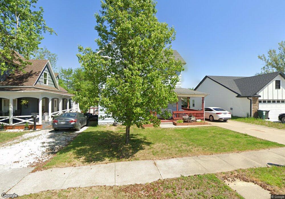
913 W Rollins St Moberly, MO 65270
Estimated Value: $92,000 - $908,000
4
Beds
2
Baths
1,904
Sq Ft
$159/Sq Ft
Est. Value
About This Home
This home is located at 913 W Rollins St, Moberly, MO 65270 and is currently estimated at $303,272, approximately $159 per square foot. 913 W Rollins St is a home located in Randolph County with nearby schools including Moberly Senior High School, St. Pius X. Catholic School, and Maranatha Seventh-day Adventist School.
Ownership History
Date
Name
Owned For
Owner Type
Purchase Details
Closed on
Apr 6, 2012
Sold by
Milnes Dennis and Milnes Savannah Stokes
Bought by
Powell Ashley D
Current Estimated Value
Home Financials for this Owner
Home Financials are based on the most recent Mortgage that was taken out on this home.
Original Mortgage
$82,845
Outstanding Balance
$57,044
Interest Rate
3.92%
Estimated Equity
$246,228
Create a Home Valuation Report for This Property
The Home Valuation Report is an in-depth analysis detailing your home's value as well as a comparison with similar homes in the area
Home Values in the Area
Average Home Value in this Area
Purchase History
| Date | Buyer | Sale Price | Title Company |
|---|---|---|---|
| Powell Ashley D | -- | -- |
Source: Public Records
Mortgage History
| Date | Status | Borrower | Loan Amount |
|---|---|---|---|
| Open | Powell Ashley D | $82,845 |
Source: Public Records
Tax History Compared to Growth
Tax History
| Year | Tax Paid | Tax Assessment Tax Assessment Total Assessment is a certain percentage of the fair market value that is determined by local assessors to be the total taxable value of land and additions on the property. | Land | Improvement |
|---|---|---|---|---|
| 2025 | $467 | $8,480 | $1,201 | $7,279 |
| 2024 | $467 | $6,410 | $1,045 | $5,365 |
| 2023 | $474 | $6,410 | $1,045 | $5,365 |
| 2022 | $444 | $6,160 | $1,045 | $5,115 |
| 2021 | $443 | $6,160 | $1,045 | $5,115 |
| 2020 | $443 | $6,160 | $1,045 | $5,115 |
| 2019 | $442 | $6,160 | $1,045 | $5,115 |
| 2018 | $441 | $6,160 | $1,045 | $5,115 |
| 2017 | $440 | $6,160 | $0 | $0 |
| 2016 | $419 | $5,900 | $0 | $0 |
| 2014 | -- | $5,530 | $0 | $0 |
| 2013 | -- | $5,530 | $0 | $0 |
| 2012 | -- | $5,530 | $0 | $0 |
Source: Public Records
Map
Nearby Homes
- 816 W Reed St
- 808 W Reed St
- 710 W Rollins St
- 1126 Fisk Ave
- 236 Bedford St
- 800 Franklin St
- 632 W Logan St
- 1029 Concannon St
- 1201 Bond St
- 1123 Concannon St
- 641 Park Ave
- 620 Burkholder St
- 817 Gilman St
- 407 Epperson St
- 216 S 5th St
- 809 Myra St
- 4 Fair Oaks
- 1224 &1226 Henry St
- LOT 2 County Rd
- 1377 Conestoga Trail
- 909 W Rollins St
- 915 W Rollins St
- 917 W Rollins St
- 107 Brinkerhoff St
- 906 W Reed St
- 923 W Rollins St
- 908 W Reed St
- 109 Brinkerhoff St
- 902 W Reed St
- 912 W Rollins St
- 910 W Reed St
- 927 W Rollins St
- 912 W Reed St
- 904 W Rollins St
- 920 W Rollins St
- 900 W Reed St
- 908 W Rollins St
- 835 W Rollins St
- 916 W Rollins St
- 931 W Rollins St