Estimated Value: $462,000 - $591,000
2
Beds
1
Bath
780
Sq Ft
$652/Sq Ft
Est. Value
About This Home
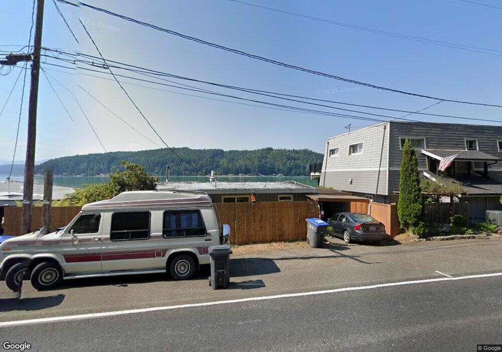
This home is located at 9131 E State Route 106, Union, WA 98592 and is currently estimated at $508,706, approximately $652 per square foot. 9131 E State Route 106 is a home located in Mason County with nearby schools including Hood Canal Elementary/Junior High School.
Ownership History
Date
Name
Owned For
Owner Type
Purchase Details
Closed on
Feb 14, 2022
Sold by
Campbell Carol A
Bought by
Campbell Carol A and Thon Lisa C
Current Estimated Value
Purchase Details
Closed on
Feb 26, 2013
Sold by
Loomis Sally K
Bought by
Campbell Carol A
Home Financials for this Owner
Home Financials are based on the most recent Mortgage that was taken out on this home.
Original Mortgage
$160,000
Interest Rate
3.4%
Mortgage Type
New Conventional
Create a Home Valuation Report for This Property
The Home Valuation Report is an in-depth analysis detailing your home's value as well as a comparison with similar homes in the area
Home Values in the Area
Average Home Value in this Area
Purchase History
| Date | Buyer | Sale Price | Title Company |
|---|---|---|---|
| Campbell Carol A | -- | Land Title | |
| Campbell Carol A | $160,000 | Mason County Title Company |
Source: Public Records
Mortgage History
| Date | Status | Borrower | Loan Amount |
|---|---|---|---|
| Previous Owner | Campbell Carol A | $160,000 |
Source: Public Records
Tax History Compared to Growth
Tax History
| Year | Tax Paid | Tax Assessment Tax Assessment Total Assessment is a certain percentage of the fair market value that is determined by local assessors to be the total taxable value of land and additions on the property. | Land | Improvement |
|---|---|---|---|---|
| 2025 | $2,630 | $387,550 | $194,465 | $193,085 |
| 2023 | $2,630 | $446,625 | $347,260 | $99,365 |
| 2022 | $3,929 | $428,860 | $366,775 | $62,085 |
| 2021 | $717 | $428,860 | $366,775 | $62,085 |
| 2020 | $723 | $427,240 | $367,460 | $59,780 |
| 2018 | $2,844 | $270,440 | $230,240 | $40,200 |
| 2017 | $2,444 | $270,500 | $230,300 | $40,200 |
| 2016 | $2,449 | $243,730 | $208,775 | $34,955 |
| 2015 | $2,478 | $250,450 | $215,230 | $35,220 |
| 2014 | -- | $250,185 | $215,230 | $34,955 |
| 2013 | -- | $209,955 | $175,000 | $34,955 |
Source: Public Records
Map
Nearby Homes
- 9451 E State Route 106
- 8820 E State Route 106
- 0 E Windstar Rd Unit NWM2436680
- 61 E Mt Ellinor Ct
- 260 NE Shorebrook Dr
- 770 E Country Club Dr E
- 11031 NE North Shore Rd
- 11 E Bonnie Ct
- 19560 NE North Shore Rd
- 0 NE Hurd Rd Unit NWM2408700
- 50 E Blackberry Ln
- 590 E Country Club Dr E
- 230 E Blackberry Ln
- 0 E Blackberry Ln
- 161 E Blackberry Ln
- 11 E Flaggwood Ln
- 530 E Country Club Dr E
- 11261 E State Route 106
- 470 E Country Club Dr E
- 131 E Vine Maple Ln
- 9121 E State Route 106
- 9141 E State Route 106
- 9161 E State Route 106
- 9091 E State Route 106
- 9181 E State Route 106
- 11 E Timber Tides Dr
- 9090 E State Route 106
- 21 Timbertides Dr Tr 21 Lot D
- 9071 E State Route 106
- 51 E Timber Tides Dr
- 9051 E State Route 106
- 0 E Timber Tides Dr Unit 923265
- 0 E Timber Tides Dr Unit 740959
- 0 E Timber Tides Dr Unit 1080462
- 0 E Timber Tides Dr Unit 961513
- 0 E Timber Tides Dr Unit 1083978
- 0 E Timber Tides Dr Unit 1185623
- 0 E Timber Tides Dr Unit NWM21086122
- 0 E Timber Tides Dr Unit NWM30900544
- 0 E Timber Tides Dr Unit NWM30900543