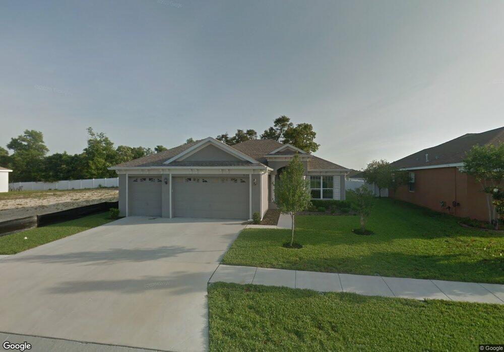
9133 Luncarty Dr Hudson, FL 34667
Estimated Value: $319,091 - $397,000
Studio
2
Baths
2,236
Sq Ft
$165/Sq Ft
Est. Value
About This Home
This home is located at 9133 Luncarty Dr, Hudson, FL 34667 and is currently estimated at $369,273, approximately $165 per square foot. 9133 Luncarty Dr is a home located in Pasco County with nearby schools including West Pasco Education Academy, Hudson Middle School, and Hudson High School.
Ownership History
Date
Name
Owned For
Owner Type
Purchase Details
Closed on
Jul 30, 2009
Sold by
Ggr Highlands Llp
Bought by
Ruszala Francis and Ruszala Arlene
Current Estimated Value
Home Financials for this Owner
Home Financials are based on the most recent Mortgage that was taken out on this home.
Original Mortgage
$65,000
Outstanding Balance
$42,008
Interest Rate
5.36%
Mortgage Type
Purchase Money Mortgage
Estimated Equity
$327,265
Create a Home Valuation Report for This Property
The Home Valuation Report is an in-depth analysis detailing your home's value as well as a comparison with similar homes in the area
Purchase History
| Date | Buyer | Sale Price | Title Company |
|---|---|---|---|
| Ruszala Francis | $227,895 | Keystone Title Agency Inc |
Source: Public Records
Mortgage History
| Date | Status | Borrower | Loan Amount |
|---|---|---|---|
| Open | Ruszala Francis | $65,000 |
Source: Public Records
Tax History
| Year | Tax Paid | Tax Assessment Tax Assessment Total Assessment is a certain percentage of the fair market value that is determined by local assessors to be the total taxable value of land and additions on the property. | Land | Improvement |
|---|---|---|---|---|
| 2026 | $2,235 | $170,110 | -- | -- |
| 2025 | $2,235 | $170,110 | -- | -- |
| 2024 | $2,235 | $160,670 | -- | -- |
| 2023 | $2,144 | $155,990 | $0 | $0 |
| 2022 | $1,917 | $151,450 | $0 | $0 |
| 2021 | $1,873 | $147,040 | $42,462 | $104,578 |
| 2020 | $1,838 | $145,010 | $26,462 | $118,548 |
| 2019 | $1,799 | $141,750 | $0 | $0 |
| 2018 | $1,760 | $139,110 | $0 | $0 |
| 2017 | $1,748 | $139,110 | $0 | $0 |
| 2016 | $1,673 | $132,711 | $0 | $0 |
| 2015 | $1,696 | $131,788 | $0 | $0 |
| 2014 | $1,645 | $130,742 | $24,382 | $106,360 |
Source: Public Records
Map
Nearby Homes
- 14753 Potterton Cir
- 14237 Beauly Cir
- 9106 Luncarty Dr
- 9101 Luncarty Dr
- 14640 Balloch Dr
- 14238 Beauly Cir
- 14543 Strathglass Dr
- 14711 Cortland Dr
- 8911 Dunmore Dr Unit 112
- 0 Little Rd Unit MFRTB8306734
- 8970 Dusk Way
- 14432 Balloch Dr
- 9273 Highland Hills Dr
- 8919 Dusk Way
- 14610 Periwinkle Dr
- 9429 Highland Hills Dr
- 9507 Passaic Dr
- 9412 New York Ave Unit 53
- 9412 New York Ave Unit 222
- 9392 Highland Hills Dr
- 9139 Luncarty Dr
- 9125 Luncarty Dr
- 9119 Luncarty Dr
- 9140 Luncarty Dr
- 14737 Potterton Cir
- 9132 Luncarty Dr
- 14741 Potterton Cir
- 9118 Luncarty Dr
- 9124 Luncarty Dr
- 9113 Luncarty Dr
- Lot 14 Abaire
- 14656 Tarves Dr
- 14733 Potterton Cir
- 14678 Abair St
- 16-24-25-003.0-000.0 S Abair St S
- 14745 Potterton Cir
- 9107 Luncarty Dr
- 14647 Tarves Dr
- 9112 Luncarty Dr
- 14652 Tarves Dr
Your Personal Tour Guide
Ask me questions while you tour the home.