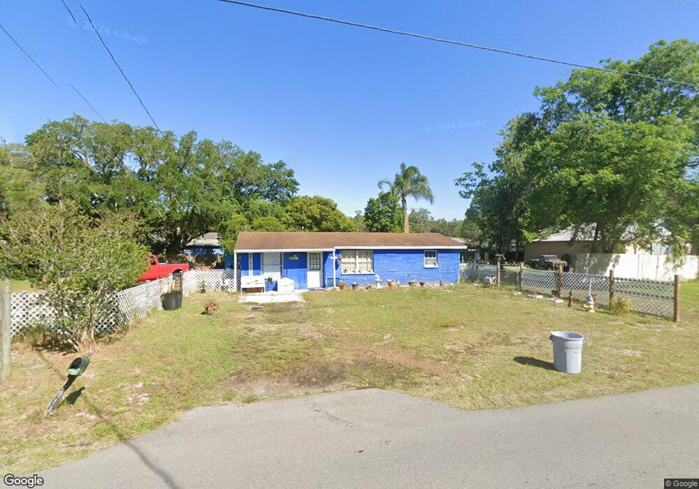
9133 Royal Palm Ave New Port Richey, FL 34654
Estimated Value: $196,000 - $220,000
2
Beds
1
Bath
1,154
Sq Ft
$180/Sq Ft
Est. Value
About This Home
This home is located at 9133 Royal Palm Ave, New Port Richey, FL 34654 and is currently estimated at $207,299, approximately $179 per square foot. 9133 Royal Palm Ave is a home located in Pasco County with nearby schools including Cypress Elementary School, River Ridge High School, and River Ridge Middle School.
Ownership History
Date
Name
Owned For
Owner Type
Purchase Details
Closed on
Feb 17, 2025
Sold by
Davis Janis and Davis Leroy
Bought by
Davis Janis and Davis Leroy
Current Estimated Value
Purchase Details
Closed on
Nov 7, 2014
Sold by
Brown James J and Fetterly Michael Alonza
Bought by
Davis Leroy and Davis Janis Sue
Purchase Details
Closed on
Nov 29, 2000
Sold by
Kehoe John P
Bought by
Davis Leroy and Davis Janis S
Create a Home Valuation Report for This Property
The Home Valuation Report is an in-depth analysis detailing your home's value as well as a comparison with similar homes in the area
Home Values in the Area
Average Home Value in this Area
Purchase History
| Date | Buyer | Sale Price | Title Company |
|---|---|---|---|
| Davis Janis | -- | None Listed On Document | |
| Davis Janis | $100 | None Listed On Document | |
| Davis Leroy | $7,000 | None Available | |
| Davis Leroy | $46,000 | -- |
Source: Public Records
Mortgage History
| Date | Status | Borrower | Loan Amount |
|---|---|---|---|
| Previous Owner | Davis Leroy | $40,000 |
Source: Public Records
Tax History Compared to Growth
Tax History
| Year | Tax Paid | Tax Assessment Tax Assessment Total Assessment is a certain percentage of the fair market value that is determined by local assessors to be the total taxable value of land and additions on the property. | Land | Improvement |
|---|---|---|---|---|
| 2025 | $670 | $58,720 | -- | -- |
| 2024 | $670 | $57,070 | -- | -- |
| 2023 | $1,004 | $55,410 | $0 | $0 |
| 2022 | $601 | $53,800 | $0 | $0 |
| 2021 | $592 | $52,240 | $34,650 | $17,590 |
| 2020 | $582 | $51,520 | $14,850 | $36,670 |
| 2019 | $572 | $50,370 | $0 | $0 |
| 2018 | $556 | $49,437 | $0 | $0 |
| 2017 | $547 | $49,437 | $0 | $0 |
| 2016 | $494 | $47,424 | $0 | $0 |
| 2015 | $579 | $54,591 | $0 | $0 |
| 2014 | $559 | $55,532 | $20,625 | $34,907 |
Source: Public Records
Map
Nearby Homes
- 9217 Maynard Ave
- 0 Royal Palm Ave Unit MFRW7858646
- 9210 Maynard Ave
- 9229 Creston Ave
- 8624 Brookwood Dr
- 8531 Bass Lake Dr
- 9240 Creston Ave
- 8617 Broad St
- 8518 Thrasher Ct
- 8522 Cranes Roost Dr
- 0 0 Unit MFRTB8421780
- 8741 Planters Ln
- 8057 Moonlight Ln
- 8823 Crescent Forest Blvd
- 9166 Sunshine Blvd
- 7946 Callan Ct
- 8711 Crescent Forest Blvd
- 9911 Mendel Dr
- 0 Hilltop Dr Unit MFRW7868266
- 9520 Indale Dr
- 9102 Oneal Ave
- 9110 Oneal Ave
- 9128 Royal Palm Ave
- 9145 Royal Palm Ave
- 9111 Royal Palm Ave
- 9118 Oneal Ave
- 9120 Royal Palm Ave
- 9136 Royal Palm Ave
- 9056 Oneal Ave
- 9112 Royal Palm Ave
- 9130 Oneal Ave
- 9101 Royal Palm Ave
- 9069 Oneal Ave
- 9111 Oneal Ave
- 9191 Outpost Dr
- 9161 Royal Palm Ave
- 9048 Oneal Ave
- 9119 Oneal Ave
- 9167 Outpost Dr
- 9065 Oneal Ave