
Seller's Agent in 2025
Daniel Schneider
CENTURY 21 Bradley Realty, Inc
(260) 312-1479
5 in this area
64 Total Sales
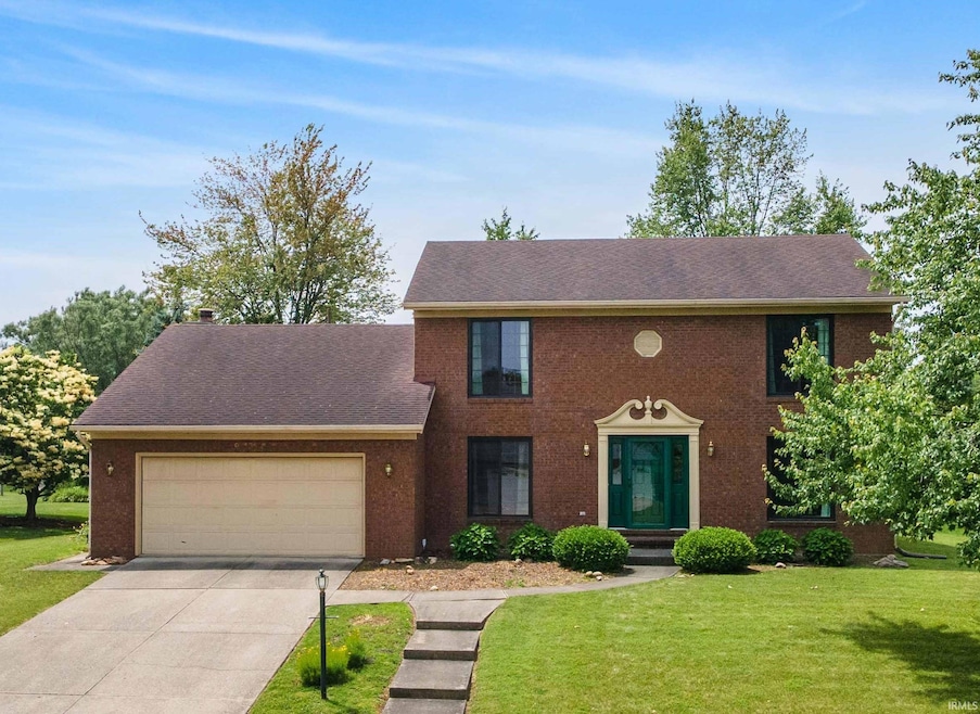
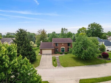
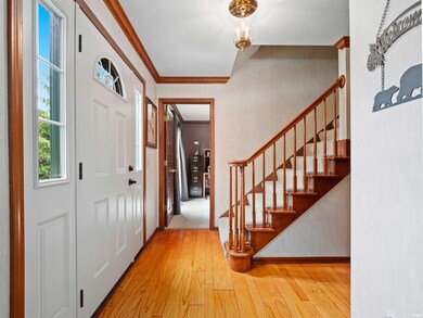
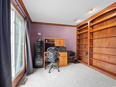
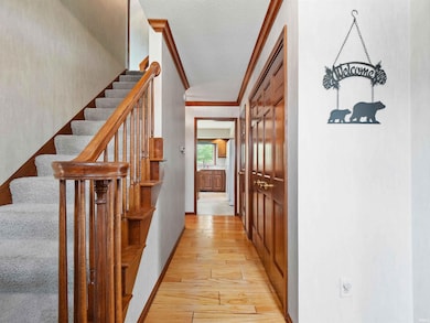
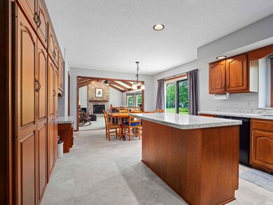
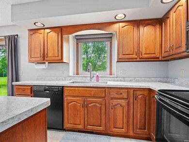
Located in the newest section of Arlington Park you will find this Move in Ready 4 bedroom 2.5 bath home with basement. There have been many updates to this home in recent years. All of the windows and exterior doors have been replaced by Bushey’s Windows & Doors. The beautiful Infinity oversized windows in the family room dramatically open up the space to the outside! The kitchen with island was updated with new counter tops, sink, and disposal in 2019. Some of the other updates include, fireplace gas logs with remote 2024, water heater 2018, and high efficient furnace and air conditioning 2013. The main bedroom has a walk in closet and private bath with double vanity, step in shower and linen closet. This home is located close to Hoseshoe Park, just one of the many neighborhood amenities Arlington Park has to offer. The Arlington Park neighborhood features 15 miles of connected walk ways, multiple swimming pools for toddlers on up to adults, diving boards, fishing ponds, tennis and pickle ball courts, playgrounds, banquet facilities, golf course and more.
Last Agent to Sell the Property
CENTURY 21 Bradley Realty, Inc Brokerage Phone: 260-399-1177 Listed on: 06/19/2025
| Date | Type | Sale Price | Title Company |
|---|---|---|---|
| Warranty Deed | -- | Near North Title Group | |
| Corporate Deed | -- | Titan Title Services Llc | |
| Warranty Deed | -- | Titan Title Services Llc |
| Date | Status | Loan Amount | Loan Type |
|---|---|---|---|
| Open | $294,500 | New Conventional |
| Date | Event | Price | List to Sale | Price per Sq Ft |
|---|---|---|---|---|
| 07/18/2025 07/18/25 | Sold | $310,000 | 0.0% | $128 / Sq Ft |
| 06/20/2025 06/20/25 | Pending | -- | -- | -- |
| 06/19/2025 06/19/25 | For Sale | $310,000 | -- | $128 / Sq Ft |
| Year | Tax Paid | Tax Assessment Tax Assessment Total Assessment is a certain percentage of the fair market value that is determined by local assessors to be the total taxable value of land and additions on the property. | Land | Improvement |
|---|---|---|---|---|
| 2024 | $3,567 | $336,900 | $45,800 | $291,100 |
| 2022 | $3,230 | $285,100 | $45,800 | $239,300 |
| 2021 | $2,689 | $239,300 | $32,100 | $207,200 |
| 2020 | $2,320 | $209,900 | $32,100 | $177,800 |
| 2019 | $2,301 | $209,200 | $32,100 | $177,100 |
| 2018 | $2,192 | $198,200 | $32,100 | $166,100 |
| 2017 | $2,068 | $185,600 | $32,100 | $153,500 |
| 2016 | $1,921 | $177,200 | $32,100 | $145,100 |
| 2014 | $1,709 | $165,500 | $32,100 | $133,400 |
| 2013 | $1,709 | $165,600 | $32,100 | $133,500 |
Seller's Agent in 2025
Daniel Schneider
CENTURY 21 Bradley Realty, Inc
(260) 312-1479
5 in this area
64 Total Sales
Buyer's Agent in 2025
Crista Miller
RE/MAX
(260) 615-9164
4 in this area
93 Total Sales
Source: Indiana Regional MLS
MLS Number: 202523426
APN: 02-08-23-228-019.000-072
Disclaimer: Certain information contained herein is derived from information provided by parties other than Homes.com. All information provided is deemed reliable, but is not guaranteed to be accurate and should be independently verified.
![]() IDX information is provided exclusively for personal, non-commercial use, and may not be used for any purpose other than to identify prospective properties consumers may be interested in purchasing. Information is deemed reliable but not guaranteed.
IDX information is provided exclusively for personal, non-commercial use, and may not be used for any purpose other than to identify prospective properties consumers may be interested in purchasing. Information is deemed reliable but not guaranteed.