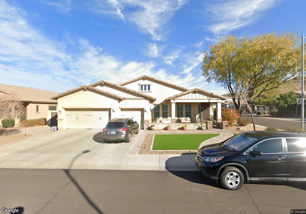
9134 W Buckhorn Trail Peoria, AZ 85383
Estimated Value: $626,003 - $756,000
--
Bed
4
Baths
2,912
Sq Ft
$236/Sq Ft
Est. Value
About This Home
This home is located at 9134 W Buckhorn Trail, Peoria, AZ 85383 and is currently estimated at $688,501, approximately $236 per square foot. 9134 W Buckhorn Trail is a home located in Maricopa County with nearby schools including West Wing Elementary School, Mountain Ridge High School, and BASIS Peoria Primary.
Ownership History
Date
Name
Owned For
Owner Type
Purchase Details
Closed on
Aug 5, 2021
Sold by
Matson Bradley G and Matson Sharon R
Bought by
Matson Bradley G and Matson Sharon R
Current Estimated Value
Purchase Details
Closed on
Oct 22, 2007
Sold by
Tousa Homes Inc
Bought by
Matson Bradley G and Matson Sharon R
Home Financials for this Owner
Home Financials are based on the most recent Mortgage that was taken out on this home.
Original Mortgage
$160,000
Interest Rate
6.27%
Mortgage Type
New Conventional
Purchase Details
Closed on
Apr 27, 2007
Sold by
Apexcapital Fund 1 Llc
Bought by
Tousa Homes Inc
Create a Home Valuation Report for This Property
The Home Valuation Report is an in-depth analysis detailing your home's value as well as a comparison with similar homes in the area
Home Values in the Area
Average Home Value in this Area
Purchase History
| Date | Buyer | Sale Price | Title Company |
|---|---|---|---|
| Matson Bradley G | -- | None Available | |
| Matson Bradley G | $381,829 | Universal Land Title Agency | |
| Tousa Homes Inc | $345,440 | First American Title |
Source: Public Records
Mortgage History
| Date | Status | Borrower | Loan Amount |
|---|---|---|---|
| Closed | Matson Bradley G | $160,000 |
Source: Public Records
Tax History Compared to Growth
Tax History
| Year | Tax Paid | Tax Assessment Tax Assessment Total Assessment is a certain percentage of the fair market value that is determined by local assessors to be the total taxable value of land and additions on the property. | Land | Improvement |
|---|---|---|---|---|
| 2025 | $3,345 | $40,337 | -- | -- |
| 2024 | $3,234 | $38,416 | -- | -- |
| 2023 | $3,234 | $46,970 | $9,390 | $37,580 |
| 2022 | $3,106 | $36,310 | $7,260 | $29,050 |
| 2021 | $3,261 | $34,310 | $6,860 | $27,450 |
| 2020 | $3,206 | $32,380 | $6,470 | $25,910 |
| 2019 | $3,114 | $30,100 | $6,020 | $24,080 |
| 2018 | $3,138 | $30,170 | $6,030 | $24,140 |
| 2017 | $3,036 | $28,780 | $5,750 | $23,030 |
| 2016 | $2,869 | $30,570 | $6,110 | $24,460 |
| 2015 | $2,665 | $30,520 | $6,100 | $24,420 |
Source: Public Records
Map
Nearby Homes
- 27344 N 91st Ln
- 9238 W Buckhorn Trail
- 9156 W Bajada Rd
- 9058 W Redbird Rd
- 9161 W Bajada Rd
- 9165 W Mine Trail
- 9185 W Mine Trail
- 27490 N Higuera Dr
- 9324 W Molly Ln
- 27486 N 89th Dr
- 26924 N 89th Dr
- 9275 W Plum Rd
- 8687 W Bajada Rd
- 9012 W Yellow Bird Ln
- 26853 N 89th Dr
- 9347 W Plum Rd
- 28001 N 92nd Ave
- 9010 W Eagle Talon Dr
- 9547 W Bent Tree Dr
- 28136 N 90th Ln
- 9144 W Buckhorn Trail
- 27332 N 91st Dr
- 9154 W Buckhorn Trail
- 27299 N 91st Dr
- 9135 W Buckhorn Trail
- 27321 N 91st Dr
- 27333 N 91st Ln
- 27354 N 91st Dr
- 27277 N 91st Dr
- 9145 W Buckhorn Trail
- 27343 N 91st Dr
- 27355 N 91st Ln
- 27255 N 91st Dr
- 9155 W Buckhorn Trail
- 27376 N 91st Dr Unit 4
- 27365 N 91st Dr
- 27377 N 91st Ln
- 9165 W Buckhorn Trail
- 27233 N 91st Dr
- 9136 W Quail Track Dr