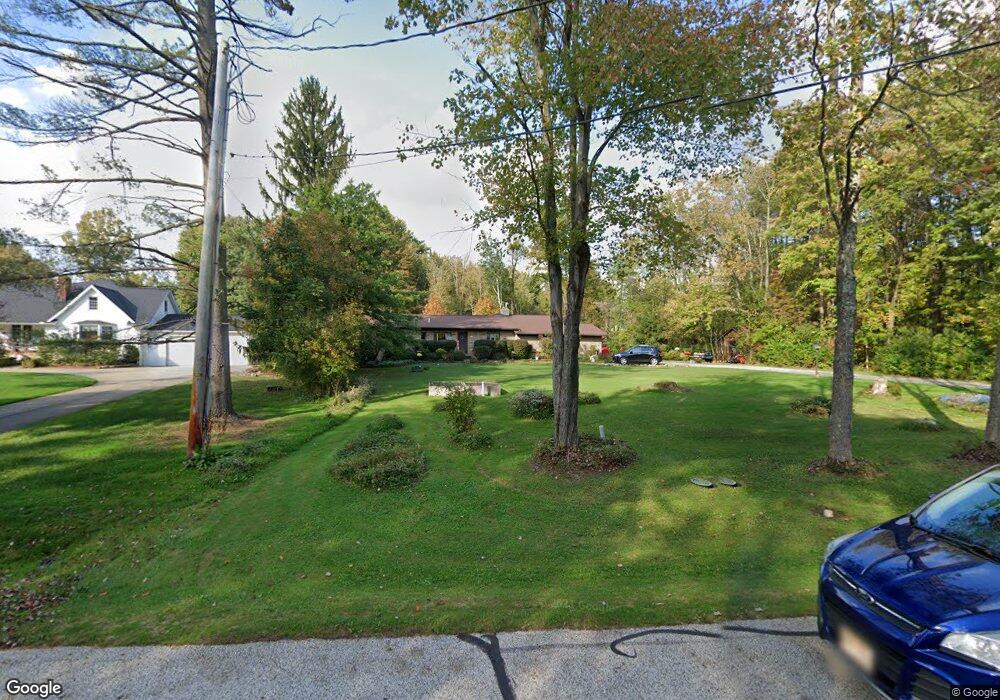
9136 Ranch Dr Chesterland, OH 44026
Estimated Value: $330,499 - $355,000
4
Beds
2
Baths
2,154
Sq Ft
$157/Sq Ft
Est. Value
About This Home
This home is located at 9136 Ranch Dr, Chesterland, OH 44026 and is currently estimated at $337,125, approximately $156 per square foot. 9136 Ranch Dr is a home located in Geauga County with nearby schools including West Geauga High School and St Anselm School.
Ownership History
Date
Name
Owned For
Owner Type
Purchase Details
Closed on
Sep 25, 2013
Sold by
Cicirella Anthony V and Cicirella Penny
Bought by
Cicirella Anthony V and Cicirella Penny
Current Estimated Value
Purchase Details
Closed on
Dec 13, 1996
Sold by
Kania Anita A and Kania Bobik Anita A
Bought by
Cicirella Anthony V
Home Financials for this Owner
Home Financials are based on the most recent Mortgage that was taken out on this home.
Original Mortgage
$96,000
Outstanding Balance
$9,705
Interest Rate
7.64%
Estimated Equity
$327,420
Purchase Details
Closed on
Jan 17, 1995
Sold by
Jean O Lassiter Est
Bought by
Kania Matthew W and Kania Anita
Home Financials for this Owner
Home Financials are based on the most recent Mortgage that was taken out on this home.
Original Mortgage
$88,000
Interest Rate
6.88%
Mortgage Type
New Conventional
Purchase Details
Closed on
Jan 1, 1990
Bought by
Lassiter Jean O
Create a Home Valuation Report for This Property
The Home Valuation Report is an in-depth analysis detailing your home's value as well as a comparison with similar homes in the area
Home Values in the Area
Average Home Value in this Area
Purchase History
| Date | Buyer | Sale Price | Title Company |
|---|---|---|---|
| Cicirella Anthony V | -- | Patriot Title Agency Inc | |
| Cicirella Anthony V | $120,000 | Lawyers Title Ins Corp | |
| Kania Matthew W | $95,000 | -- | |
| Lassiter Jean O | -- | -- |
Source: Public Records
Mortgage History
| Date | Status | Borrower | Loan Amount |
|---|---|---|---|
| Open | Cicirella Anthony V | $96,000 | |
| Previous Owner | Kania Matthew W | $88,000 |
Source: Public Records
Tax History Compared to Growth
Tax History
| Year | Tax Paid | Tax Assessment Tax Assessment Total Assessment is a certain percentage of the fair market value that is determined by local assessors to be the total taxable value of land and additions on the property. | Land | Improvement |
|---|---|---|---|---|
| 2024 | $3,756 | $96,680 | $25,100 | $71,580 |
| 2023 | $3,756 | $96,680 | $25,100 | $71,580 |
| 2022 | $2,811 | $64,480 | $20,900 | $43,580 |
| 2021 | $2,802 | $64,480 | $20,900 | $43,580 |
| 2020 | $2,913 | $64,480 | $20,900 | $43,580 |
| 2019 | $2,656 | $57,830 | $20,900 | $36,930 |
| 2018 | $2,635 | $57,830 | $20,900 | $36,930 |
| 2017 | $2,656 | $57,830 | $20,900 | $36,930 |
| 2016 | $2,646 | $54,960 | $20,900 | $34,060 |
| 2015 | $2,450 | $54,960 | $20,900 | $34,060 |
| 2014 | $2,450 | $54,960 | $20,900 | $34,060 |
| 2013 | $2,933 | $54,960 | $20,900 | $34,060 |
Source: Public Records
Map
Nearby Homes
- 8949 Ranch Dr
- 9502 Winchester Valley
- 9475 Mayfield Rd
- 8735 Cedar Rd
- 8701 Mayfield Rd Unit 194
- 9448 Mayfield Rd
- 12790 Heath Rd
- 8547 Camelot Dr
- 0 Cedar Rd
- 13610 Sperry Rd
- 13655 Sperry Rd
- 8986 Fairmount Rd
- 13031 Dorothy Dr
- 13339 Hickory St
- 0 Hickory St
- 10263 Wye Rd
- 12084 Heath Rd
- 9610 Wilson Mills Rd
- 7775 Woodlands Trail
- 11865 Africa Acres Dr