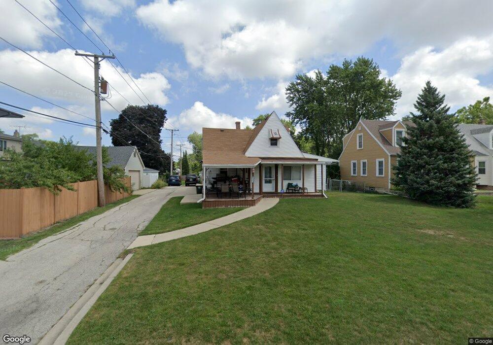
9139 Newcastle Ave Morton Grove, IL 60053
Estimated Value: $448,843 - $494,000
4
Beds
3
Baths
1,521
Sq Ft
$316/Sq Ft
Est. Value
About This Home
This home is located at 9139 Newcastle Ave, Morton Grove, IL 60053 and is currently estimated at $480,211, approximately $315 per square foot. 9139 Newcastle Ave is a home located in Cook County with nearby schools including Hynes Elementary School, Golf Middle School, and Niles North High School.
Ownership History
Date
Name
Owned For
Owner Type
Purchase Details
Closed on
Oct 12, 2015
Sold by
Mcdonagh Debora
Bought by
The Debora Mcdonagh Revocable Living Tru
Current Estimated Value
Purchase Details
Closed on
Jul 30, 2012
Sold by
Ynot Quirico C and Ynot Dominga B
Bought by
Mcdonagh Deborah
Home Financials for this Owner
Home Financials are based on the most recent Mortgage that was taken out on this home.
Original Mortgage
$172,893
Interest Rate
3.75%
Mortgage Type
FHA
Create a Home Valuation Report for This Property
The Home Valuation Report is an in-depth analysis detailing your home's value as well as a comparison with similar homes in the area
Home Values in the Area
Average Home Value in this Area
Purchase History
| Date | Buyer | Sale Price | Title Company |
|---|---|---|---|
| The Debora Mcdonagh Revocable Living Tru | -- | Attorney | |
| Mcdonagh Deborah | $177,000 | Chicago Title Insurance Co |
Source: Public Records
Mortgage History
| Date | Status | Borrower | Loan Amount |
|---|---|---|---|
| Previous Owner | Mcdonagh Deborah | $172,893 |
Source: Public Records
Tax History Compared to Growth
Tax History
| Year | Tax Paid | Tax Assessment Tax Assessment Total Assessment is a certain percentage of the fair market value that is determined by local assessors to be the total taxable value of land and additions on the property. | Land | Improvement |
|---|---|---|---|---|
| 2024 | $7,497 | $30,877 | $8,852 | $22,025 |
| 2023 | $8,727 | $30,877 | $8,852 | $22,025 |
| 2022 | $8,727 | $37,000 | $8,852 | $28,148 |
| 2021 | $6,410 | $24,977 | $5,447 | $19,530 |
| 2020 | $6,362 | $24,977 | $5,447 | $19,530 |
| 2019 | $6,436 | $28,064 | $5,447 | $22,617 |
| 2018 | $8,795 | $30,237 | $4,936 | $25,301 |
| 2017 | $8,828 | $30,237 | $4,936 | $25,301 |
| 2016 | $8,349 | $30,237 | $4,936 | $25,301 |
| 2015 | $8,258 | $27,279 | $4,255 | $23,024 |
| 2014 | $8,100 | $27,279 | $4,255 | $23,024 |
| 2013 | $7,960 | $27,279 | $4,255 | $23,024 |
Source: Public Records
Map
Nearby Homes
- 9244 Newcastle Ave
- 6909 Beckwith Rd
- 6712 Maple St
- 6727 Beckwith Rd
- 7014 Church St
- 6638 Hazel St
- 8929 Cherry Ave
- 9421 Sayre Ave
- 8927 Belleforte Ave
- 8836 Sayre Ave
- 9247 Natchez Ave
- 6619 Palma Ln
- 7030 Foster St
- 7215 Beckwith Rd
- 7207 Church St
- 7215 Lyons St
- 27 Logan Terrace
- 7302 Ponto Dr
- 8661 N National Ave
- 7303 Ponto Dr
- 9135 Newcastle Ave
- 9131 Newcastle Ave
- 6813 Church St
- 6813 Church St
- 6817 Church St
- 9127 Newcastle Ave
- 6809 Church St
- 6809 Church St
- 9136 Oak Park Ave
- 9134 Oak Park Ave
- 6805 Church St
- 9121 Newcastle Ave
- 6831 Church St
- 9124 Oak Park Ave
- 9138 Newcastle Ave
- 6801 Church St
- 6801 Church St
- 9134 Newcastle Ave
- 6833 Church St
- 9128 Newcastle Ave